Download
1 / 21
210 likes | 351 Views
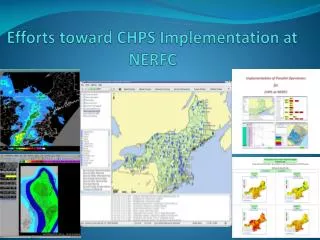
An Overview of Gridded Flash Flood Guidance; A Spatially Distributed Runoff and Threshold-Runoff Based Approach. Erick Boehmler NERFC. Eastern Region Flash Flood Guidance. Goals of Gridded FFG Development.

E N D
An Overview of Gridded Flash Flood Guidance; A Spatially Distributed Runoff and Threshold-Runoff Based Approach Erick BoehmlerNERFC ER FFG Conference
Eastern Region Flash Flood Guidance ER FFG Conference
Goals of Gridded FFG Development • Produce a flash flood guidance product at a resolution closer in scale to basins in FFMP that: • Reflects the spatial variability of the physical characteristics that impact the susceptibility of a location to flash flooding • Uses freely available (or easily derived) data with nationwide coverage • Requires minimal calibration effort • Fits seamlessly into the existing RFC and WFO operational flash flood warning infrastructure ER FFG Conference
Gridded Flash Flood Guidance • Advantages of GFFG approach are: • Improves the spatial resolution of soil-moisture conditions and flash flood thresholds • Applies a spatially consistent soil-moisture accounting model across RFC areas and independent of RFC forecast basins ER FFG Conference
Gridded Flash Flood Guidance ER FFG Conference
Gridded Flash Flood Guidance • Gridded FFG has a significant precedence • It is an accepted and operationally utilized method for FFG grid displays from Southern Region RFCs beginning in 2007 ER FFG Conference
Gridded Flash Flood Guidance Model Length to divide Slope OHD RDHM Soil Moisture Area Static CN Gridded Runoff Duration 2-yr, 3-hr DDF Dynamic NRCS Curve Number Variable Threshold Runoff Gridded FFG How much runoff to produce flash flooding How much rain to produce runoff ER FFG Conference Arkansas-Red Basin River Forecast Center
UZFWC UZTWC LZFPC LZTWC LZFSC Soil Moisture Accounting with a Distributed Hydrologic Model 4km gridded temperature 4km gridded precipitation National Weather Service Office of Hydrologic Development Research Distributed Hydrologic Model Sacramento Model Storages Upper Zone Saturation Ratio 4km gridded soil moisture products ER FFG Conference Arkansas-Red Basin River Forecast Center
Upper Zone Saturation Upper zone saturation, 5/1/2009 Upper zone saturation, 6/1/2009 ER FFG Conference
Runoff Computation • Development of Dynamic Curve Number • Combined to create an average (ARCII) Curve Number grid at HRAP scale • 30m National Land Cover Dataset • 1000m NRCS Hydrologic Soil Groups • Utilized upper zone saturation ratio from RDHM output with NRCS curve number model (NEH Part 630, chap. 10) to formulate an automated curve number adjustment • Convex of average for wet conditions • Concave of average for dry conditions ER FFG Conference
Varying Curve Numbers by Antecedent Soil Moisture Conditions 75% Upper Zone Saturation * Soil Moisture Adjusted Curve Number Average Curve Number ER FFG Conference Arkansas-Red Basin River Forecast Center
NRCS Curve Number Graphic ER FFG Conference Arkansas-Red Basin River Forecast Center
Threshold Runoff Computation • Development of Variable Threshold Runoff (Thresh-r) • Thresh-r is estimated at the HRAP scale • Ratio of flood flow, Qs to peak flow, Qp of the unit hydrograph. • Qs is approximated by the annual return period flow, Q2 • Qp is derived through the use of NRCS’ triangular unit hydrograph method • Adjustment for runoff anticipated within the next 6-hours from rainfall in progress through latest available MPE grid ER FFG Conference
NRCS Triangular Unit-graph Variables Known Variables CN = NRCS Curve Number S = Abstraction = (1000/CN)-10 l= length to divide y = average watershed slope A= drainage area D = duration of rainfall ( 1 Hour for unit Hydrograph) Calculated Variables tp= lag time (time from center of mass of rainfall toQp) TR= time to Qp from beginning of rainfall Qp = peak discharge from unit hydrograph ER FFG Conference Arkansas-Red Basin River Forecast Center
NERFC Area Computed Thresh-r = Qs=f (design storm, slope, curve number) Qp =f (slope, curve number) Thresh-r ER FFG Conference
GFFG System FFG Calculation S = (1000/CN)-10 Q = ThreshR ER FFG Conference Arkansas-Red Basin River Forecast Center
Limitations of the GFFG system • GFFG system limitations include: • No projection of snow-melt runoff within applicable duration of FFG value RDHM modeled SWE 1/25 12Z MPE 12 hours ending 1/25 12Z SCHOHARIE COUNTY SWE about 3 inches Approaching rainfall ER FFG Conference
Limitations of the GFFG system • GFFG system limitations include: • No projection of snow-melt runoff within applicable duration of FFG value GFFG system 1/25/2010 00Z GFFG system 1/25/2010 12Z SCHOHARIE COUNTY 00Z 3-hr FFG = 1.9 12Z 3-hr FFG = 1.8 ER FFG Conference
Limitations of the GFFG system • GFFG system limitations include: • No projection of snow-melt runoff within applicable duration of FFG value Legacy system 1/25/2010 00Z Legacy system 1/25/2010 12Z SCHOHARIE COUNTY 00Z 3-hr FFG = 2.0 12Z 3-hr FFG = 1.4 ER FFG Conference
Limitations of the GFFG system • GFFG system limitations include: • CN adjustment for runoff response is consistently overestimated during cool season months • RDHM models upper zone tension water at capacity • Upper soil zone contents to capacity ratio remains high ER FFG Conference
Questions / Contacts John Schmidt (918) 832-4109 john.schmidt@noaa.gov Tony Anderson (918) 832-4109 tony.anderson@noaa.gov James Paul (918) 832-4109 james.paul@noaa.gov Erick Boehmler (508) 824-5116 erick.boehmler@noaa.gov ER FFG Conference