Download
1 / 25
250 likes | 258 Views
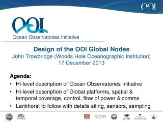
The Ocean Observatories Initiative at SIO: capabilities, research opportunities, and potential benefits of the global and Pacific coastal nodes. Uwe Send. Design and status. Long evolution and many changes since community workshops and last SIO presentations:

E N D
The Ocean Observatories Initiative at SIO: capabilities, research opportunities, and potential benefits of the global and Pacific coastal nodes Uwe Send
Design and status • Long evolution and many changes since community workshops and last SIO presentations: • fewer nodes, less geographic coverage • BUT • not only cables and buoys, but now LOTS of sensors • now includes spatial context/footprint around the sites • now includes mobile platforms (gliders and AUVs)
4 Global Scale Nodes • Coastal Scale Arrays: Mid-Atlantic “Pioneer” Array Pacific Northwest “Endurance” Array • 3 Regional cabled nodes in the NE Pacific • Include mobile assets • Cyberinfrastructure • Interfaces for education users Design elements Research infrastructure like a vessel, but remote/interactive
Mesoscale footprint Fixed and mobile assets No power/fiber link 1-year duration Surface to near bottom water column coverage Fully interactive 300 sensors together Built-in expandability Four global nodes 50 km
Four global nodes Surface buoy: bulk met, direct covariance fluxes, pCO2, T/S, waves, ADCP, modem Surface mooring: 2 stable pH, 12 T/S, fluorometer Shallow profiler: optical attenuation, fluorometer, spectral irradiance, T/S, O2, pCO2, nitrate, zooplankton sonar, modem Deep profiler: T/S, turbulent U/V, fluorescence, O2 Two flanking moorings: 12 T/S, O2, fluorometer, stable pH, ADCP, modem Three gliders: T/S, O2, fluorometer, modem All: spare capacity for more sensors
Multi-platform, multi-scale Fixed and mobile assets Cross-shelf arrays at Newport/Oregon and Grays Harbor/Washington Oregon Line Cabled 237 sensors total Endurance Array 500 km 125 km
Full water column. Cross-shelf resolution. High power/high bandwidth via cable to 80 & 500m. Benthic experiment nodes Endurance Array: Oregon line 25m 80m 500m
Full water column Cross-shelf resolution High-power surface buoys Benthic experiment nodes No cable Endurance Array: Washington line
Core sensors OOI-wide distribution of sensors by primary disciplines, total 800
First deployments Fall 2012: PNW Endurance gliders Winter 2012/13: Mid-Atlantic Pioneer gliders Argentine Basin global array Summer 2013: Station PAPA (Gulf of Alaska) Irminger Sea Fall 2013: Oregon mooring line Pioneer moorings Winter 2013/14: Southern Ocean Array Summer 2014: Washington mooring line
OOI science themes driving global component • Carbon cycle and acidificationsequestration is global, depends on open-ocean phys./biol. processes • Ocean-Atmosphere exchangeheat, momentum, freshwater fluxes/budgets are set in the open ocean • Ocean Circulationsets biogeochem.inventories&spreading, propag. of signals, stratification&mixing • Climate and ecosystemsvariability has basin-scale mechanisms/footprints, ecosystem impacts
Global carbon cycle processes and acidification Revelle factor (CO2 buffering capacity) showing regions most susceptible to CO2 increase and acidifications – provide infrastructure to observe the relevant processes and changes.
Global carbon cycle processes and acidification Total CO2 flux Anthropogenic CO2 inventory Observe fluxes and inventory changes, AND physical/biological processes that determine and modulate them
Ocean Circulation and Mixing The locations of vertical mixing (water mass formation) drive much of the biogeochemistry, the global uptake and inventories (CO2, O2, iron, etc) , and productivity (via nutrient supply). intermediate water formation Antarctica Greenland Low O2 Oxygen uptake south of Greenland, Deep Water spreading High O2 Two global centers of action.... need to catch episodic events !
Circulation variability Energetic circulation variability
Ocean-atmosphere exchange High wind forcing Iron dust deposition
Large climate-mode driven variability Ocean-atmosphere exchange The Pacific North American Oscillation (PNA) and North Atlantic Oscillation (NAO), have maximum wind variability at the northern OOI locations, strongly impacting atm-ocean exchange and forcing of physics, chemistry, biology.
Climate variability and ecosystems NAO and calanus PDO and fish stocks
Contrasting ocean productivity regimes “not limited” High producivity but still iron limited chlorophyll nitrate Nutrient-rich but (iron) limited
Community usage and interaction • Ways to use the infrastructure • the data from the core sensors will flow from day 1 and be publicly available: use these data for science (with or without proposal) or for writing proposals • plan expedition around an OOI node for intensive process studies • add passive sensors that are not connected to anything (just use platforms) • interact with and control the infrastructure (change sampling rates, control moving platforms) • add sensors that are integrated into the infrastructure (for data, power, etc)Each system will have spare capacity…
Feedback on capabilities and usage • The large-scale design is fixed, but details can be adjusted based on input. • Examples: • placement and capabilities of sensors • detailed location of sites (e.g. exactly where in Argentine Basin) • use of spatial footprint (distance of mesoscale moorings, glider tracks, etc) • quality assurance and quality control • ways to access or manipulate the data • …..
Other opportunities • participate in the SIO work to make this successful and useful for research, and connect this with other SIO/SWFSC interests/projects (funding is available…)- contribute disciplinary expertise - participate in detailed design, sensor selection, etc - participate in sensor operation - operate part of the infrastructure (e.g. gliders) - get instant access and familiarity with data by participating in data/QC effort - join field work with disciplinary expertise and interest • developments/expertise from OOI will be useful in other efforts • developments/expertise from other efforts can be brought into OOI work • influence OOI evolution and useage through advisory panels/reviews • use OOI cruises as opportunities for other work • technology proposals in support of OOI (e.g. future sensors)
CCE-1 Meteorology, 500m ADCP (Send) 7-channel radiometer (Ohman) pCO2, T/S (Sabine, Dickson) pH, O2 (Martz, Dickson) T/S (Send) Chl-a, turbidity (Ohman) 20m T/S (Send) NO3, Chl-a, turbidity (Ohman) pH, O2 (Martz, Dickson) Real-time/Inductive telemetry 40m T/S (Send) 7-channel radiometer (Ohman) Zooplankton/fish sonar (Demer) Still camera (Demer) 1000m 80m Acoustic mammal receiver (Hildebrand) 150m 4000m Example for observatory partnership in La Jolla • CCE-1: Multi-institution (SIO, SWFSC, NOAA/PMEL), multi-PI, multi-investigator • Comprehensive monitoring of interrelated physical, carbon/acidification, chemical, and ecosystem processes http://mooring.ucsd.edu
CCE-1 (Send, Ohman) CalCOFI/LTER (Koslow, Ohman) Pt.Conception Gliders (Davis, Rudnick, Ohman) ….also placed in spatial context Model for observatory partnership within SIO/SWFSC ? We are inviting expanded participation…!!
Interested ? • Come and talk to me • this presentation will be at http://mooring.ucsd.edu (under OOI project) • check OOI websites at COL (Consortium for Ocean Leadership)www.oceanleadership.org/programs-and-partnerships/ocean-observing/ooi/ • Come for Monday noon presentation by OOI program director Tim Cowles Thank you for coming