Download
1 / 85
870 likes | 1.09k Views
Surface Albedo and SW Flux Calculation. Y-C. Zhang and W.B. Rossow LandFlux Conference CNES/CESBIO, Toulouse, France May 28 – 31, 2007. OUTLINE. I. Introduction II. Datasets Used III. SRF Albedo & SW Comparison: FD vs MODIS IV. SRF Albedo & SW Comparison: FD vs CERES

E N D
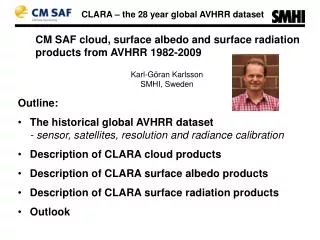
Surface Albedo and SW Flux Calculation Y-C. Zhang and W.B. Rossow LandFlux Conference CNES/CESBIO, Toulouse, France May 28 – 31, 2007
OUTLINE I. Introduction II. Datasets Used III. SRF Albedo & SW Comparison: FD vs MODIS IV. SRF Albedo & SW Comparison: FD vs CERES V. SRF Albedo & SW Comparison: FD vs GEWEX-SRB VI. SRF Albedo & SW Comparison: FD vs SOB VII. SRF Direct/Diffuse Fluxes & Their ratio VIII. Uncertainties of Albedo and Others and their Caused Global, Daily-mean SW Uncertainties
I. Introduction Clarifications of (Land) Surface SW Albedo and Fluxes ● Definition: (Surface) Albedo = Reflected / Incident Flux (at Surface) ● Spectral Dependence: Broadband: 0.2 – 5.0 μm ~ SW Visible: ~ 0.2 – 0.7 μm ~ VIS SW Near-Infrared: ~ 0.7 – 5.0 μm ~ NIR SW ● Scene Dependence: ♦ (1) Black-Sky Albedo (BSA, or True/Inherent Albedo) ) ~ Direct SW (2) White-Sky Albedo ~ Diffuse SW ♦ (a) Full-sky Albedo (Blue-sky Albedo; All-sky Albedo) ~ full-sky SW (b) Clear-sky Albedo: Often approximated to BSA ~ clear-sky SW ● TOA Clear-sky Albedo: Often used to check consistency with SRF albedo (BSA or SRF clear-sky albedo) or even produce SRF abedo
II. Datasets Used 1. ISCCP-FD Flux Product (Version: 0.00) ►FD is a self-consistent and physically-integrated, SRF-to-TOA profile flux product, including all up & down, SW (diffuse/direct and VIS/NIR) and LW for full-, clear- and overcast sky • Spatial resolution: horizontal: 280-km equal-area (2.5° on equator) vertical: 5 levels (SRF-680mb-440mb-100mb-TOA) • Temporal resolution: 3-houly (UTC = 0, 3, … 21) • Spatial coverage: fully global (on 280-km equal-area map) • Temporal coverage: July 1983 → Dec. 2004 → … ► Five Datasets of the FD product: (1) FD-TOA, (2) FD-SRF, (3) FD-PRF, (4) FD-INP & (5) FD-MPF ► Radiative Model: (modified) NASA GISS model using mainly ISCCP-D1 Albedo: Land: VIS -- based on ISCCP-D1 visible reflectance NIR -- modified model ratio of VIS/NIR over 8 Vege types Ocean: from NASA GISS model
... II. Datasets Used 2. MODIS Surface Albedo (and Flux) Product ► Version: MOD43C2 V004 L3 (from Crystal Schaaf) ► Black Sky Albedo • Spatial resolution: 0.05 ° X 0.05° (Averaged to 280 km equal area) • Temporal resolution: 16-day (orbital double repeat cycle; New 8-day?) • Spatial coverage: global (usually not fully) • Spectral Features: VIS 0.3 – 0.7 μm (based on 3 channels) NIR 0.7 – 5.0 μm (based on 4 channels) ► SW Flux (MODIS-FD) Calculation is based on MODIS BSA using ISCCP-FD production code
... II. Datasets Used 3. CERES Flux Product ► Version: SRBAVG Ed. 2 Rv. 1 from GEWEX-RFA website ► Satellite: TERRA FM1 or FM2, XTRK and GEO-interpolated ► SRF and TOA up & down, SW and LW for all and clear sky • Spatial resolution: horizontal: 2.5° X 2.5° • Temporal resolution: monthly mean (based on original 3-hourly CERES) • Spatial coverage: fully global • Temporal coverage: March 2000 → ► Radiative Model for SRF fluxes: Model B:LPSA/LPLA (Langley Parameterized SW/LW Algorithm) based on the relationships with TOA fluxes and atmospheric data
... II. Datasets Used 4. GEWEX-SRB Flux Product ► Version: SW Rel 2.5 and LW Rel 2.6 (from Paul Stackhouse) ► SRF and TOA up & down, SW and LW for all- and clear sky • Spatial resolution: 1° X 1° (Averaged to 280 km equal area) • Temporal resolution: 3-houly (UTC = 0, 3, … 21) • Spatial coverage: fully global • Temporal coverage: July 1983 → Dec. 2004 ► Radiative Model: SW (0.2 – 4.0 μm) from Pinker/Laszlo (quality check by Staylor Model) LW (4.5 – ∞ μm) from Fu/Liou, (quality check by Gupta Model)
... II. Datasets Used 5. SOB = Surface Station Observed Flux Product, available at GEWEX-RFA project. ► Based on 15 selected stations of BSRN, ARM and SURFRAD networks obtained from GEWEX-RFA (Processed by Chuck Long) ► SRF down and up, SW (diffuse and direct) and LW and their inferred clear-sky fluxes, cloud fraction, etc. • Temporal resolution: 15-minute (from original 1-3 min) (Averaged to 8 Local Solar time or daily/monthly mean) • Temporal coverage: 2004 for 15-min 1992-2004 for monthly-mean 15-min ► Processing method: “Next Generation Flux Analysis” (NGFA) method
... II. Datasets Used 6. References (only one for each dataset is given below) (1) ISCCP-FD: Zhang, Y-C., W.B. Rossow, A.A. Lacis, V. Oinas and M.I. Mishchenko (2004), Calculation of radiative fluxes from the surface to top-of-atmosphere based on ISCCP and other global datasets: Refinements of the radiative transfer model and the input data, J. Geophys. Res., 109, D19105, doi:10.1029/2003JD004457. (2) MODIS: Schaaf, C.B., et al. (2002), First operational BRDF, albedo and nadir reflectance products from MODIS, remote sens. Environ., 83, 135-148. (3) CERES: Loeb, N.G., B.A. Wielicki, W. Su, K. Loukachine, W. Sun, T. Wong, K.J. Priestley, G. Matthews, W.F. Miller, and R. Davies (2007), Multi-Instrument Comparison of Top-of-Atmosphere Reflected Solar Radiation, J. Clim., 20, 575-591.
... II. Datasets Used … 6. References (4) GEWEX-SRB: Stackhouse Jr., P.W., S. J. Cox, S.K. Gupta, M.Chiacchio, and J.C., Mikovitz (2001), The WCRP/GEWEX surface radiation budget project release 2: An assessment of surface fluxes at 1 degree resolution. International Radiation Sysposium, St.-Petersburg, Russia, July 24-29, 2000. IRS 2000: Current Problems in Atmospheric Radiation, W.L. Smith and Y. Timofeyev (eds.), A. Deepak Publishing, 147. (5) SOB: Long, C.N. (2004), The next generation flux analysis: Adding clear-sky LW and LW cloud effects, cloud optical depths, and improved sky cover estimates, in Proceedings of the Fourteenth ARM Science Team Meeting, Albuqueque, New Mexico, March 22-26, 2004, available at http://www.arm.gov/publications/proceedings.stm.
III. SRF Albedo & SW Comparison: FD vs MODISLand SRF BSA (%) for 4 16-day periods (2000 4/6, 7/11 & 9/29 and 2001 1/17)
BSA-based Constructed SRF Clr-sky Albedo (%) & SW-up (w/m2): FD vs. MODIS-FD for July 2000 and January 2001
TOA Clr-sky Albedo (%): FD vs. MODIS-FD for July 2000 & Jan. 2001:Snow-free Land
TOA Clr-sky Albedo (%): FD vs. MODIS-FD for July 2000 & Jan. 2001:Snow-covered Land
TOA Clr-sky SW-up (W/m2): FD vs. MODIS-FDJuly 2000 & Jan. 2001: Snow-free Land N. Africa & Arabia Peninsula
TOA Clr-sky SW-up (W/m2): FD vs. MODIS-FDJuly 2000 & Jan. 2001: Snow-covered Land
IV. SRF Albedo & SW Comparison: FD vs. CERES Averaged from 36-month (0003 to 0302) Global, monthly-mean statistics; SW in W/m2; ALB in %; Cor… are without unit
.. SRF Albedo & SW Comparison: FD vs. CERES Averaged from 36-month (0003 to 0302) Land-only, monthly-mean statistics; SW in W/m2; ALB in %; Cor… are without unit
Difference of annual-mean TOA Clear-sky Albedo (%): FD - CERES (Land)
Difference of annual-mean SRF Clear-sky Albedo (%): FD - CERES (Land)
Difference of Annual-mean SRF Clear-sky SW↓ (W/m2): FD - CERES (Land)
Difference of Annual-mean SRF Clear-sky SW↑ (W/m2): FD - CERES (Land)
Difference of Annual-mean SRF Clear-sky SW-net (W/m2): FD - CERES (Land)
Difference of annual-mean TOA Full-sky Albedo (%): FD - CERES (Land)
Difference of Annual-mean SRF Full-sky SW↓ (W/m2): FD - CERES (Land)
Difference of Annual-mean SRF Full-sky SW↑ (W/m2): FD - CERES (Land)
Difference of Annual-mean SRF Full-sky SW-net (W/m2): FD - CERES (Land)
Difference of Annual-mean SRF Cloud Effects of Albedo (%): FD - CERES (Land)
Difference of Annual-mean SRF Cloud Effects (W/m2): FD - CERES (Land)
Difference of January SRF Full-sky Albedo (%): FD - CERES (Land)
Difference of January SRF Full-sky SW-net (W/m2): FD - CERES (Land)
V. SRF Albedo & SW Comparison: FD vs GEWEX-SRBStatistics for 85-89 Annual-mean Comparison (albedo in % & flux in w/m2)