Download

1 / 39
390 likes | 400 Views
Configuring ArcGIS for State Government. Lindsay King John Hauck Jess Neuner. Agenda. Transportation. Environment & Natural Resources. Introduction Configuring the solution What’s next Get started. Emergency Management. Fish and Wildlife. Economic Development. Health.

E N D
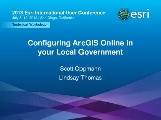
ConfiguringArcGIS for State Government Lindsay King John Hauck Jess Neuner
Agenda Transportation Environment & Natural Resources • Introduction • Configuring the solution • What’s next • Get started Emergency Management Fish and Wildlife Economic Development Health Secretary of State
ArcGIS as a Platform Transforming the role of GIS Knowledge Workers Executive Access Public Engagement WorkAnywhere Enterprise Integration Web GIS ArcGIS Professional GIS Making mapping and location aware apps available across your organization
ArcGIS for State Government A solution for Esri’s government customers … available on-premise or in the cloud Program Specific Workflows Constituent Engagement • Series of useful maps and apps focused on government work • Organized into modules • Extensible, configurable • Freely available and fully supported • A foundation for Partner solutions • Community of users • Best Practices / Implementation Support • Network of Esri Services and Partner offerings • Help users implement, sustain and enhance Focused Maps and Apps
Our Mission To help you…
ArcGIS for State Government Environment and Fish and Wildlife Transportation Railroad Crossing Inspection Road Closures Bridge Inventory Environmental Screening Crash Analysis Guardrail Inventory Pavement Marking Inventory Sign Inventory Signal Inventory Transportation 511 Crash Risks Briefing Permit Status Permit Inspection Permit Dashboard Hunting License Locator Water Access Locator Wildlife Management Area Locator Environmental Screening Environmental Impact Analysis Environmental Impact Polling Trail Locator Citizen Science Reporter Citizen Science Manager Model Organization Impact Briefing Water Quality Inspections Water Quality Results Park and Recreation Locator Community Events Wildlife Photo Survey Public Health Economic Development Beach Monitoring Water Quality Monitoring Restaurant Inspection Restaurant Inspection Results My Health Services Birth Outcomes Birth Outcomes Briefing Model Organization Emergency Management Live, Work, and Locate Incentive Zones Site Selector Event Locator Situational Awareness Viewer Flood Planning Community Events Community Mitigation Emergency Assistance Evacuation Zones Road Closures Damage Assessment My Hazard Information EM Maps Model Organization Briefing Book Citizen Reports Common Operational Picture Incident Analysis Viewer Operations Response Photo Survey Shelter Locator Public Information Map Local Impact Map Road Closures CAMEO Tools Incident Briefing Health and Safety Reports Debris Reporting Floodplain Inquiry Emergency Assistance Evacuation Zone Incident Status Dashboard Logistics Planning Hazard Vulnerability Assessment GIS/IT Executive Dashboard Community Parcels Community Addresses Maps and Apps Gallery Crowdsource Manager Crowdsource Polling Crowdsource Reporter Service Catalog/Hosted Services Model Organization PLSS Secretary of State Early Voting Polling Place Locator Election Results My Elected Representative Historical Elections Results
Transportation Environment & Natural Resources Emergency Management Fish and Wildlife Demonstrations John & Lindsay Economic Development Health Secretary of State
Transportation 511 InfoSummary Widget + Script • Designed for use by DOT • Communicate status • InfoSummary Widget • Exploring feature details • Feature Counts • Configurable list of feature details • Can be grouped (optional) • Display point features as clusters
Transportation 511 InfoSummary Widget + Script Business System • Python Script • Refresh hosted feature collections • Python 2.7 or Python 3.4 • Publisher rights in your ArcGIS Online organization
Transportation 511 InfoSummary Widget + Script Business System • Designed for use by DOT • Communicate status • InfoSummary Widget • Exploring feature details • Feature Counts • Configurable list of attributes from each feature • Display point features as clusters • Update script to refresh hosted feature collections
Environmental Analysis understand the potential impact of activities on the natural environment • Geoprocessing tools • Analysis Tools • Basic Proximity • Distance • Feature Comparison • Report Tools • Analysis Summary • Impact Report • ArcGIS Pro Tasks • Sample Models • Layout Templates (*.pagx)
Environmental Analysis understand the potential impact of activities on the natural environment • Geoprocessing tools • Analysis Tools • Basic Proximity • Distance • Feature Comparison • Report Tools • Analysis Summary • Impact Report • ArcGIS Pro Tasks
Wildlife Photo Survey Helps Fish and Wildlife departments leverage photos collected from camera traps in the wild Expedites photo processing using custom GP tools Streamlines the collection of information from wildlife photos
Photo Survey Components Organized in to maps for each survey Photo Survey Toolbox Accessible to constituents in Photo Survey app Photos ArcGIS Online Portal for ArcGIS Monitored by organization (operational dashboards) …..available as a hybrid solution
My Health Services Make information about health services easily accessible to the public Allow constituents to find health services organized by service type With a simple web application, allow your constituents to search by location and be presented with a list of health services near that location
Near Me Widget My Health Services is a configurable web application that utilizes the Near Me widget Near Me allows users to search for features within a defined distance of an address or location, then discover more information and get directions to those features
Incentive Zones Promote economic development by making information about incentive zones easily accessible Present incentive zone information in geographic context Attract businesses by making it easy for them to quickly discover and take advantage of incentive zones
Information Lookup Leverage your existing data Publish your data as a feature service, then build and configure a web map Share the web map using the Information Lookup web application template on ArcGIS Online Information Lookup app can be hosted on ArcGIS Online, or downloaded and hosted internally The finished application can stand alone, or can be easily embedded in your government website
ArcGIS as a Platform Transforming the role of GIS Knowledge Workers Executive Access Public Engagement WorkAnywhere Enterprise Integration Web GIS ArcGIS Professional GIS Making mapping and location aware apps available across your organization
Getting Started solutions.arcgis.com • Identify the business needs of your organization • Select a configuration pattern that makes sense for your organization • Configure quickly, customize if necessary • Leverage ArcGIS Online web application templates • Don’t hesitate to ask for help from • Esri, Partners, Peers
The Community It’s not just about the technology
Road Ahead Emergency Management • Logistics and Infrastructure Dashboard, Emergency Management Maps , Humanitarian Solutions , Disaster Resilience and Capacity (DFID, FEMA), Community Impact Assessment, Critical Infrastructure Mapping , Watch Officer Dashboard, 3D Situational Awareness GIS/IT • PLSS, Community Boundaries, Executive Dashboard • Implementation across new ArcGIS offerings Environment and Natural Resources • Wildlife Identification, Invasive Species Mapping, Park Infrastructure/Facilities, Land Ownership/Leasing, NEPA Citizen Notification Economic Development • Property Registration, Event Registration Health • Restaurant Inspections (New config) • Well and Septic Inspections
Find us at UC Tonight! Tonight! Tonight! Social at the Hilton Bayfront Promenade 5:30 pm – 7:00 pm • Local Government Special Interest Group • 12:00 Today in Room 04 • Solutions Area in the Expo • Recommended Sessions • Today at 3:15 PM in Room 15B: Environment and Natural Resources Maps and Apps for State Government • Thursday at 3:15 PM in Room 30E: Economic Development Maps and Apps for State and Local Government
Find us at UC • Demo Theatres --- Demo Theater 10
Please fill out the survey using the Esri Events app Thank You Scroll Down http://solutions.arcgis.com/state-government http://www.linkedin.com/groups?gid=5114903 @ArcGISStateGov http://esri.github.com