Download
1 / 1
10 likes | 135 Views
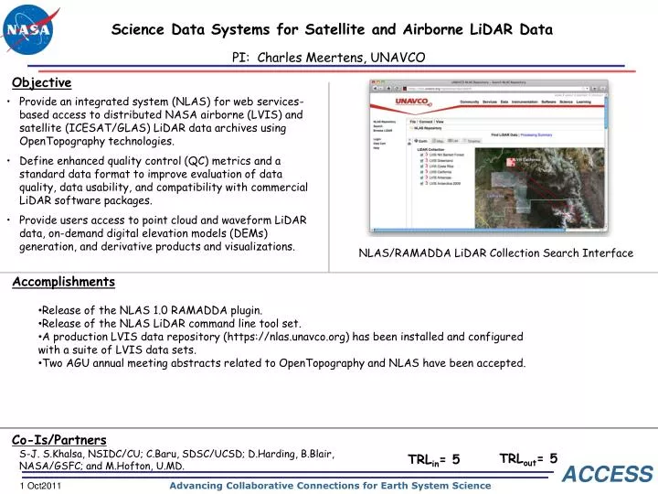
Science Data Systems for Satellite and Airborne LiDAR Data. PI: Charles Meertens, UNAVCO. Insert an eye-catching yet meaningful picture ere. If possible, show the scale of an instrument.

E N D
Science Data Systems for Satellite and Airborne LiDAR Data PI: Charles Meertens, UNAVCO Insert an eye-catching yet meaningful picture ere. If possible, show the scale of an instrument. • Provide an integrated system (NLAS) for web services-based access to distributed NASA airborne (LVIS) and satellite (ICESAT/GLAS) LiDAR data archives using OpenTopography technologies. • Define enhanced quality control (QC) metrics and a standard data format to improve evaluation of data quality, data usability, and compatibility with commercial LiDAR software packages. • Provide users access to point cloud and waveform LiDAR data, on-demand digital elevation models (DEMs) generation, and derivative products and visualizations. NLAS/RAMADDA LiDAR Collection Search Interface • Release of the NLAS 1.0 RAMADDA plugin. • Release of the NLAS LiDAR command line tool set. • A production LVIS data repository (https://nlas.unavco.org) has been installed and configured with a suite of LVIS data sets. • Two AGU annual meeting abstracts related to OpenTopography and NLAS have been accepted. S-J. S.Khalsa, NSIDC/CU; C.Baru, SDSC/UCSD; D.Harding, B.Blair, NASA/GSFC; and M.Hofton, U.MD. TRLout= 5 TRLin= 5 1 Oct2011