Download
1 / 36
420 likes | 771 Views
Learn about the Science Olympiad event Road Scholar, rules, preparation, team picking, and competition statistics. Get tips on maps, symbols, topographic mapping, and more. Essential for students and coaches.

E N D
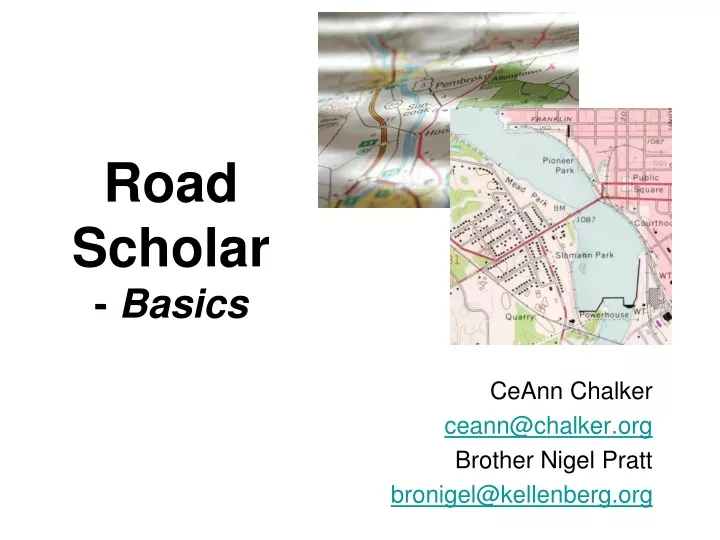
Road Scholar- Basics CeAnn Chalker ceann@chalker.org Brother Nigel Pratt bronigel@kellenberg.org
BASICS Assumes Road Scholar (& Science Olympiad) are a new experience • About the Event • Background • The Rules • Competition • Preparation & Practice • Picking a Team • Practice • Resources • What to Bring to a Competition
The 'Original' Science Olympiad Event • First Science Olympiad sponsor: US Army • One mandatory requirement: map-reading skills event • WW I and WW II experience: Americans were not very good at reading maps compared to Europeans • British damage control success during the ‘blitz’ due to detailed mapping/modeling • Combination of topographic and other map skills
The Rules • Two students • Students can bring: • Protractor • Ruler or other measuring devices • USGS Map Symbol Sheet • Hard copies of any other information • A non-programable, non-graphing calculator • (phones, laptops, tablets are not allowed) • Colored pencils • Equipment & Reference materials may be in: • A container • Three ring binder • File Folder • Box or similar item
The Rules • Multiple Maps - • Topographic maps • Highway maps • Internet maps • Satellite photos • Student –generated PLSS Township Map & Profile • Test usually are in story format; may be a list of questions • Typically 6-8 pages; 40-50 questions • Scored by points for right answers • Harder questions may have more value • Not based on time!
Concepts Key Concepts to be covered, ranked in the order of general mastery, based on Competition Statistics. • Identifying info from: • Satellite/Internet Maps • Highway Map • Topographic Map • Legends/Margin Information • PLSS – Public Land Survey System • Distance/Rate • Slope/Gradients • Map Drawing • Coordinates • Azimuth
Competition Statistics Data from 2008-11 Cinc/Piqua Regional & OH State Competitions Percent of questions answered correctly (blue) ‘Identify’ = identification of a feature, symbol, route, direction, location, etc. Common theme of weak areas: MATH!
Picking a Team of 2 Students • Common Options • Story Reader / Map Analyst • Work everything together • Split the test • Front / back half - popular; risk of story confusion & map contention • Roadmap / Topo • Speed run • Skip the hard, time-consuming questions • Risky with tiebreaking • Compatibility! Organization and Teamwork are vital
Science OlympiadRoad Scholar Coaches Handbook • Topo Maps • Marginal Info • Coordinates, Sectors • Symbols • Elevation, Control Data • Distances • Gradients • Directions • PLSS • Profiling • Highway Maps • Features and Symbols • Mileage • Appendices • Answers to questions • Sample Test Practice questions illustrating the concepts in each section/lesson Sample Topo & Hwy maps (1 ea.)
Practice Techniques • Experience + Study/Lecture • Past tests (usually you won’t have the Topo) • Go to USGS for free pdf of all topos • Use alumni • Real world comparison to the map/model • Local maps, features • Orienteering • Plotting family trips
Other Exercises Besides practice tests… • Topographic drills • Contours • Measuring distance • Symbol flashcards • Locate an actual USGS benchmark
Planemetric Road Map Tips • Four ways to measure distance • Mileage grid between population centers (fast for bigger cities) • Ruler/string and the map scale (must for non-road distance) • Add road miles between marked points (must for smaller towns, etc.) • Difference in controlled access highway exit numbers (select states) • Read the test! Road distance or straight line • Be specific! • Interstate, US, State, County highways • Amplify answers w/units, exact names if required (read the question) • Use the information available on the maps! • City insets • Location indices and the map grid • Legends (learn common symbols but verify on the map in use)
Topographic Map Tips Heart of the event – mapping/modeling the physical world • Understand ‘Up’ & ‘Down’ • Contour lines • ‘V’s of stream valleys From a USMC training manual
Topographic Map Tips Symbols - they’re standard; practice & learn them for speed • Download the Topographic Map Symbols sheet from www.USGS.gov • Every student needs a copy and should bring it to the event Margin Information – Top & Bottom of Map
Topographic Map Tips • Students Remember • To include units in answers (mi, ft, km, etc.) • all coordinates are “N” and “W” • Coaches Remember • Use the USGS on-line for: • Maps to see terrain variety for no cost • Teaching resources
Public Land Survey System (PLSS) States & territories incorporated after 1785 (excl TX, HI) “Initial Point” was the intersection of the Ohio River and the PA western border
PLSS • Replaced the ‘metes and bounds’ system • Ohio territory was the proving ground (‘Seven Ranges’) • Keyed from 31 principal meridians and base lines in the contiguous USA
Townships 6 x 6 mi squares North/South of base line (T) for Tier or Township East/West of meridian (R) for Range Sections 1 sq mile Boustrophedonicsequencing 640 acres (16 forty acre lots) Reverse reference: the star is in 'SE ¼, NE ¼, Sect 13' PLSS
What to Bring to Competitions • Topo Map Symbol Key • Calculator • Ruler (metric) see through are the best • Protractor • Topo Map Protractor • String • Optional, helpful • Colored pencils • Magnifying glass • Notes on slope, azimuth, declination, etc.
Protractors • Protractors • C-Thru Rose Compass w/arm • www.guirys.com/c-thru-protractors • Topo Map Protractor • UTM Coordinate Scale
ROAD SCHOLAR ADVANCED Assumes you have experience with Road Scholar • Profiles & Map Drawing • Slope & Gradient • UTM • Satellite Photos/Internet Maps • Competition Techniques • Other Resources • Discussion
Student Drawings • Maps • Read the directions! • If time permits, read it through before constructing • Get an idea of how much ‘stuff’ vs. space available • Practice drawing decent symbols: not too big (filling a square) or too small (illegible) • Remember ‘Small to Large’ notation • Pond in the drawing at the right is in the center of SW ¼, NE ¼ • If the test explains how many points are at stake, evaluate the time required vs. the potential reward • Note the potential requirement to use color - pack a few colored pencils (red, blue, green, brown, besides basic grey/black)
Stream woods contour 120' contour 130' Student Drawings • Profiles • Two common methods: • Make a list (12 mm: stream / 14-18mm: woods / 22 mm: contour = 120‘ / etc.) • Scrap paper ruler (don't start at an edge for easier measuring) • Annotate each symbol/feature crossed at the specific distance • On the answer grid, leave a contour line above and below the extreme points to be graphed • Assess the horizontal scale difference between map and graph space • Transfer the points to the profile graph (multiplying for scale) • Okay to provide natural curves – just intercept the elevation lines at the right spot (mark the dots, connect the dots); some judges may want hilltops not ‘mesas’, and stream channels.
Stream woods contour 120' contour 130' Student Drawings • Profiles
Topo Map Tips Positive or Negative (uphill or downhill) • Gradient vs. Slope • Coordinates • Latitude before Longitude (A before O) • As long as it’s the US: it’s always North and West • Features/Symbols • Precision! 3rd order benchmark vs. control marker Smith State Park vs. park • Contour interval – look at the legend! – don’t assume, especially if the test has more than one topo map Put the N and W on the answer sheet
Universal Transverse Mercator (UTM) • Simplifies map use within a limited area by treating the surface of the Earth as flat (no degrees-minutes-seconds) • 60 north-south zones, each = 6o of longitude, starting at 180o and progressing eastward • Center line of each zone = 500,000 m easting (positions to the west < 500k, to the east > 500k) • Equator assigned a value of 10,000,000 m so all locations on the globe have a positive value • UTM grid shown on USGS topo maps at 1000 m intervals • Points are identified by their distances north and east (notes and practice including on website)
UTM 24 Horizontal Zones • no “I” or “O” • A/B south of 80oS • Y/Z north of 84oN • X = 12o of latitude • Others = 8o 60 Vertical Zones (~ 6o Longitude)
Satellite Photos/Internet Maps • Identify features from photos similar to below • Be able to interpret different types of scales to determine distances • Be able to identify the time of day by the features on the photos in the image
Internet Maps • Road travel between points
Internet Map Symbols • Internet Map symbols • (found on Google)
Competition Techniques • Pawns, wire nuts, sticky arrows • Keep track of position(s) on a map • Facilitate point-to-point measurement • Don’t let it become a distraction • Sector Overlays • Clear transparency with a 2.5’ lat x 2.5’ long grid of 30” and/or 10” lines • Faster location of coordinates • Risk: variance in width of degrees of longitude from north to south (multiple sheets or approximate) • UTM km grids (100 m units) • Constant for USGS 7.5 min series (…unless topo maps are printed to a different scale)
More Resources • Maps • Highway: AAA, state DOT’s, atlases, internet • Topo: Local Colleges/Universities, architectural firms, travel software or books (library), local gov’t civil engineering depts. • Tests • Tufts University – many good sample tests • www.tufts.edu/as/wright_center/products/sci_olympiad/sci_olympiad_road_scholar.html • Invitationals • More Internet Map-Reading Tutorials and Aids • Idaho State Univ - topo tutorial; declination, other concepts • http://geology.isu.edu/geostac/Field_Exercise/topomaps/topo_map.htm • Others: • http://www.wisc-online.com/objects/ViewObject.aspx?ID=SOC5102 • http://www.virginiawind.com/tips/map_reading.asp • http://www1.excite.com/home/info/learn2/tutorials_qa_overview/0,14899,travel_452_0,00.html • http://www.treadlightly.org/page.php/news-featuredarticle/Featured-Article.html?i=14&gclid=CK3q7uykzqQCFYbD7QodYSvvCA
Resources • S.O. website www.soinc.org • USGS Topo Maps - download for free (plot as ANSI D) • http://store.usgs.gov/b2c_usgs/usgs/maplocator/(xcm=r3standardpitrex_prd&layout=6_1_61_48&uiarea=2&ctype=areaDetails&carea=%24ROOT)/.do • http://store.usgs.gov/b2c_usgs/usgs/maplocator • USGS Topo Map Symbols • http://egsc.usgs.gov/isb/pubs/booklets/symbols • USGS Fact Sheets • Examples: UTM, National Map (in clinic materials) • Other Government sites: • http://www.fhwa.dot.gov/programadmin/interstate.cfm