Download
1 / 15
200 likes | 602 Views
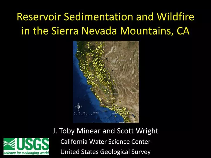
Reservoir Sedimentation and Wildfire in the Sierra Nevada Mountains, CA. J. Toby Minear and Scott Wright California Water Science Center United States Geological Survey. Outline. Introduction What is reservoir sedimentation? How does fire affect sedimentation?

E N D
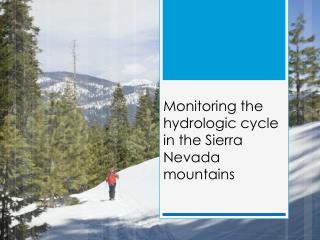
Reservoir Sedimentation and Wildfire in the Sierra Nevada Mountains, CA J. Toby Minear and Scott Wright California Water Science Center United States Geological Survey
Outline • Introduction • What is reservoir sedimentation? • How does fire affect sedimentation? • ‘3W’ model for reservoir sedimentation in California • Sedimentation study with Sierra Nevada Conservancy • How we could use your help…
Reservoir Sedimentation Sediment Reservoir blocks downstream transport of sediment Sediment accumulates in the reservoir = reservoir sedimentation Reduced sediment supply to downstream areas “Hungry water” = downstream erosion of bed and banks Erosion of bed and banks from “Hungry water” Dam Reservoir sedimentation Water Sediment
Effects of Fire on Sediment Dynamics • Fires in S. CA and Coast Ranges: • Fires can increase sediment loads 5-120+ times the pre-fire level • In particular, the ‘fire-flood’ scenario leads to highest sediment rates • Typically 5+ years before rates return to pre-fire levels • Effects are not as well known for the Sierras CalFire fire history database
Modeling Reservoir Sedimentation in the Sierras • Mutiple dams in the same watershed and changes to trap efficiency with time are major issues • Minear and Kondolf (2009) came up with a method to address this issue: ‘3W’ model • Estimates long-term sediment yields from reservoir sedimentation records; applies these yields to unmeasured reservoirs • Accounts for multiple dams in the same watershed and changes in trap efficiency • User-chosen time-step (yearly time-step for 2009 paper) and number of sub-regions (geomorphic regions for 2009 paper)
Reservoir Sedimentation in California: ‘3W’ Model Black dots = measured reservoirs White dots = unmeasured reservoirs - 12 geomorphic regions - 1,391 dams - 70 dams with measured sedimentation rates 3W model: statistical approach; based on geomorphic region to estimate median sediment yield Minear and Kondolf, 2009, WRR
3W Model Results Sediment yield rates by geomorphic region: Minear and Kondolf, 2009, WRR
3W Model Results Estimated reservoir capacity remaining in 2008 (as percent of original) Minear and Kondolf, 2009, WRR
3W Model Results Estimated reservoir sedimentation in acre-feet Minear and Kondolf, 2009, WRR
Limitations of the 3W model 2. Difficult to include GIS attributes / modeling - e.g watershed parameters, fires, soils, climate, climate change, etc. Reservoir B, Bulit 1957 Reservoir D, Bulit 1984 Reservoir C, Bulit 1933 Reservoir E, Bulit 1964 3. No hydrology Reservoir A, Bulit 1949 hydrology 1. Not GIS friendly Reservoir F, Bulit 1947 time
Objectives of this study 1. Determine better reservoir sedimentation rates in the Sierra, particularly related to fire 2. Compile existing reservoir sedimentation records into a single, publicly accessible database **We could use help from local partners to help obtain the sedimentation and capacity data
Improved Reservoir Sedimentation Model Addressing sediment concerns and long-term reservoir storage in the Sierras (both in the reservoir and downstream) + + GIS data: watershed factors (fire history, slope, aspect, watershed size, mainstem length, etc.) Dam data (size, date constructed, sedimentation, operation) Gage data (hydrology + sediment)
Publicly Accessible Database The RESSED database: Interagency project to update nation-wide reservoir sedimentation database: http://ida.water.usgs.gov/ressed/
Future Steps Next Phase: Field studies of individual reservoirs • Determine sedimentation rates related to fire • Additional bathymetric mapping, coring, sediment mapping • Will depend on finding interested partners
Questions? jminear@usgs.gov