Download
1 / 63
640 likes | 901 Views
CDOT CORS/OPUS Team. P. Fromhertz Colorado State Geodetic Advisor National Geodetic Survey (NGS) January 13, 2011 . Gotomeeting https://www2.gotomeeting.com/join/544417138 Call in number: 877-988-6989 participant passcode : 1680881 . Topics. CDOT CORS/OPUS Team formed

E N D
CDOT CORS/OPUS Team P. Fromhertz Colorado State Geodetic Advisor National Geodetic Survey (NGS) January 13, 2011
Gotomeetinghttps://www2.gotomeeting.com/join/544417138Call in number: 877-988-6989 participant passcode: 1680881
Topics • CDOT CORS/OPUS Team formed • Review Goals/Purpose of Team • What is CORS and OPUS • Review Articles • Examine Pilot data • Set Next Steps
Goals • Determine if CORS/OPUS can fulfill CDOT needs • Update Manual • Understand whether CDOT needs more CORS across the State and if so where and at what density.
Topics • Use CORS/OPUS to bring in horizontal control to a project area to serve as a starting position instead of tieing into a HARN. • Use CORS/OPUS to get coordinates on all your survey control project horizontal coordinates (instead of running RTK). • Use CORS/OPUS to establish a vertical starting height for a project area. • Use CORS/OPUS on project control vertically.
User Friendly CORS time zone date start time # hours select CORS epoch rate coords, met, datasheet, orbits, zip? RINEX: 1 hour @ 30-second epoch = 125KB
Why do we need OPUS? • Recognize most positioning done with GPS • Want to provide fast, accurate, consistent, reliable access to NSRS • CORS data alone does not ensure consistency • OPUS • NGS computers • NGS software • Standard parameterization • Standard coordinates/velocities • Your machine talks to our machine
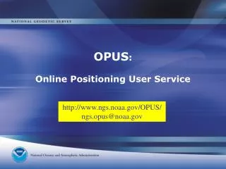
What is OPUS? • OPUS is an acronym for: • Online Positioning User Service (OPUS) • It started as a service for Static GPS users and has grown from there to serve other users. • Designed to work with minimal data input from user and be as fully automated as possible. • Only a Web Browser and Email needed to use. • Fast, easy, consistent access to NSRS.
Many Flavors of OPUS Planned • OPUS-S (static) • $$$ receiver, hours of data • OPUS-RS (rapid static) • $$$ receiver, minutes of data • OPUS-DB (database) • $$$ receiver, hours of data, share results • OPUS-Projects – Beta • Multiple $$$ receivers, share results • OPUS-GIS – not released ?? • ¢¢ receiver, minutes of data • OPUS-Leveling – LOCUS
Online Positioning User Service (OPUS) • L1/L2 GPS data >>> www.ngs.noaa.gov/OPUS • Processed automatically on NGS computers • OPUS-S (2-48 hrs): ties to 3 CORS or • OPUS-RS (15 min–2 hrs): ties to 9 CORS • Solution via email - in minutes • Fast, easy, consistent access to NSRS
How does OPUS work? • Each OPUS ‘flavor’ is a bit different • Let’s start with OPUS-S • Then, we’ll highlight the differences in • OPUS-RS • OPUS-DB • OPUS-Projects
OPUS-S • OPUS-Static, (formerly just called OPUS and sometimes now called OPUS-CLASSIC) • Basic Steps • Submit GPS data to OPUS Web site • Processed automatically on NGS computers • Ties to 3 CORS stations • Solution via email - in minutes • Fast, easy, consistent access to NSRS
How Does OPUS Compute Position? • NGS-PAGES software used • L3-fixed solution w/ tropo adjusted • 3 “best” CORS selected • 3 separate baselines computed • 3 separate positions averaged • Position differences also include any errors in CORS coordinates
How Does OPUS select CORS • Estimate remote station position • Compute distance to every available CORS • Selected CORS assigned 0.0 distance • Sort CORS by increasing distance • Select the 5 closest CORS • Look at 1st 3 CORS with TEQC program ● covers remote data span ● > 80% data available ● low multipath ● replace with 4th (then 5th) • Start single baseline solutions on 1st 3 CORS ● check solution quality ● if bad solution, replace CORS with 4th (then 5th)
OPUS Guidelines • Email address for results • Data file with 2 hrs to 48 hrs of GPS L1/L2 data • Static GPS observations only • 30-second epochs processed • not approved for less than 2 hrs of data, but you can try • Antenna type/phase model • Antenna height from mark-to-ARP vertical
OPUS Website (all flavors) http://www.ngs.noaa.gov/OPUS/
OPUS Inputs • Email – pamela.fromhertz@noaa.gov • GPS file - .dat or Rinex (.obs) • you may zip several files together • IF they all have same antenna type and antenna height. • Antennas need not be same serial numbers
Allowable Data Formats • RINEX • Receiver Independent Exchange—uncompressed • Manufacturer’s native / raw (binary)— Uncompressed--as long as UNAVCO’s TEQC program can process it • Compressed archive of multiple files. Archive must contain RINEX “site123h.04o” or Hatanaka “site123h.04d” • Compressed individual files. • “Site123h.zip”must contain “site123h.06o” or “site123h.06d”
OPUS Inputs • Email – pamela.fromhertz@noaa.gov • GPS file - .dat or Rinex (.obs) • you may zip several files together • IF they all have same antenna type and antenna height. • Antennas need not be same serial numbers • Antenna Type – TRM41249.00 (choose from list) • Antenna Ht – vertical measure from mark to ARP
Antenna Height • True vertical distance • measured in meters ARP MARK
Why Do I Need the Antenna Type? L1/L2 phase centers are around here antenna offsets relate ARP w/ phase centers & are passed to processing software if no antenna type selected, offsets are set to 0 & phase center becomes the reference Antenna Reference Point (ARP) incorrect or missing antenna type large vertical errors
Antenna Phase Center Variation . . . . . . . . . . . . SV 20 SV 20 SV 14 SV 14 Different Phase Patterns SV elevation and varying phase patterns affect signal interpretation differently Antenna Type B Antenna Type A
OPUS Inputs • Email – pamela.fromhertz@noaa.gov • GPS file - .dat or Rinex (.obs) • you may zip several files together • IF they all have same antenna type and antenna height. • Antennas need not be same serial numbers • Antenna Type – TRM41249.00 (choose from list) • Antenna Ht – vertical measure from mark to ARP • Options – Next 3 slides
OPUS Inputs (OPTIONS 1 & 2) specify SPCS specify CORS
OPUS Inputs (OPTIONS 3, 4, & 5) Specify GEOID model: Auto GEOID09 GEOID03 Choose OUTPUT type Choose XML or not
OPUS Inputs (OPTIONS 6, 7, & 8) OPUS-Projects Keyword Set USER Profile Choose PUBLISH and Submit
CORS B CORS A + CORS C OPUS Positions • NGS PAGES processing software • Ionospheric-free solution • Tropospheric scale height adjusted • Fixed ambiguities • Average of 3 unique CORS ties • ITRF & NAD83 coordinates/errors Average
OPUS Report – check results • > 90% observations used • > 50% ambiguities fixed • < 3 cm overall RMS • check ephemeris type • check antenna info • < 5 cm peak-to-peak errors …and which CORS were used? … resubmit later for better CORS scenario & ephemeris
How Does OPUS Compute Errors? peak-to-peak distances N 1 σ standard deviation W E peak-to-peak error more conservative ~ 2 σ S
WHAT IS A GOOD SOLUTION? • No hard rules - only guidelines • Make sure antenna type and antenna height • are correct • Review statistics • should use 90% or more of your observations • at least 50% of the ambiguities should be fixed • overall RMS should seldom exceed 3.0 cm • peak to peak should seldom exceed 5.0 cm
NGS/IGS PRECISE ORBITS • Precise (Final) • 14 days latency • 1 cm accuracy • updated weekly • Rapid • 1 day latency • 2 cm accuracy • updated daily • UltraRapid • 24 hrs observed / 24 hrs predicted • 5 cm / 10 cm accuracy • updated 4 times/day
OPUS Extended Output • HTDP-transform CORS ITRF coordinates from published epoch to session midpoint • Remote station ITRF solution from each CORS • G-files – vector components, standard deviations, & correlations for each vector • post-fit RMS & # observations per satellite/vector • solution covariance matrix-relates errors in each coordinate to every other coordinate • network accuracies - H & V • summary of NAD83 derivation • SPC feet values, if available for user’s state
Articles • Accuracy of OPUS solutions for 1- to 4-h observing sessions, NGS et. al., 2005 • Geodetic Connections – OPUS Rapid State, D. Martin, The American Surveyor, 2007 • Accuracy assessment of the National Geodetic Survey’s OPUS-RS utility, NGS et al., 2009 • Rover Station Positional Accuracies from OPUS as a Function of Reference Station Spacing and Rover Station Occupation Time, NGS et al,. 2009
R5 Pilot Data • Static Data • S 422 • U 422 • X 423 • RTK data, CDOT control • MP192.10 • MP192.28 • MP192.45 • MP192.55 • MP192.62
OPUS-RS (Rapid Static) • 15-minute sessions minimum, 4 hr maximum • ties to 3 – 9 CORS (< 250km) • uses RSGPS vs. PAGES software • P1/P2 code & L1/L2 phase observations • resolves all ambiguities with LAMBDA • similar to Real-Time Network computations • RSGPS solution modes: • network: solves ambiguities, tropo, iono • rover: tropo and ion interpolated to rover • ~10,000 lines of code
OPUS-RS geographical coverage (15 minute session) Don’t use OPUS-RS outside areas Where Insufficient CORS exist.
OPUS-RS geographical coverage (60 minute session) Don’t use OPUS-RS outside areas Where Insufficient CORS exist.