Download
1 / 42
420 likes | 502 Views
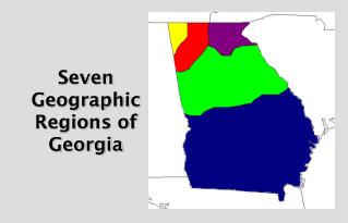
Discover the unique geographic regions of Georgia - the Appalachian Plateau, Valley and Ridge, Blue Ridge, Piedmont, and Coastal Plain. From rugged mountains to fertile valleys and coastal plains, each area offers distinct physical characteristics, agriculture, economic contributions, and interesting features. Explore historical sites, national parks, agricultural landscapes, and diverse industries. Learn about the climate, agriculture, and economic significance of each region as you delve into the rich diversity of Georgia's landscapes.

E N D
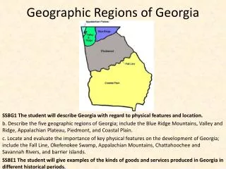
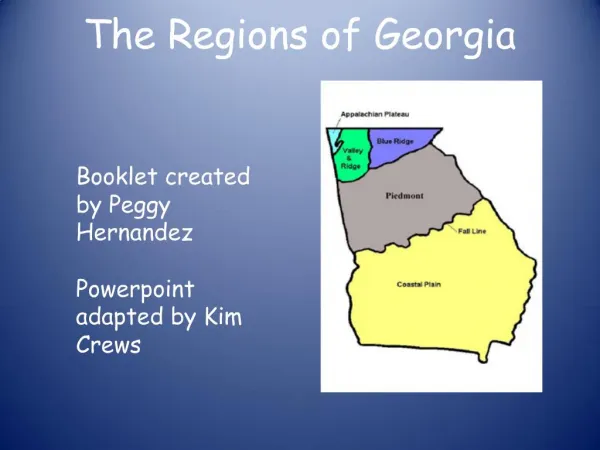
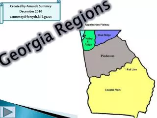
Location • Northwest Georgia • Known as TAG corner (Tennessee, Alabama, Georgia)
Physical Characteristics • Flat or gently sloping land sitting above surrounding valleys
Climate • Averages 5 inches of snow per year • 20-40 degrees in the winter • 80’s (degrees) in the summer
Agricultural Products • Corn • Soybeans • Limited due to poor soil
Economic Contributions • Tourism • Forestry • Coal • Limestone
Interesting Feature • Smallest region • Lookout Mountain • Cloudland Canyon • Chickamauga National Military Park
Location • Northern Georgia • Lies between the Appalachian Plateau and Blue Ridge regions
Physical Characteristics Long, parallel ridges separated by wide, fertile valleys
Climate • Some snow and ice in winter • 20-40 degrees in the winter • 80’s (degrees) in the summer
Agricultural Products • Corn • Soybeans • Wheat • Cotton • Lumber
Economic Contributions • Textiles • Carpet Manufacturing
Unique Features Dalton— “Carpet Capital of the World”
Location Northeastern corner of Georgia
Physical Characteristics • Highest peaks in Georgia • Beginning of the Appalachian Trail • Name comes from blue haze over the mountains
Climate • Most precipitation (80” per year) • 40-41 degrees in winter • 74 degrees in summer
Agricultural Products • Vegetable Farming • Apples • Corn
Economic Contributions • Mining (gold) • Timber
Interesting Features • Brasstown Bald—highest point in Georgia • Dahlonega (tourism)
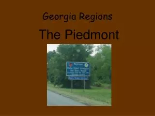
Location • Central part of state • 30% of the state’s land • North of the Fall Line
Physical Characteristics • Gently rolling hills • Name means “foot of the hills” • Red clay • Granite
Climate • Can be around 20 degrees in the winter • 79 to high 90’s in the summer
Agricultural Products • Wheat • Soybeans • Cotton • Poultry/eggs • Cattle/beef
Economic Contributions A variety of businesses and industries
Interesting Features • Physically, 2nd largest region in Georgia • Region with the highest population • Stone Mountain • Major cities—Atlanta, Columbus, Macon, and Augusta
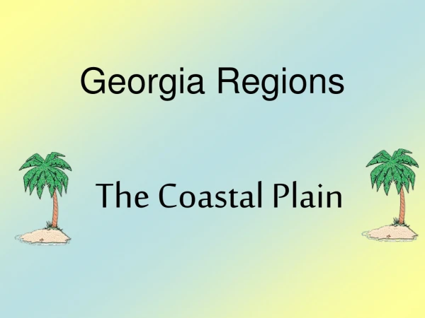
Location Southernmost region in Georgia
Physical Characteristics • Physically largest (60% of the state) • Major rivers flow through to Atlantic Coast or the Gulf of Mexico • Can be divided into 2 regions • Inner Coastal Plain • Outer Coastal Plain
Climate • Hot, steamy summers • Snowfall, ice are rare in winter
Agricultural Products • Vidalia onions • Peanuts • Cotton • Pecans • Peaches • Soybeans
Economic Contributions • Pulp/paper production • Recreation/tourism (barrier islands, Savannah) • Seafood industries • Shipyards • Deep-water ports (Savannah and Brunswick) • Inland-water ports (Bainbridge and Columbus)
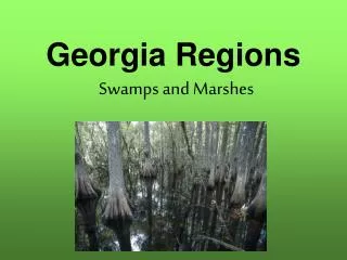
Interesting Features • Largest region • Major agricultural area • Includes the Barrier Islands • Okefenokee Swamp—largest swamp in North America
Photos From the GeorgiaInfo website http://georgiainfo.galileo.usg.edu/photogallery/contents.htm