Download
1 / 8
80 likes | 303 Views
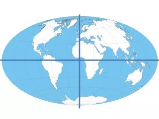
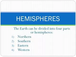
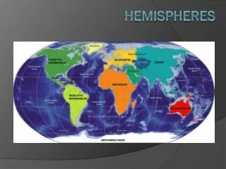
Hemispheres. Equator- circles the Earth like a belt. Separates the Northern and Southern Hemispheres. Prime Meridian- imaginary line, separates the Western and Eastern Hemisphere. Finding Places on The Earth. Latitude- circle the Earth parallel to the Equator.

E N D
Hemispheres • Equator- circles the Earth like a belt. Separates the Northern and Southern Hemispheres. • Prime Meridian- imaginary line, separates the Western and Eastern Hemisphere.
Finding Places on The Earth • Latitude- circle the Earth parallel to the Equator. • The Equator is at 0 (zero degrees) latitude, while the North Pole is at 90 degrees. • Longitude- circle the Earth from pole to pole. Lines of Longitude circle the globe along side the Prime Meridian. • Prime Meridian is at zero degrees longitude, while the line of longitude measure to 180 degrees West and 180 degrees East.
Types of Maps • Physical maps- shows land and water features. • Brown/green- land blue-water • Political Map- shows the names and borders of countries, location of cities, and identifies major physical features of a place.
Special Purpose Map • Show patterns such as climate, natural resources, or population. • Road map • Historical information. • Choropleth- a special purpose map that uses color to show population density.
Goode’s Interrupted Equal-Area projection • close to their true shapes and sizes. • Helpful for comparing land areas among continents.
Mercator Projection • Shows true direction and land shapes fairly accurately. • However, does not show correct size or distance. • Areas far from the Equator appear distorted. Ex: Alaska
Robinsons Projection • Less Distorted • Western and eastern sides appear much as it does on a globe. • North ad South Poles ten to be distorted.
Winkle Triple Projection • Good overall view of the continents’ shapes and sizes. • Land areas are not distorted near the Poles.