Download
1 / 13
130 likes | 400 Views
New Name: Institute of Remote Sensing and Digital Earth CAS. IRSA,CAS. Merging with the Institute of Remote Sensing Applications, Chinese Academy of Sciences. IRSA : established in 1979, with a long history in disaster monitoring and research. CEODE. Academic Consultancy.

E N D
IRSA,CAS Merging with the Institute of Remote Sensing Applications, Chinese Academy of Sciences IRSA: established in 1979, with a long history in disaster monitoring and research.
CEODE Academic Consultancy International Platform Satellite Remote Sensing Center Airborne Remote Sensing Center Spatial Data Center Lab. of Digital Earth Sciences Collaborative Research Unit Division of Operation of Satellite Ground Systems Strategic Development Committee International Center on Space Technologies for Natural and Cultural Heritage under the auspices of UNESCO Division of Operation of Airborne Remote Sensing Section for Data Technology Division of Digital Earth System CAS-NRCAN Capacity Building Center Division of Digital Land Academic Committee CEODE-CRCSI Joint Centre for Spatial Information Section for Data Management Ground System Engineering Division Division of the Airplane Engineering Secretariat of International Society for Digital Earth Division of Digital Ocean and Atmosphere Joint Laboratory for Remote Sensing and Archeology Satellite Data Pre-processing Division Division of Optical System Engineering Section for Value Added Products Division of Optical Earth Observation Committee of Engineering and Technology Joint Lab. for Environmental RS and Data Assimilation The Miyun Ground Station Division of Micro-wave System Engineering Section for Customer Service Division of Microwave Earth Observation Degree Evaluation Committee The Sanya Ground Station Division of Data Preprocessing Committee of Customer Service The Kashi Ground Station Research Organizations Sub-Centers Kashi Sub-Center Sanya Sub-Center International Experts Committee IRDR International Program Office Editorial Office of International Society of Digital Earth Division of Digital Heritage Division of Global Disasters
Satellite Remote Sensing Center • Satellite Remote Sensing Center
Remote Sensing Satellite Ground Station High-resolution, All Weather and Round-the-clock EO Capabilities Receiving and Distributing Satellite Data from 10 satellites: • One of the world largest ground stations receiving, processing and distributing satellite data; • 15TB satellite data being archived annually; • Over 2.70 million scenes of satellite data being stored in CEODE since 1986, providing a precious database for the Earth Observation in China.
Miyun Station in the Suburb of Beijing Staff: 20 persons Area: 66, 700m2
Kashi Station in Xinjiang Province Staff: 15 persons Area: 133,400m2
Sanya Station in Hainan Province Staff: 15 persons Area: 53, 360m2
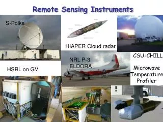
Airborne Remote Sensing System • Two Remote Sensing Aircrafts Cessna Citation S/II • Round-the-clock flying capability; • Equipped with various airborne remote sensors, and can be used to test newly-developed advanced sensors; • Provides high-resolution satellite data. • Two new Remote Sensing Aircrafts • Equipped with 10 state-of-the-art remote sensors: visible, infrared, and microwave remote sensors and a high-performance data processing system. ARJ21 Airplane To be purchased Airborne pushbroom imaging spectrometer (0.45m-2.5m) Airborne 3-D light detection and ranging Airborne whiskbroom imaging spectrometer (0.45m-12.5m) Airborne X-band interferometry SAR Airborne atmospheric laser radar Digital CCD camera
Cutting-edge EO Technologies Spatial Earth Information Sciences Digital Earth Platform Global Change Key Lab of Digital Earth Sciences, CAS • Approved by CAS in Dec., 2009. • Focus on remote sensing application and digital earth, to support: The national economic and social development, environmental protection, resource exploitation, disaster mitigation; A digital earth prototype system was developed and is used to support the global change study and disaster monitoring and forecasting.
International Cooperation Network Broad network with international organizations, such as UNESCO, GEO, and CODATA. Host institution of two other international organizations: HIST, a UNESCO Category 2 Center, and ISDE. Host for the secretariat of the national committee of IRDR in China.
A larger Institution towards Innovation 2020 CEODE Plus IRSA: A larger institution with over 1000 staff 5 State Labs and Centers,1 International Center and 1 CAS Lab Strengthened capacity and competence in space s/t; Top institution in the field of Earth observation and Digital Earth research in China. Innovation 2020 Strategic Plan Disaster research, international cooperation and IRDR development being listed as a key strategic objective in the plan.