Download
1 / 22
230 likes | 367 Views
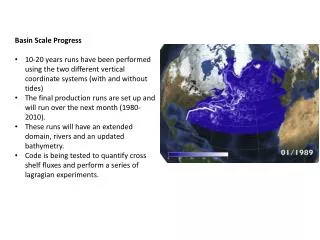
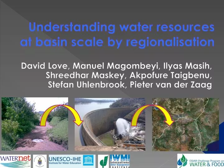
Understanding water resources at basin scale by regionalisation. David Love, Manuel Magombeyi, Ilyas Masih , Shreedhar Maskey , Akpofure Taigbenu, Stefan Uhlenbrook, Pieter van der Zaag. Introduction. Regionalisation

E N D
Understanding water resources at basin scale by regionalisation David Love, Manuel Magombeyi, IlyasMasih, ShreedharMaskey, Akpofure Taigbenu, Stefan Uhlenbrook, Pieter van der Zaag
Introduction • Regionalisation • transferring small-scale (or meso-scale) measurements to a large scale (or basin or regional) model • Transferring from gauged catchments to ungauged catchments • Calibrate model against control catchments or long time series • Catchment classification for regionalisation
Objectives (i) To regionalise three selected models in three semi-arid secondary river basins (ii) To compare the benefits and weaknesses of the selected models in the semi-arid environment
Catchment classification • Flow duration curves • Compare groups of FDCs using non-parametric Kolmogorov-Smirnov test • Catchment characteristics • multivariate statistical classification of catchments based on biophysical descriptors (discriminant analysis) • determine relationships between biophysical descriptors and hydrological parameters
Results – Catchment Classification, Mzingwane • Discriminant analysis • Confirmed statistically differences between Region IV and Region V • Flow duration curves • Confirmed statistically differences between sub-perennial and (sub-)ephemeral catchment groups • Did not confirm independence of ephemeral catchment groups
Results – HBVx Regionalisation, Mzingwane • Calibration: 60% CNS > 0.3 • Regionalisation partially successful: • 40% CNS > 0.3 • Model performance best at 10 d
Results – HBVx Regionalisation, Mzingwane • Parameter sets that performed best: slow infiltration and percolation, moderate to fast “overland” flow, less “baseflow” • Mutangi • Sub-perennial catchments simulated well • Successfully calibrated HDAM • Degraded catchments simulated poorly • Proportion degraded land correlated to K0, fast “overland” flow component
Results – SWAT calibration, B72 of Olifants Catchment • Calibrated in B72E, B72F, B72G • Critical parameters were • baseflow alpha factor • curve number • soil evaporation compensation • soil available water capacity • Correlation coefficient 0.56
Results – SWAT regionalisation, B72 of Olifants Catchment • Correlation coefficient for calibration of whole sub-catchment B72H: 0.51 • Application to ungauged B72A
Results – Catchment Classification, Karkheh • Based on • geographical area • spatial proximity • shape of the flow duration curve (FDC)
Way forward • SWAT regionalisation, Olifants Basin • SWAT application, Karkheh & Mzingwane • HBV application, Mzingwane & Olifants • HBVx application, Karkheh & Olifants
Acknowledgements • Challenge Program on Water and Food: PN17 and PN57 • International Foundation for Science (DL) • Echel Eau Foundation (MM) • International Water Management Institute (IM) • Rand Water (MM)
Acknowledgements • Ministry of Energy, Meteorological Organization and Agricultural Research and Extension Organization of Iran • Department of Environment and Water Affairs of South Africa • Department of Meteorological Services and Zimbabwe National Water Authority of Zimbabwe