Download
1 / 19
190 likes | 288 Views
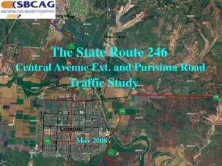
The State Route 246. Central Avenue Ext. and Purisima Road. Traffic Study. May 2008. Objective of the Study

E N D
The State Route 246 Central Avenue Ext. and Purisima Road Traffic Study May 2008
Objective of the Study • To examine the 2030 traffic impacts associated with four roadway improvement alternatives to access the City of Lompoc from Route 246 and to evaluate the critical intersection LOS within in the study area. • Interagency Steering Committee: City of Lompoc, County of Santa Barbara, Caltrans, SBCAG • The Four Alternatives • Alt 1 – 2030 No-Build (Programmed Forecast) • Alt 2 – 2030 Central Ave Ext. as a 2-Lane Minor Arterial • Alt 3 – 2030 Central Ave Ext. as a 4-Lane Minor Arterial • Alt 4 – Widen Rt. 246 e/o Rt. 1 to a 4-Lane Minor Arterial
Daily & PMPH Traffic (03) 11540, PH = 8.5% (06) 11100. PH = 9.0% (03) 33740, PH = 6.8%(06) 31480, PH = 8.2% (03) 16240, PH = 8.6% (04) 13800, PH = 8.3% (03) 8900, PH = 9.2% (03) 9200, PH = 12.6% (06) 8600, PH = 9.9 %
Traffic and Truck % 33740, Trucks = 5.6% 11540,Trucks = 4% 16240, Truck = 6.3% 8900, Trucks = 4% 9200, Truck = 11%
Traffic Impacts: Alt. 1 vs. Alt. 2
Critical Intersection LOS Analysis • Focus on P.M. Peak Hour • Forecast • Growth factors from SBCAG model • Applied to current turning movement count data • Level of Service (LOS) • Grades A (free-flow conditions) through F (heavy congestion) • Intersection Capacity Utilization (ICU) Methodology • Some capacity improvements were assumed to be in place for the Year 2030 scenario
YEAR 2030 P.M. PEAK HOUR INTERSECTION LOS ALTERNATIVE 1 1 2 3
YEAR 2030 P.M. PEAK HOUR INTERSECTION LOS ALTERNATIVES 2 & 3 1 2 5 3 4
YEAR 2030 P.M. PEAK HOUR INTERSECTION LOS ALTERNATIVE 4 1 2 3
Conclusions • Alt. 2 provides a direct access from Rt.246 to the City of Lompoc. The Central Ave Ext. has a significant impact in terms of: • Diverting approx. 8,100 ADT (46%) traffic volumes from Rt.246 • Providing a primary truck access from Rt. 246 to the City and nearby communities • Facilitating an alternate route for traffic between Downtown and Mesa Oaks/Mission Hills • Increasing PM peak volumes on Central Avenue by approx. 15-30% • Alt. 3 offers no significant benefits with the added capacity on the Central Ave Extension. • Alt. 4 does not appear to provide any operational benefits. • With adequate capacity improvements in place, most study area intersections would operate efficiently with Central Avenue Extension except the Central Avenue and H Street intersection.
Next Steps: • Interagency MOU between County, City of Lompoc, and SBCAG for continued study of improvement alternatives. Cost sharing among County and City with SBCAG as Project Manager • RFP for Feasibility Study to examine costs (e.g. bridge, road improvements), environmental issues (e.g. sensitive habitats), etc. of improvement alternatives • Feasibility Study subject to public review