Download
1 / 2
0 likes | 18 Views
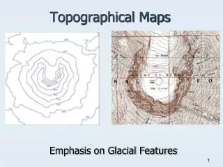
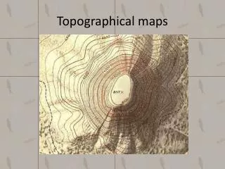
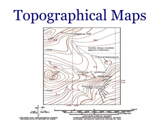
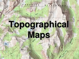
Technicians conduct Oklahoma topographical surveys to create detailed property maps.<br>These document every feature, improvement, and elevation change on the land. To ensure<br>the finished survey reaches the needed level of accuracy, technicians work according to the<br>stateu2019s surveying standards.

E N D
Oklahoma Topographical Surveying Standards Technicians conduct Oklahoma topographical surveys to create detailed property maps. These document every feature, improvement, and elevation change on the land. To ensure the finished survey reaches the needed level of accuracy, technicians work according to the state’s surveying standards. Standards and Specifications for Oklahoma Topographical Surveys The Oklahoma State Board of Licensure for Professional Engineers and Land Surveyors adopted its Instruction Manual for Topographic and Planimetric Mapping in 2019. This document outlines the proper method of conducting a topographical survey Tulsa. To ensure your survey is accurate and provides the information you need, you must partner with a “surveying company near me” that completely understands and adheres to the state’s topographical surveying rules and guidelines. While there are many standards outlined in the Manual, here are some that are especially important: Production Procedures. Technicians follow standards set by Part 3 of the Federal Geographic Data Committee Geospatial Positioning Accuracy Standard. They also adhere to any applicable extensions and revisions. ● Reporting Standards. Technicians document data according to Part 1 of the FGDC’s Geospatial Standards. They carefully test and report horizontal and vertical accuracy to ensure Geospatial Position Accuracy. ● Accuracy Standards. The survey must meet an accuracy standard set by the FGDC, the USDA’s National Agriculture Imagery Program, or adopted by the state. This does not apply if the survey is marked as a “Preliminary Map.” ● Survey Map Requirements. The map or report should include the date the data was acquired, the altitude of the sensor and its focal length (if applicable), and the date that the document or data set was compiled. ● Hard Copy Requirements. If the technician creates a hard copy of the survey, the map must include a north arrow, map legend, and final document scale. This scale should include a bar graph and contour interval, if applicable. ● Partner with a Reliable Surveying Company
Near Me If you need a topographical survey Tulsa for your next significant project, the land surveying and civil engineering experts at Sisemore & Associates are prepared to help. Our technicians have the knowledge, equipment, and expertise to conduct your next survey accurately and efficiently. Contact us to learn more.