Download

1 / 39
410 likes | 642 Views
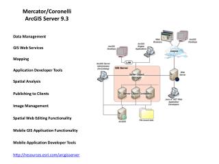
ArcGIS Server. The Good, the Bad, and the Ugly. Steve Foster. GIS Programmer City of Frisco. What does Server do. 1. Client requests a map from Server by specifying layers and extent

E N D
ArcGIS Server The Good, the Bad, and the Ugly
Steve Foster GIS Programmer City of Frisco
What does Server do 1. Client requests a map from Server by specifying layers and extent 2. Server renders the requested map and returns an image (i.e. jpg) to the client (Note: cached images are pre-rendered) 3. Client displays image for user
The Good Available at www.ESRI.com or your any ESRI salesman
The Good • Web application: Allows distribution of spatial data to anyone with a browser • Map utilizes full window! • Centralized management reduces cost of ownership • Heir apparent to ArcIMS
Scalable * Source: ESRI System Design Strategies
ArcGIS Mobile Lightweight applications that run on a variety of platforms Locally cached data for disconnected operation, Syncs when connected Requires Advanced Enterprise level of Server $$$ Photos taken from www.ESRI.com/arcgismobile
The Good (continued) • Ability to integrate with Enterprise applications through web services • Flexible • Choose from Java or .NET • Powerful • Custom geoprocessing tasks developed with Model builder • Limited editing of layers • Support for most ESRI extensions • Network Analyst • Spatial Analyst • 3D Analyst • Sever Data Interoperability
Easy to create Out-Of-The-Box website • Wizard based • Relatively low skill level required
Your Done! It really is that easy
The Bad Or at least not so good
The Bad • Web application • Limited by the technology (HTML) • The best web apps don’t measure up to a good desktop app • Different browsers (IE, Netscape, Firefox, etc) makes testing more difficult • Timing problems in a multi-threaded environment can be difficult to debug • Relatively new product, Support personnel not up to speed yet
SLOW Source: System Design Strategies, Dave Peters, ESRI, 2007
Complex Development Environment • Much more complex than extending ArcGIS desktop • Several different technologies • HTML, ASP.NET, AJAX, VB and/or C#, Jscript • Requires Microsoft Visual Studio 2005 • Requires a fairly high skill level to customize code
Bugs • True curves causes errors in Identify • Certain combinations of null and non-null values in table cause search to fail • Zoom function sometimes fails to refresh map (Timing problem with window resize event) • Map tiles sometime fail to draw (source file for toolbar incorrectly specified App_Code\FriscoTools.vb)
Caching does not work correctly when “PrimaryMapLayer” is set to a non-cached layer (Documentation omission). • TOC collapses when refreshed (wrote my own) • TOC update contains 100’s of repeated elements. (SP4) • Dynamic rendering speed unnecessarily slow. Depends on what layers are in the map, not what is drawn. • Custom cursors don’t behave correctly
If possible…wait for Server 9.3 • Faster? • Improved Diagnostics (log files) • Major additions to Documentation • Microsoft ASP.NET AJAX Final release • Print task • Use Mozilla Firefox with Firebug extension for debugging • Use Fiddler with IE (not as good but some bugs limited to IE)
Optimization • Server is slow • Keep it simple • Cache everything possible / minimize dynamic rendering • Keep symbology simple on dynamic layers, Use optimized symbol set • Online seminar: Authoring and Publishing Optimized Map Services (http://training.esri.com/acb2000/showdetl.cfm?did=6&Product_id=908)
Oops! I didn’t budget for that! Client Browser City of Frisco Server Configuration Client Browser Reverse Proxy Server (ISA) Web ArcGIS (SOM, SOC) Server ArcServer: Dual Xeon/Dual Core 3.0 GHz (8Gb) ArcIMS Server (internal) Frisco6: Xeon 2.4 GHz (2Gb) SDE / SQL 2005 Server ATLAS: Client Browser Client Browser DMZ Secure Internal Network WWW
Resources • ESRI Developer Network (EDN) • http://edn.esri.com/ • Discussion Forums • Latest Documentation • EDN Media Kit ($1500/yr) • ArcGIS Server (all editions) & extensions • ArcIMS • ArcGIS Engine & Extensions • ArcGIS Image Server • ArcView (+$500), ArcEditor(+$1500), ArcInfo (+$2500) • ESRI Developers Blog • http://blogs.esri.com/Dev/blogs/arcgisserver/ • Examples of code customization • ESRI Developer Summit • March 17-20 Palm Springs • ESRI Training • Developing Applications with ArcGIS Server Using the Microsoft .NET Framework
Create an Error Log Private Sub Page_Error(ByVal sender As System.Object, ByVal e As System.EventArgs) Handles MyBase.Error Dim exception As Exception = Server.GetLastError() Server.ClearError() My.Computer.FileSystem.WriteAllText("C:\ESRI_ArcGIS_Server\Log\Error.txt", Date.Now.ToString("yyyy-MM-dd") & "," & Date.Now.ToString("HH:mm:ss") & "," & Session.SessionID & ", PAGE ERROR TEXT: " & exception.ToString & vbCrLf, True) callErrorPage("Page_Error", exception) End Sub • Note: Add to Default.aspx.vb
Toolbar: Adding Tools & Commands • Sample TOOL • ' Zoom in to the rectangle area defined by user. • Public Class ZoomRect • Implements IMapServerToolAction • Sub ServerAction(ByVal args As ToolEventArgs) Implements IMapServerToolAction.ServerAction • Dim map As ESRI.ArcGIS.ADF.Web.UI.WebControls.Map = CType(args.Control, ESRI.ArcGIS.ADF.Web.UI.WebControls.Map) • Dim pea As RectangleEventArgs = CType(args, RectangleEventArgs) • Dim peanut As System.Drawing.Rectangle = pea.ScreenExtent • If peanut.Height < 15 And peanut.Width < 15 Then • Dim center As Integer • 'Y • center = peanut.Y + (peanut.Height / 2) • peanut.Height = map.Height.Value / 2 • peanut.Y = center - (map.Height.Value / 4) • ' X • center = peanut.X + (peanut.Width / 2) • peanut.Width = map.Width.Value / 2 • peanut.X = center - (map.Width.Value / 4) • End If • map.Zoom(peanut, True) • End Sub 'IMapServerToolAction.ServerAction • End Class 'ZoomRect • Sample COMMAND • ' Zoom to the Extent of City • Public Class ZoomFullExtent • Implements IMapServerCommandAction • Sub ServerAction(ByVal info As ToolbarItemInfo) Implements IServerAction.ServerAction • Dim map As ESRI.ArcGIS.ADF.Web.UI.WebControls.Map = CType(info.BuddyControls(0), ESRI.ArcGIS.ADF.Web.UI.WebControls.Map) • map.Extent = New ESRI.ArcGIS.ADF.Web.Geometry.Envelope(2450000, 7080000, 2511000, 7132000) • End Sub 'IMapServerToolAction.ServerAction • End Class
Frisco GIS Team Susan Olson John Morley Amy Rose Bud Videan Brian Macke
Coming Attractions NCTCOG Regional GIS Meeting May 22, 2008 Frisco City Hall (96°50’4”W 33°9’N) Integration of Spatial and Business data systems at the City of Frisco
Demonstration • Frisco Interactive maps at http://maps.friscotexas.gov/ • Frisco Home page: www.friscotexas.gov • This presentation will be available on our GIS page