Download
1 / 23
230 likes | 246 Views
Detailed analysis of Hurricane Ana and Bill missions, focusing on the impact of dry air, low-level jet streams, and surrounding environmental conditions on the storm structure and intensity. Data from sondes, Doppler analyses, and flight tracks provide insights into how dry air affected the development of these storms.

E N D
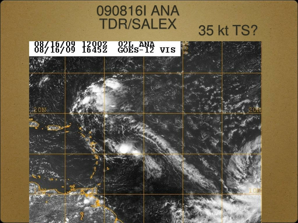
35 kt TS? 090816I ANATDR/SALEX
ANA: Limited convection, SW shear, and surrounded by moderately dry air
105 nmi east 090816I skew-Ts 135 nmi north
Notes on 080916I Ana mission: No closed circulation at any level- from sondes, 2 Doppler analyses Storm inhibited by shear and dry air? What role did a low-level (700 mb) jet have? Little distinction between air near the wave axis and in the environment
90 KT, 963 mb 090818N2 BILLTDR/SALEX
105 nmi south 090818N2 sonde skew-Ts 150 nmi north
105 nmi south 090818N2 sonde wind profiles 150 nmi north
Notes on 080918N2 Bill mission: Dry air on south and west side of storm Low-level jet (700 mb) seen on west side Nearby environment well-samples by sondes on G-IV - inner core by concurrent P3 mission Unusually high number of fast fall sondes and ones with bad PTH
115 KT, 950 mb 090819N2 BILLTDR/SALEX
Bill still had dry air nearby but was the inner core protected?
150 nmi NW 090819N2 sonde skew-Ts 150 nmi NE
Notes on 080919N2 Bill mission: Dry air on west and southwest sides of storm Low-level jet (700 mb) seen on west side Nearby environment well-samples by sondes on G-IV - inner core by concurrent P3 mission Was the core of Bill protected by dry air intrusions?
105 KT, 951 mb 090820I2 BILLSALEX
090820I2_ Radar sytem was down but the G-IV was sampling the environment
Flew a figure 4 with 105 nmi legs then used microwave imagery to circumnavigate dry slot outside of Bill’s eyewall
On ferry to Bill at 600 mb, SAL air clearly visible below us
090820I2 skew-T ~105 nmi west
Different imagery will give you a different interpretaion of storm structure
Notes on 080920I2 Bill mission: Radar inoperative but sondes and flight-level data combined with G-IV and C-130 synoptic data could prove valuable Was the dry air eroding the convection on Bill’s west side and weakening or limiting intensification? Microwave imagery useful for mission planning and execution Was the core of Bill protected by dry air intrusions