Download
1 / 54
600 likes | 811 Views
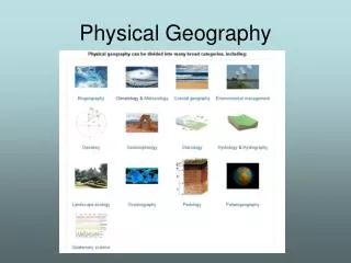
Physical Geography. What is Physical Geography?. Examines the relationships among patterns and processes within the physical environment. Study of earth’s physical processes Geology – rocks and earth formations Environmental science – human interaction with the environment

E N D
What is Physical Geography? • Examines the relationships among patterns and processes within the physical environment • Study of earth’s physical processes • Geology – rocks and earth formations • Environmental science – human interaction with the environment • Topography – earth’s features • Cartography – map making.
How are Physical Factors spatially defined? Location: The location of a place or thing on the earth’s surface Absolute Location: The exact spot of a place on the earth’s surface -Use Latitude and Longitude to define it Ex. - Toyko, Japan is at 36° N Latitude and 140° E Longitude Relative Location: The location of a place in relation to another place or thing Ex.) Sonic is across the street from Kroger Globe: Scale model of the earth
Latitude AKA: Parallels Numbers get higher the further North or South you move away from the Equator Latitude lines measure North or South of the Equator Zero Degrees Latitude is the Equator 90 Degree North (North Pole) 90 Degrees South (South Pole)
Latitude KNOW THESE LINES and their latitude measurements!! Equator 2 Tropics 2 Circles 2 Poles
Zero Degrees longitude is the Prime Meridian. 180 degrees East or West is the International Date Line By international agreement - 0 degrees longitude runs through the Royal Observatory in Greenwich, England Numbers get higher the farther you move either East of West Longitude lines measure East or West of the Prime Meridian Longitude AKA- Meridians
Where lines of latitude and longitude cross they form a pattern known as: A Grid System (a global address) Each degree of the earth is equal to 1/360 of the earth. Each degree is divided into 60 minutes (‘). Each minute = 60 seconds (“)
Hemispheres If you cut the Earth through the Equator you would get two halves, the Northern and Southern Hemisphere If you cut the Earth through the Prime Meridian you would get two halves, the Western and Eastern Hemisphere The US is in the Western Hemisphere and the Northern Hemisphere
Absolute Location 30°03' 39.60" N 95°09' 19.26" W
Absolute Location Basic Geography
0 • 0 latitude – Equator • (Distance from it has large effect on climate) • 0 longitude –Prime Meridian • (Distance from it has no effect on climate)
Rotation • The spinning of the earth on its axis • Takes 24 hours • Creates night & day
Revolution • The orbit of the earth around the sun • Takes 365 ¼ days • Creates the seasons
Polar Night • When the polar region is tilted away from the sun – the polar area receives 24 hours of darkness. When it is pointed toward the sun the area receives 24 hours of daylight.
EQUINOX • Direct rays of the sun are located on the EQUATOR • Days and nights are equal in length • Spring (Vernal) and Fall (Autumnal) • When it is Spring in the northern hemisphere it is Fall in the southern hemisphere (the opposite is also true)
SOLSTICE • Direct rays of the sun are located on the TROPIC OF CANCER OR CAPRICORN • Days and nights are not equal in length – summer days are longer – winters nights are longer • Summer and Winter • When it is Winter in the northern hemisphere it is Summer in the southern hemisphere (the opposite is also true)
Red – LOW LATITUDES 0 – 23 ½ North & South Tropics Hot and Humid Green – MID LATITUDES 23 ½ - 66 ½ North & South Temperate Mild THE MAJORITY OF THE WORLD’S PEOPLE LIVE IN THE TEMPERATE ZONE!! Blue – HIGH LATITUDES 66 ½ - 90 North & South Polar Cold and Dry
LITHOSPHERE Solid, rocky crust covering entire planet. http://mediatheek.thinkquest.nl/~ll125/images/struct.jpg
ATMOSPHERE The air surrounding Earth • 78% Nitrogen • Just under 21% Oxygen • less than 1% argon, carbon dioxide & other gasses www.space.gc.ca
HYDROSPHERE All the water in or near the Earth
BIOSPHERE Composed of all living organisms • Plants • Animals • One-celled organisms
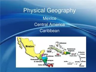
7 continents – Africa, Asia, Antarctica, South America, North America, Europe & Australia • 5 Oceans – Southern, Arctic, Pacific, Indian, Atlantic
FACTORS THAT AFFECT CLIMATE http://upload.wikimedia.org/wikipedia/commons/thumb/9/97/The_Earth_seen_from_Apollo_17.jpg/300px-The_Earth_seen_from_Apollo_17.jpg LACEMOPS
Weather – The daily condition of the atmosphere which includes temperature and precipitation. Precipitation - Moisture that falls from the sky. Precipitation has 4 forms: rain, snow, sleet, and hail. Climate - Average weather. Measured over an extended period of time (usually 30 years). http://www.mnh.si.edu/archives/garden/images/4seasons.gif
L - LATITUDE - The most important factor! The farther from the Equator - the colder and drier it becomes. Direct rays of the sun are always between the Tropics. Areas not in the tropics receive indirect sun rays. High Mid Low High
A - AIR MASSES In the Northern Hemisphere, cold air from the Polar Regions comes from the north. Hot air from the tropics comes from the south, Mountains to the north of a city could block the cold air from reaching the city. (opposite in the Southern Hemisphere).
C - CONTINENTALITY Water moderates climate. Water takes longer to heat and cool than land. Areas inland from the coast will be hotter in the summer and colder in the winter than areas with the same latitude on the coast. http://images.google.com/imgres?imgurl=http://edc.usgs.gov/imagegallery/imageSrc/United%2520States-NED500.jpg&imgrefurl=http://edc.usgs.gov/imagegallery/imageDetail.php%3Fpage%3D18%26img%3DUnited%2BStates-NED%26id%3D2071%26col%3DStates%2B-%2BNED%2BShaded%2BRelief&h=353&w=500&sz=121&hl=en&start=17&um=1&tbnid=tsJBVC5mQRiZ6M:&tbnh=92&tbnw=130&prev=/images%3Fq%3Dunited%2Bstates%2B%26svnum%3D10%26um%3D1%26hl%3Den%26safe%3Dactive%26rls%3Dcom.microsoft:en-us:IE-SearchBox%26rlz%3D1I7GGLG%26sa%3DG
E - ELEVATION It gets colder as you go up a mountain. The formula for vertical climate is: Temperature decreases 3.5º F for every 1,000 feet increase in elevation (the opposite is also true). You can work out the temperature at the top of a tall mountain. http://images.google.com/imgres?imgurl=http://www.savetibet.org/images/images/MountEverest.jpg&imgrefurl=http://www.savetibet.org/news/newsitem.php%3Fid%3D1050&h=300&w=400&sz=22&hl=en&start=6&um=1&tbnid=ODjU-A29uyNbXM:&tbnh=93&tbnw=124&prev=/images%3Fq%3Dmt%2Beverest%26svnum%3D10%26um%3D1%26hl%3Den%26safe%3Dactive%26rls%3DGGLG,GGLG:2005-42,GGLG:en http://www.commondreams.org/headlines05/images/0314-01.jpg
It is 75º at the base of a 15,000 ft. tall mountain. What is the temperature on top of the mountain? First, count the thousands… (15,000) Second, multiply that number by 3.5… 3.5° (from formula) X 15 (how many thousands of feet the mountain is tall) 52.5° (how much colder at the top than the bottom) Third, Subtract that number from the temperature at the base to get the answer… 75° (temperature at bottom) - 52.5° (how much colder at the top) 22.5 ° (temperature at the top) Answer
M - MOUNTAIN BARRIERS Orographic effect: Wind containing moisture hits the windward side of a mountain (the side facing the wind). Moisture-full clouds are too heavy to get over the mountain so precipitation occurs, after they’re empty, they are able to rise over the mountain. The side facing away from the wind is called the leewardside. The leeward side of a mountain is arid. The windward side has lush vegetation. The leeward side of a mountain is in the rain shadow and is usually a desert.
O - OCEAN CURRENTS Cold currents bring dry, cool air to the coastal areas. Warm currents bring warm, wet air to coastal areas. http://go.owu.edu/~jbkrygie/krygier_html/geog_111/geog_111_lo/geog_111_lo05_gr/3-16.jpg
P - PRESSURE AND PREVAILING WINDS: Pressure High pressure is heavy, cold air. Low pressure is warm, light air. Heat rises. There are some fairly constant air pressure systems. Notice that these lines are located at 0, 30, 60, 90 (not 0, 23 ½, 66 ½, and 90)
Prevailing Winds The Equator is surrounded by an area of calm called the Doldrums (ITCZ). The Trade Winds (Tropical Easterlies) blow from east to west (generally warm and moist). Westerlies(Prevailing Westerlies). They blow from west to east. The PolarEasterliesblow from 90º in an eastward direction toward the Westerlies. There are serious thunderstorms around the 60º latitude line where the two wind patterns collide http://www.worldstats.org/general_world/maps/prevailing_winds_big.gif Notice that these lines are located at 0, 30, 60, 90 (not 0, 23 ½, 66 ½, and 90)
S - STORMS Where the Polar Easterlies meet the Westerlies there are thunderstorms. When hot air masses and cold air masses collide - there are storms. Cyclonic storms (hurricanes, typhoons, etc.) in the Northern Hemisphere spin counter-clockwise. In the Southern Hemisphere cyclones spin clockwise.
Internal Forces of Change
Continental Drift The theory that the land of the earth was once connected as one large super continent (Pangaea) and has moved “drifted” to its current locations (still moving) Plate Tectonics The theory that the crust of the earth is broken up into plates (8 major and many minor) that “float” on the mantle
Subduction When a sea plate and continental plate collide, the heavier sea plate DIVES under the lighter continental plate. The sea plate then is heated and becomes magma which escapes through volcanoes.
Spreading When sea plates pull apart leaving a rift, or deep crack. Magma wells up between the two plates to make underwater volcanoes and ridges.
Volcano mountain formed by lava (magma) that breaks through the earth’s crust.
Ring of Fire area along the edge of the Pacific Ocean that is a zone of frequent earthquakes and volcanoes.
Folding when moving plates squeeze the earth’s surface until it bends the layers of rock.
Faulting When moving plates grind past each other, creating cracks in the curst.