Download
1 / 33
330 likes | 435 Views
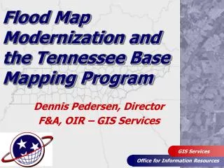
The Tennessee Base Mapping Program. Dennis Pedersen, Director OIR – GIS Services. “A New Beginning”. TNBMP…A New Beginning. Initial Production Complete Accomplishments Summary Ortho Imagery Pilot Program TDOT Partnership Enterprise GIS – TNMap (“The Tennessee Map”).

E N D
The Tennessee Base Mapping Program Dennis Pedersen, DirectorOIR – GIS Services “A New Beginning”
TNBMP…A New Beginning • Initial Production Complete • Accomplishments Summary • Ortho Imagery Pilot Program • TDOT Partnership • Enterprise GIS – TNMap (“The Tennessee Map”)
TNBMP…A New Beginning Let’s take a look back…
TN Base Mapping Program Pilot Counties – 1997, 1998
Milestones/AccomplishmentsA few quick facts: • Total cost: $28 million • $19 million (ortho, DTM, planimetrics) • $ 9 million (parcels) • Collaboration/Local partnerships • $5 million in contracts • 250+ organizations in 57 counties • Leveraged existing data in 6 counties • Local GIS maintenance in 45 counties
Sustainable Ortho Imagery Principles • Cost effective approach that meets needs of State and local users • Leverage federal funding to help reduce or eliminate duplication of effort • Regional or Statewide acquisition • County by county more expensive/inefficient • Eliminate production of overlapping map sheets • Develop set schedule for updates • Examine State/local cost share
Data Maintenance Strategies • Initial statewide production complete • Ortho Imagery is 7 years old in some counties • Population growth/development driving demand for new imagery • Need a plan for ortho imagery update/maintenance
Data Maintenance Strategies • FY07 - 08 Funding in place • Extended current contract from 10/07 to 10/08 and modified specs to emulate “Imagery for the Nation” and local requirements • Identify counties with significant growth, imagery that is outdated, TDOT region 1 (upper East TN) • Continue operating under current cost share model (75% State / 25% local)
Dept. of Transportation • Existing analog aerial photography program • Large scale engineering projects (site specific) • Right-of-way corridor studies • Regional planning efforts • Need to develop or enhance internal processes for using new technology • Identified need to update current photogrammetry processes • Completed “Gap” analysis to provide detailed recommendations
OIR-GIS/TDOT - Partnership • TDOT Modernizing Equipment • Digital camera suitable for ortho photo production • Training staff on new photogrammetry production req. • ortho acquisition for ¼ of State annually • OIR-GISresponsiblefordata hosting and distribution • TNMap enterprise GIS • Dissemination to local government • 2008 Acquisition: Region 4 (West TN)
TDOT Federal State Sustainable Tennessee Ortho-Maintenance Program IFTN OIR-GIS Local Gov Future Current Aerial Surveys Standards/Funding T N B M P
Sustainable Ortho Imagery Principles • Cost effective approach that meets needs of State and local users • Leverage federal funding to help reduce or eliminate duplication of effort • Regional or Statewide acquisition • County by county more expensive/inefficient • Eliminate production of overlapping map sheets • Develop set schedule for updates • 4 year cycle • Revisit State/local cost share
Enterprise GIS Development • How can State agencies create and maintain spatial data once and use (share) it many times? • The “Tennessee Map” (TNMap)
The Tennessee Map (TNMap): Enterprise GIS Architecture • Goals • Develop enterprise GIS infrastructure to provide secure, usable, and easy access to TNBMP data • Provide State agencies with ability to publish data to enterprise GIS • Support vision of USGS’ National Map and NSDI • Identify data stewards, reduce or eliminate redundant GIS data collection
The Tennessee Map (TNMap): Enterprise GIS Architecture • Initiatives/Strategies • Staffing requirements (2 to 8) • Enterprise Geospatial Data Repository • GIS Data Inventory and Data Stewardship • TN Geospatial Data Sharing Standards • Enterprise Services and Geospatial Applications • Geospatial Standards (software, metadata)
Business Case for Enterprise GIS The Tennessee Map (TNMap): Enterprise GIS Architecture • Comptroller – Manage real property • TWRA/TDEC/Ag. – Governor’s Heritage Conservation Trust Fund • TDOT – Right-of-way acquisition • ECD – community planning, land use regulations, business development ROI: Create once – use many times, eliminates duplication of effort, saves time and money
The Tennessee Map (TNMap): Enterprise GIS Architecture TNMap…More than just a map • Geo-portal application • Base Map Data Repository • Shared GIS infrastructure for application hosting • Access: Public, State GIS users TNMap portal demonstration…
TNBMP…A New Beginning • State will provide local government with updated ortho imagery – 4 year cycle • Local gov. will provide the State with updated parcels, street centerline GIS data • Counties with new imagery (2007 or 2008): • Local cost share is 25% of parcels only
TNBMP…A New Beginning • Vision: Maintain a statewide GIS base map through partnership development that can be used in support of a wide range of local, state, and federal programs
Thank you…. • Contact Information: • Dennis Pedersen, Director, GIS Services312 8th Avenue North16th Floor, WRS Tennessee TowerNashville, TN 37243-0288 • E-mail: dennis.pedersen@state.tn.us • Phone: 615-741-9356 http://tnmap.state.tn.us/portal