Download
1 / 26
410 likes | 918 Views
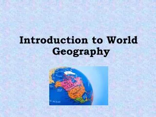
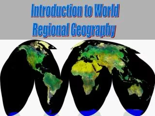
Introduction to World Geography. Geography. Study of the Earth’s surface and the process that shapes it, the connection between places, and the complex relationship between people and their environments . Starts with the Solar System. Planets orbit around the Sun.

E N D
Geography • Study of the Earth’s surface and the process that shapes it, the connection between places, and the complex relationship between people and their environments.
Planets orbit around the Sun • 1. Mercury 2. Venus 3. Earth 4. Mars 5. Jupiter • 6. Saturn 7. Uranus 8. Neptune
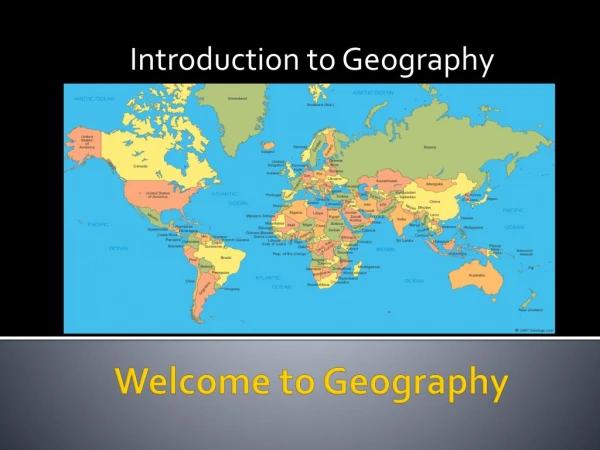
Earth consists of 7 Continents 7 Continents in size order : 1. Asia 2. Africa 3. North America 4. South America 5. Antarctica 6. Europe 7. Australia
Earth consists of 5 Oceans 5 Oceans in size order : 1. Pacific 2. Atlantic 3. Indian 4. Southern 5. Arctic
2 ways to show the Earth in a smaller Scale • Globes – Most accurate because the Earth is a Sphere and so is a Globe.
2nd way to show the Earth in a smaller scale is……… • Maps–are flat and to put the round earth on a flat surface distortion occurs. This means some parts of a Map needs to be shrunk and stretched to fit.
Cartographer • One who Creates and Makes maps
Political Maps • Display Countries or States with different COLORS
Physical/Topographic Maps • Display elevation with different COLORS
4 Essential parts of a Map • 1. Title – Name, Date, and description of the Map
4 Essential parts of the Map • 2. Key or Legend – Shows and explains what symbols mean on a Map.
4 Essential parts of a Map • 3. Scale – Compares the distance on the Map to the actual distance of the Earth.
4 Essential parts of a Map • 4. Compass Rose Displays Direction • Cardinal Direction North, South, East, West • Intermediate Direction Northwest, Northeast, Southwest, Southeast
Equator – an imaginary line that separates the Earth into Northern and Southern Hemispheres.
Prime Meridian – is an imaginary line that separates the Earth into Western and Eastern Hemispheres.
The other Half of the Prime meridian is the 180th Meridian International Date Line rest mainly on the 180th Meridian
The Grid System • A systematic way of locating a place.
Lines of Latitude are imaginary lines that circle the Earth, measure North and South but run East and West. • Latitude Linesare also called Parallelsbecause they never cross or intersect.
Longitude Lines are imaginary lines that circle earth. They start from North Pole and meet again at the South Pole. Lines measure East and West but run North and South Longitude lines are also called Meridians
Together they set up a graph so one can Chart and Locate Places.