Download
1 / 20
200 likes | 241 Views
The Full Circle RFAC explored various methods for assessing habitat loss, including habitat gained and ecological approaches. This proposed methodology provides guidance on determining impacted areas, extent of habitat loss, and calculating areas of lost habitat, aiming to standardize assessments for different stream types and reservoirs. Key aspects include using GIS calculations, determining impacted tributaries, and loss mitigation negotiations. The methodology also covers operational losses separately.

E N D
Proposed MethodologyforAquatic Habitat Loss Assessment Prepared by the CBFWA Resident Fish Advisory Committee
Full Circle RFAC looked at several options • Habitat gained • Alterations in habitat • Ecological approach • Weighting of habitat • Variations between different types of reservoirs and streams • Loss of habitat features (islands, falls, side channels)
Area or Lineal Calculations • Neither area or lineal works for all areas • Managers will determine which is best method of the two for their area • GIS calculations will be standardized • Free of subjective judgments • Will work for all stream classes
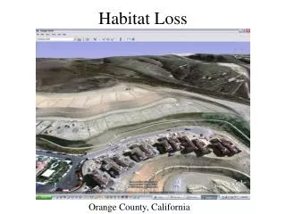
Determine Area Impacted • How many kilometers or acres of river were lost to inundation from hydro-power construction • How many kilometers or acres of aquatic habitat in tributaries was lost from hydro-power construction
Determine Extent of Habitat • Do natural barriers exist that were the end of fish passage? • Did gradient create barrier? • Calculate length of stream • Determine average channel width • Calculate square meters of habitat • Convert to acres • Or create polygon to automatically calculate area
Process and Benefits • Will acquire or digitize shape files of the original channel to calculate area and or length • Work will be done at a scale of 1:12,000 or less • Will determine stream order on 1 through 12 order streams then define by name or as mainstem • Determine gradient • Loss mitigation will be negotiated separately between each entity and BPA • Can use to credit for acquisition or protection easements • When unable to find similar habitat for acquisition especially on mainstem the process will provide for mitigation even when no similar habitat available
Calculating the Areaor Lengthof Lost Habitat • Select area to assess (Lake Rufus Woods) • Create of locate GIS shapefile of original river and clip to Reservation boundary • Clip to high water line of original river • Loss will be defined in kilometers or acres • of aquatic habitat
Determine Tributaries Impacted by Inundation • Lake Rufus Woods has 4 tributaries that had historic use • Nespelem River • Peter Dan Creek • Coyote Creek • Tumwater Creek • Many intermittent streams also provided habitat during the spring freshet
Calculating Area of Tributaries Without GIS • Use of stream surveys to determine average width • Determine length with surveys or map wheel • Calculating the area
Nespelem River Average width = 5.526 meters Length of habitat = 121281 meters w x l = m2 5.526 x 121281 = 670,198.6 sq meters m2/0.093 = ft2 670,198.6/0.093 = 7,206,436 sq feet ft2/43,560 = 165.437 acres
Operational Losses Separated • Methodology for the operational losses will be developed separately and presented at a later date.