Download
1 / 43
450 likes | 1.06k Views
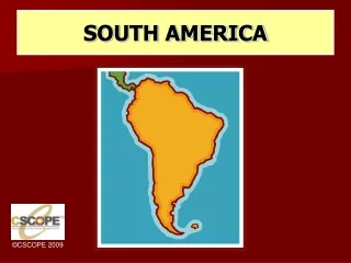
South America. South America Geographical Facts. 1. South America is the 4 th largest continent, covering about 12% of the earth’s total land area. 2. South America is the 5 th most populous continent, with a population of around 387 million. South America’s Physical Geography.

E N D
South America Geographical Facts 1. South America is the 4th largest continent, covering about 12% of the earth’s total land area. 2. South America is the 5th most populous continent, with a population of around 387 million.
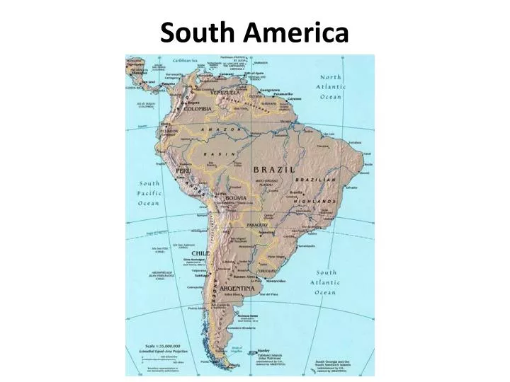
South America’s Physical Geography • Physically, South America is dominated by two physical features: • The Andes Mountains • The Amazon River Basin
The Andes Mountains • The Andes Mountains run down the western side of South America and provide important mineral resources for the countries they run through. • The Andes are volcanic in origin so earthquakes and volcanic eruptions are problems for the area. • Mt. Aconcagua, at 22,831 feet above sea level, is the tallest mountain of the Andes and also the highest point in the Western Hemisphere.
The Amazon River Basin • The Amazon River is the largest river in the world and the second longest, at 4,100 miles long. • The Amazon River’s drainage basin covers around 2.7 million square miles, which is about 40% of all of South America. • During the rainy season, the Amazon can be up to 60 miles wide in places. • The Amazon discharges more than 50 billiongallonsof water per second into the Atlantic Ocean.
Lake Maracaibo • Lake Maracaibo is S. America’s largest lake and one of the oldest bodies of water in the world. • It is brackish – a mixture of fresh and salt water. • It’s a major oil producing region of Venezuela.
Lake Titicaca • On the border of Peru and Bolivia, it is South America’s largest fresh-water lake. • It is also the world’s highest navigable lake (13,000 feet above sea level).
Rio de la Plata • The Rio de la Plata is one of the world’s largest estuaries. • An estuary is an inland arm of the sea that meets the mouth of a river. • The Rio de la Plata is actually a confluence, which is where two or more rivers run together (Paraguay and Parana Rivers).
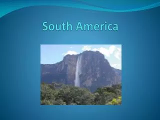
Angel Falls 1. Located in Venezuela, Angel Falls is the world’s highest waterfall (3,212 feet).
Iguacu Falls • Located on the border of Brazil and Argentina, Iguacu Falls is the world’s widest waterfall during South America’s rainy season. • Its two falls flow together and are over two miles wide.
Cape Horn • A cape is a strip of land that juts out into a large body of water. • Cape Horn is actually an island that is part of the Tierra del’ Fuego archipelago. • The Strait of Magellan is the channel that runs just north of the islands of Tierra del’ Fuego (its 331 miles long and between 2 to 15 miles wide). • The Strait is difficult to maneuver but much safer for ships than the waters off Cape Horn.
South America’s Climate • The northern region of South America has a tropical climate, except in the highland areas, where the climate is more temperate, or mild. • The central region of South America has a more temperate climate. • The southern region of South America is much cooler – the weather at Cape Horn is below freezing year round.
South America’s Population • The majority of South America’s population lives within 500 miles of the coast due to the difficulty in getting to the interior of the continent. • Culturally, most of South America was colonized by Spain or Portugal. • The predominant language is Spanish and the predominant religion is Catholicism. • Historically, South American countries have faced poverty and political instability.
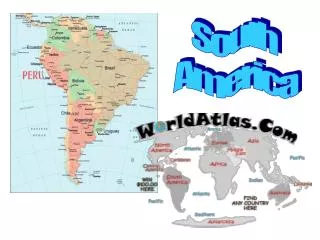
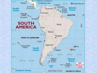
South American Regions • South American can be broken into four regions: • Northern Countries • Central Andean Countries • Southern Cone Countries • Brazil
Northern Countries • The Northern Countries of South America are Columbia, Venezuela, Guyana, Suriname and French Guiana. • The western portion of this region is covered by the Andes, where mining is an important economic activity – Venezuela is the largest producer of oil in S.A. • East of the Andes are the llanos, which are grass plains suitable for agriculture and raising livestock. • East of the llanos are the Guiana Highlands, a heavily forested plateau region. • A plateau is wide area of level, elevated land. • The eastern portion of the region is covered with tropical rainforests.
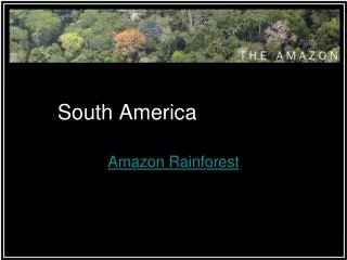
South American Rain Forests • The Amazon is the world’s largest, most famous rain forest region. • The Amazon River Basin is home to more species of plants and animals than any other ecosystem in the world - an estimated 30% of the world’s species. • The region has a large, tribal population known as Amerindians. • The rain forests are being cleared for farming, logging and livestock.
Slash and Burn Agriculture • In the rain forest regions of South America, farmers use a technique known as shifting agriculture or slash and burn agriculture. • Farmers will clear a part of the rain forest and farm it until the soil wears out. • After the soil wears out, they abandon the land and clear another portion of the rain forest.
Central Andean Countries • The Central Andean Countries are Peru, Bolivia and Ecuador. • Mining is important in this region because of the rich mineral resources of the Andes. • Agriculture is also important in the region. • They farm the area using terraces, which are flat areas cut into the mountain sides. • The interior of these countries have always been sparsely populated but it has increased because of the discovery of oil in the region. • Tourism is important in this area – people visit the sites of the ancient Incas.
Southern Cone Countries • The Southern Cone Countries are Chile, Argentina, Uruguay and Paraguay. • The northern part of the region is covered by the Pampas, which are grass-covered plains that are excellent for agriculture and raising livestock. • The southern part of the region is the plateau area of Patagonia. • The Patagonia region is very cold and also very dry because it is in the rain shadow of the Andes. • The main economic activity of the Patagonia region is raising sheep.
Brazil • Brazil is the largest, most populous country in South America and the 5th largest country in the world. • Over half of South America’s population lives in Brazil. • In the 1950’s, Brazil decided to develop the interior of the country by: • Building the a new capital, Brasilia, and a new high system to make trade and transportation easier. • Giving away mining rights and land for farming and raising livestock. • This led to the destruction of more of Brazil’s rain forests and the destruction of the natural habitat of the native tribes of Brazil.