Download
1 / 47
500 likes | 891 Views
Physical Characteristics of the United States. Unit 2 Lesson 1. Content Expectations 4 - G1.0.2: Use cardinal and intermediate directions to describe the relative location of significant places in the United States.

E N D
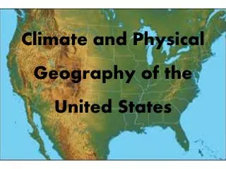
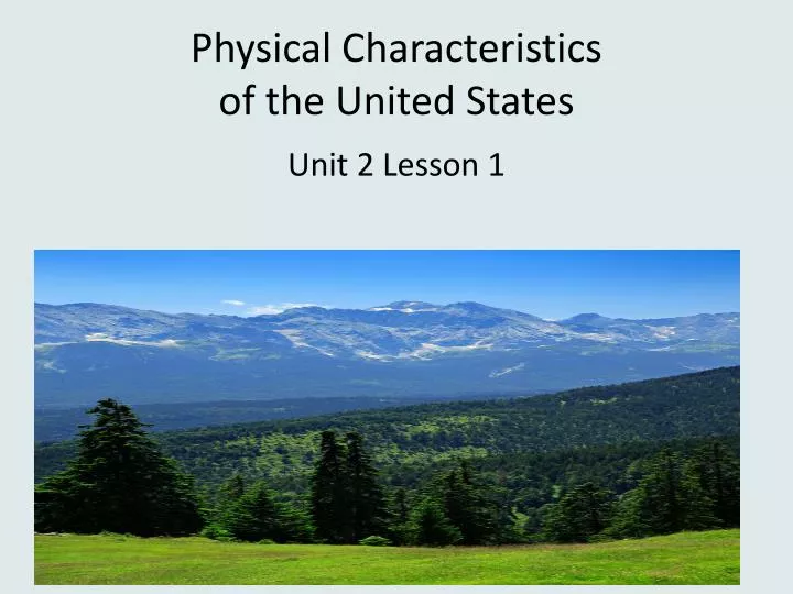
Physical Characteristics of the United States Unit 2 Lesson 1
Content Expectations 4 - G1.0.2: Use cardinal and intermediate directions to describe the relative location of significant places in the United States. 4 - G1.0.3: Identify and describe the characteristics and purposes (e.g., measure distance, determine relative location, classify a region) of a variety of geographic tools and technologies (e.g., globe, map, satellite image). 4 - G1.0.4: Use geographic tools and technologies, stories, songs, and pictures to answer geographic questions about the United States.
Graphic Organizer coastal plain plain mountain range plateau LAND valley basin canyon desert Physical Characteristics of the United States WATER ocean gulf lake river system
This Land is Your Land http://youtu.be/FeMLaQTwIgU
THIS LAND IS YOUR LAND Words and music by Woody Guthrie This land is your land, this land is my land From California, to the New York Island From the redwood forest, to the gulf stream waters This land was made for you and me As I was walking a ribbon of highway I saw above me an endless skyway I saw below me a golden valley This land was made for you and me
I've roamed and rambled and I've followed my footsteps To the sparkling sands of her diamond deserts And all around me a voice was sounding This land was made for you and me The sun comes shining as I was strolling The wheat fields waving and the dust clouds rolling The fog was lifting a voice come chanting This land was made for you and me
America the Beautiful • http://youtu.be/3Irf9bck5LQ
AMERICA THE BEAUTIFUL Words by Katharine Lee Bates O beautiful for spacious skies, For amber waves of grain, For purple mountain majesties Above the fruited plain! America! America! God shed his grace on thee And crown thy good with brotherhood From sea to shining sea!
O beautiful for pilgrim feet Whose stern impassioned stressA thoroughfare of freedom beat Across the wilderness! America! America! God mend thine every flaw, Confirm thy soul in self-control, Thy liberty in law!
O beautiful for heroes proved In liberating strife. Who more than self their country lovedAnd mercy more than life! America! America! May God thy gold refine Till all success be nobleness And every gain divine!
O beautiful for patriot dream That sees beyond the years Thine alabaster cities gleam Undimmed by human tears! America! America! God shed his grace on thee And crown thy good with brotherhood From sea to shining sea!
O beautiful for halcyon skies, For amber waves of grain, For purple mountain majesties Above the enameled plain! America! America! God shed his grace on thee Till souls wax fair as earth and air And music-hearted sea!
O beautiful for pilgrims feet, Whose stem impassioned stress A thoroughfare for freedom beat Across the wilderness! America! America! God shed his grace on thee Till paths be wrought through wilds of thought By pilgrim foot and knee!
O beautiful for glory-tale Of liberating strife When once and twice, for man's avail Men lavished precious life! America! America! God shed his grace on thee Till selfish gain no longer stain The banner of the free!
O beautiful for patriot dream That sees beyond the years Thine alabaster cities gleam Undimmed by human tears! America! America! God shed his grace on thee Till nobler men keep once again Thy whiter jubilee!
For more landforms, go to enchanted Learning Geography http://www.enchantedlearning.com/geography/landforms/glossary.shtml
Possible inferences may include: • The western part of the United States is very mountainous. • There is a large mountain range in the eastern part of the United States. • The central part of the United States is fairly flat. • There is a high area in the south central part of the U.S. • There is a large valley between the mountains in the west. • The coastline in the eastern part is very jagged in a lot of areas and has some large bays.
To see labeled landform map, go to the following site. http://www.worldatlas.com/webimage/countrys/usanewe.htm
PLATEAU MOUNTAINS MOUNTAINS HILLS MOUNTAINS INTERIOR PLAINS BASIN MOUNTAINS MOUNTAINS VALLEY MOUNTAINS PLATEAU COASTAL PLAIN PLATEAU COASTAL PLAIN
Go to Mr. Nussbaum’s Interactive Site http://www.mrnussbaum.com/stateimageindex.htm
To learn about the four deserts in the United States, go to the following site. http://desertusa.net/glossary.html Compare how the four deserts are alike and different.
Read the book Where the River Begins by Thomas Locker. What are physical characteristics of water –rivers, oceans lakes?
For a map of rivers and lakes http://www.nationalatlas.gov/printable/images/pdf/outline/rivers_lakes%28u%29.pdf
Locate Atlantic Ocean, Pacific Ocean, Arctic Ocean, Bering Sea, Gulf of Alaska and the Gulf of Mexico. These bodies of water all border the United States.
Using the same map, identify several inland lakes beginning with the Great Lakes. Also identify Lake Champlain, Lake Okeechobee, Lake Pontchartrain, Red Lake and Great Salt Lake.
Find any examples of inland seas. The Salton Sea in southern California is the largest lake in California . Death Valley is below sea level. This unique physical characteristic is actually part of the Colorado Desert ecosystem.
The United States has over 250,000 rivers which total around 3,500,000 miles. The Missouri River is the longest, but the biggest in terms of water volume is the deeper Mississippi River.
• Rivers provide food, drinking water, irrigation, transportation, electrical power, drainage, and recreation. • Rivers can erode the land and carry it downstream to the sea. This type of erosion can create canyons like the Grand Canyon and waterfalls like Niagara Falls. • A river system is made up of a river and its tributaries. A tributary is a stream or river that flows into a larger stream or river.
The Mississippi River system includes many tributaries such as the Missouri River, the Illinois River, and the Red River. • A drainage basin is the land drained by a river system. • The Mississippi River system drains most of the land between the Rocky Mountains and the Appalachian Mountains, about 40% of the U.S.
Student Resource Bates, Katherine. America the Beautiful. New York: Putnam Juvenile, 2003. Deserts in the United States. DesertUSA website. 7 October 2008 <http://desertusa.net/glossary.html>. Guthrie, Woody. This Land is Your Land. New York: Little, Brown Young Readers, 1998. Illustrated Glossary of Landforms and Bodies of Water. Enchanted Learning. 7 October 2008 <http://www.enchantedlearning.com/geography/landforms/glossary.shtml>. Interactive Landforms Map. 7 October 2008 <http://www.mrnussbaum.com/landforms.htm>. Landforms of the United States Map. World Atlas. 7 October 2008 <http://www.worldatlas.com/webimage/countrys/usanewe.htm>.
Landform Photos. 7 October 2008 <http://pics.tech4learning.com/?view=sub&cat=Geography>. Locker, Thomas. Home: A Journey Through America. New York: Voyager Books, 2000. Locker, Thomas. Where the River Begins. New York: Puffin Books, 1984. Physical Map of the United States. Eduplace.com. 7 October 2008 <http://www.eduplace.com/ss/maps/pdf/usphys.pdf>. Rivers and Lakes Map. National Atlas. 7 October 2008 <http://www.nationalatlas.gov/printable/images/pdf/outline/rivers_lakes.pdf>. U.S. Rivers Outline Map. Enchanted Learning. 7 October 2008 <http://www.enchantedlearning.com/usa/outlinemaps/rivers/>.
Teacher Resource Egbo, Carol. Supplemental Materials (Unit 2, Lesson 2).Teacher-made material. Michigan Citizenship Collaborative, 2008. Illustration of the Gulf Stream. 7 October 2008 <http://oceancurrents.rsmas.miami.edu/atlantic/img_mgsva/gulf-stream-YYY.gif>. Landforms of the United States - A Digital Shaded-Relief Portrayal. 7 October 2008 <http://pubs.usgs.gov/imap/i2206/usa_shade.pdf>. Rivers in North America. World Atlas. 7 October 2008 <http://www.worldatlas.com/webimage/countrys/nariv.htm>. The Salton Sea. National Geographic. 7 October 2008 <http://ngm.nationalgeographic.com/ngm/0502/feature5/index.html>.
The Salton Sea Coalition. 7 October 2008 <http://www.saltonseacoalition.org/pages/thesaltonsea.cgi>. Thomas Locker in Pursuit of Nature. 7 October 2008 <http://findarticles.com/p/articles/mi_qa3666/is_200103/ai_n8949704>. U.S. Rivers Labeled Outline Map. Enchanted Learning. 7 October 2008 <http://www.enchantedlearning.com/usa/outlinemaps/riverslabeled/>. Water Fact Sheet: Largest Rivers in the United States. U.S. Dept. of Interior. 7 October 2008 <http://pubs.usgs.gov/of/1987/ofr87-242/pdf/ofr87242.pdf>.