Download
1 / 32
340 likes | 358 Views
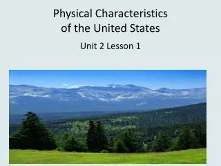
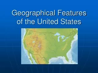
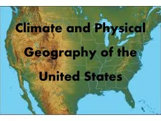
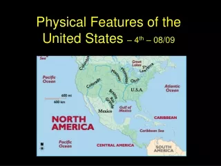
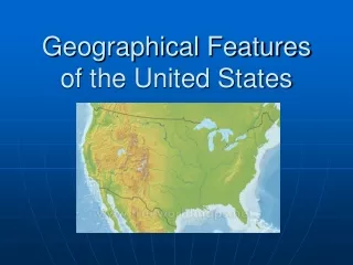
Physical Features of the United States. Geography. What Information can you gather from a map?. Where are some important physical features in the United States?. Physical features are natural landforms and bodies of water on Earth’s surface.

E N D
Physical Features of the United States Geography
Where are some important physical features in the United States? • Physical features are natural landforms and bodies of water on Earth’s surface. • Important land physical features in the United States include: • The Atlantic Coastal Plain • The Great Plains • The Continental Divide • The Great Basin • Death Valley
Lowland area borders the Atlantic Ocean in the Eastern part of the United States. Has many excellent harbors. Many people live in this region. The Atlantic Coastal Plain
The Great Plains • The Interior plains are a flat area in the middle of the United States. • The Great Plains are the western part of the interior plains. • The Great Plains are east of the Rocky Mountains. • The Great Plains consists of grasslands with no trees.
High peeks of the rocky mountains form an imaginary line called the backbone of North America. On the eastern side of the Continental Divide, rivers flow toward the Atlantic Ocean or the Gulf of Mexico. On the Western side of the Continental Divide, rivers flow toward the Pacific Ocean. The Continental Divide
This area is west of the Rocky Mountains and east of the Sierra Nevada and Cascade mountain ranges. You will find isolated mountain ranges as well as Death Valley – the lowest point in North America! The Great Basin
Death Valley The Lowest Point in North America!!
Practice Time! • Turn to Map Skill Builder on page 85 in your GA Experience Book. • Read the Directions and Complete the page on attached handout. • Turn to Enrichment page 86 in Your GA Experience Book and complete attached handout.
Where are some important physical features in the United States? • Physical features are natural landforms and bodies of water on Earth’s surface. • Important bodies of water in the United States include: • The Gulf of Mexico • The St. Lawrence River • The Great Lakes
This body of water is between the eastern coast of Mexico and the Western coast of Florida. It has warmer water than the Atlantic Ocean. The Gulf of Mexico
St. Lawrence River • This important river flows through northeastern Canada. • It is a major transportation route for large ships bringing goods into Canada and the United States.
These five lakes are located in the northern part of the United States between the U.S and Canada. They are the largest freshwater lakes in the world. The Great Lakes
Practice Time! • Turn to Map Skill Builder on page 87 and 88 in your GA Experience Book. • Read the Directions and Complete the page on attached handouts.
Where are some important man-made features in the U.S? • There are many things in the United States that have been created by man. • These man-made features include: • Cities • Structures like a canal or a dam. • Some major man-made features in the United States include: • New York City • Boston • Philadelphia • Erie Canal
New York City • This the largest city in the United States. • Located in New York State. • It is the world center of finance and business. • It is located on a large harbor that helped it to grow as a trade center.
Boston • This city is the capital of Massachusetts. • It is located on a harbor at the mouth of the Charles River. • It is the largest city in the New England region.
Philadelphia • This is the largest city in Pennsylvania. • It is known as the “birthplace of a the nation.” • Both the Declaration of Independence and the Constitution were written there. • \
The Erie Canal • This man-made waterway links lake Erie with the Hudson River in New York. • It was completed in 1825. • It allows goods to be transported easily along the Great Lakes and then further west. • It helped make New York City a major trade center.
Man Made FeaturesTrue or False? • New York City is the largest city in the United States. • New York City is not located on a harbor. • Boston is the capital of Massachusetts. • The largest city in the New England region is Providence, Rhode Island. • Philadelphia is the capital of Pennsylvania. • The Declaration of Independence was written in Philadelphia.
Practice Time! • Turn to Map Skill Builder on page 90 in your GA Experience Book. • Read the Directions and Complete the page on attached handout.