Download
1 / 12
120 likes | 241 Views
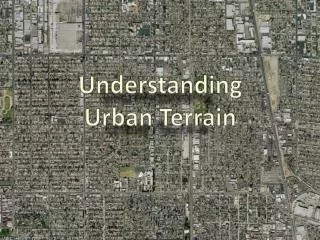
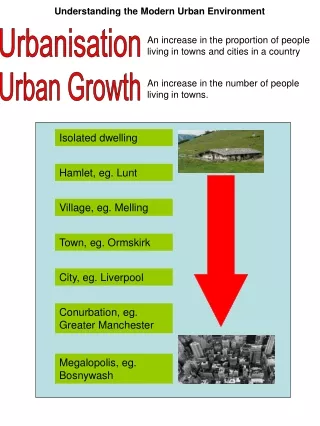
Understanding Urban Terrain. Six Fundamental Differences. Decentralized Control Communications are frequently restricted and intermittent Requires centralized planning and focus Presence of a civilian population Is always a factor Uneven ambient light Glaring lights and harsh shadows

E N D
Six Fundamental Differences Decentralized Control Communications are frequently restricted and intermittent Requires centralized planning and focus Presence of a civilian population Is always a factor Uneven ambient light Glaring lights and harsh shadows Many surfaces are highly reflective Night vision nearly impossible • Defensive Advantage • Defender enjoys cover and concealment • Avenues of approach are highly predictable • Three-Dimensional • Buildings are hollow and multi-story • Some buildings have intrinsic value • Vertical avenues of approach and escape • Short-range engagements • Typical engagement is less than seven yards • Targets are fleeting and line of sight is restricted
Understanding Urban TerrainPublic Land Survey System • Originated by Thomas Jefferson in 1785 • Includes private land that has been sold • >1.5 billion acres have been surveyed • Used to divide public lands into rectangles • Townships—6 square miles • Sections—1 square mile(640 acres) • Subdivisions—anything less than a section • Half section, quarter section, quarter-quarter section, etc. 1 Mile(640 Acres)
Understanding Urban TerrainCity Streets Range line • Conventions • Street numbers • Odd—north and west • Even—south and east • Base line • Central or Center • Main • Midway • Range line • Meridian • Principal 100N→ Base line ←100S ←100W 100E→ 200E→ ~1/8th Mile
Sociological Influences • Age • The 100 year old house is an anomaly. The "lifespan" for houses is ~73 years • 43+% have been built since 1970 and about 70% of the 110 million houses in the USA will be around at least another twenty years • Family • Size and idea offamily has impactedsize and construction • Societal shifts • Agriculture to industryto information • Crime, congestion, safety(reversed floor plans)
Technological Influences • Construction materials • Plywood, trusses, metal reinforcements, drywall, pre-hung doors, plastic pipes, zero clearance fireplaces, central air conditioning, manufactured housing • Accessories • Fiber optics, HD TV, intercoms, dishwashers, trash compactors, wireless internet, multiple phones, whole house audio, etc. • Multiple bathrooms and home office now common • Anti-intrusion systems • Floor plans changedto accommodate newtechnologies and life styles
Economical Influences • House is single most expensive lifetime investment • House representsperson's "worth" • Great Depression • Smaller houses,row houses andtract housing • Post World War II Boom • Converted row houses, large scale tracts, mass-produced housing • Similar, even identical floor plans • Today • Cottage industries, telecommuting, electronic access • Home offices now becoming a norm
Political Influences • Building Codes • First appeared in 1922 • Governs types of construction • Planning and Zoning Ordinances • Four major zones • Residential, industrial,commercial and agricultural • Divided still further into types of each • Results in clusters oftypes of buildings • Adjacent attributes oftenapply to target
Environmental Influences • Every house is a "mini-environment" (climate) • Conditioned air, water storage and drainage, protection from elements, etc. • Fire • Protection is paramount • Primary impetus for building codes • Water • Protection from precipitation • Protection from ground water • Water kept inside for drinkingwashing, eating, cooking, etc. • Wind • Affects building codes and design • Gravity • The ubiquitous force to which all buildings eventually succumb • Strongly influences construction and provides reliable clues for floor plans— especially weight over distance (span)
Single Story Multi-Story Front side is “1 Side” “Rear Five” “Front Five” Number System E 1 2 3 D 1 2 3 3 1 2 3 C 2 4 1 2 3 B 1 2 3 A 4 1 1 Left to RightBottom to Top Immediate Deployments
NAVIGATION • Cardinal Directions (most well known) • Awkward in city, compasses affected by magnetic fields and steel objects • Shift from a known point (common) • Uses prominent terrain features as steering marks • Requires prior knowledge or detailed directions • Grid System (MGRS, Thomas Guide and others) • Effective over distance but requires map and ineffective for micro-terrain • Numbering System (Common tactical “work around”) • Highly effective for micro-terrain, inappropriate for longer distances