Download
1 / 20
200 likes | 373 Views
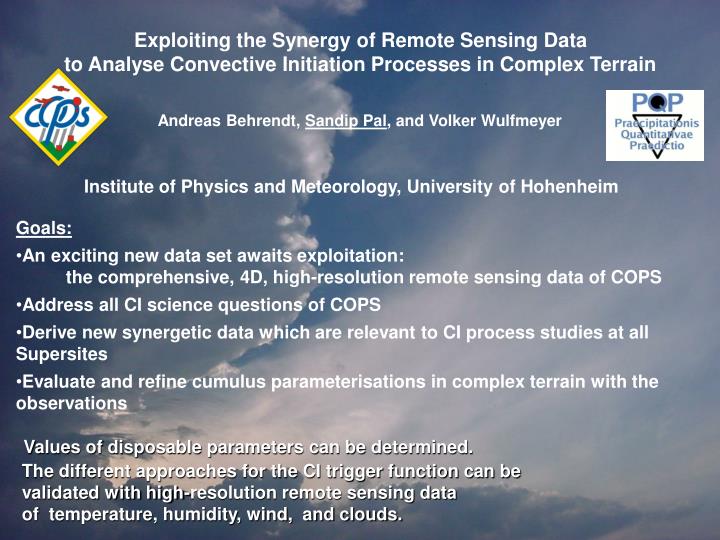
Exploiting the Synergy of Remote Sensing Data to Analy s e Convective Initiation Processes in Complex Terrain. Andreas Behrendt , Sandip Pal , and Volker Wulfmeyer. Institute of Physics and Meteorology, University of Hohenheim. Goals:

E N D
Exploiting the Synergy of Remote Sensing Data to Analyse Convective Initiation Processes in Complex Terrain Andreas Behrendt, Sandip Pal, and Volker Wulfmeyer Institute of Physics and Meteorology, University of Hohenheim • Goals: • An exciting new data set awaits exploitation: the comprehensive, 4D, high-resolution remote sensing data of COPS • Address all CI science questions of COPS • Derive new synergetic data which are relevant to CI process studies at all Supersites • Evaluate and refine cumulus parameterisations in complex terrain with the observations Values of disposable parameters can be determined. The different approaches for the CI trigger function can be validated with high-resolution remote sensing data of temperature, humidity, wind, and clouds.
WP1: Intercomparison of COPS water vapor data, derive bias and RMS errors WP2: Priority list of IOPs for CI case studies WP3: Apply higher-order corrections to water vapor lidar data in order to reach better than 5 % accuracy COPS IOP 13a/b, 1/2 August 2007 LEANDRE2 DLR DIAL UHOH DIAL Courtesy by C. Kiemle (DLR, Oberpfaffenhofen ) Courtesy by C. Flamant (CNRS, France)
Synergetic measurements of ABL key parameters, COPS IOP 9c 7a) 7b) 7c) CNR-MWR Water Vapor Mix. Rat. Courtesy by: F. Madonna and G. Pappalardo UHOH DIAL Water Vapor Mix. Rat. UHOH DIAL nad radiosonde Water Vapor Mix. Rat.intercomp. UHOH RRL: dӨ/dz UHOH RRL: Temp. L UHOH RRL: βpar, 355 nm UHOH DIAL and RRL: Rel. Hum. IMK Doppler lidar: Raw SNR and vertical velocity Courtesy by: Katja Traeumner. Andreas Wiesser, IMK, KIT WP4: Analyse the diurnal cycle of boundary layer variables and relate the result to QPF deficiencies Synergetic Measurements at COPS Supersites COPS IOP 9c, 20 July 2007
WP5: Investigate temperature lids in remote sensing data UHOH Rotational Raman Lidar WP6: Quantify gravity waves by remote sensing data COPS IOP 4a, 19 June 2007 Courtesy by Marcus Radlach (IPM, UHOH) bpar,355 dq/dz Raw data resolution: 3.75 m, 10 s Gliding average: Dt = 60 s, Dz = 150 m
WP7: Derive sensible and latent heat fluxes by collocated lidars at all Supersites WP8: Investigate the small scale heterogeneity of water vapor, temperature, wind, clouds, aerosols and their relation to CI WP9: Combine simultaneousscanningdataofwatervaporandtemperature: RH, q, qv, dq/dz, dqv/dz , buoyancy, CAPE, CIN w(t, z) q(t,z) w‘q‘ Lv Doppler Lidar, U. Karlsruhe/FZK WaterVapor DIAL, U. Hohenheim TARA Radar, TU Delft COPS IOP 8b, 15 July 2007 w, Courtesy by: Katja Traeumner (IMK, KIT) Resolution: 72 m, 1 s Gliding average: Dt =30 s
WP10: Employ clear-air echos of DOWs and POLDIRAD for CI DOW1 POLDIRAD Courtesy by Tammy Weckwerth (NCAR, USA) DOW1 CI at the “Neuried Boundary“ IOP 13b, 2 August
WP1: Intercomparison of COPS water vapor data, derive bias and RMS errors WP2: Priority list of IOPs for CI case studies WP3: Apply higher-order corrections to water vapor lidar data in order to reach better than 5 % accuracy WP4: Analyse the diurnal cycle of boundary layer variables and relate the result to QPF deficiencies WP5: Investigate temperature lids in remote sensing data WP6: Quantify gravity waves by remote sensing data WP7: Derive sensible and latent heat fluxes by collocated lidars at all Supersites WP8: Investigate the small scale heterogeneity of water vapor, temperature, wind, clouds, aerosols and their relation to CI WP9: Combine simultaneousscanningdataofwatervaporandtemperature: RH, q, qv, dq/dz, dqv/dz , buoyancy, CAPE, CIN WP10: Employ clear-air echos of DOWs and POLDIRAD for CI WP11: Detailed case studies of CI events and comparison with parameterization concepts WP12: Compare case study results with D-PHASE model simulations, COPS-GRID re-analyses, and hybrid convection schemes in cooperation with the respective projects
UHOH RRL LEANDRE2 Courtesy: M. Radlach (UHOH) DOWs Courtesy: P. Di Girolamo (Italy) BASIL DLR DIAL UHOH DIAL
R S H M V Supersite Instrumentation Lidars Cloud radars Precip. radars • FZK WTR • MICCY (scan.) • UV MRR • UV radiosondes • Ceilometer • UV AWS network • GFZ GPS receiver • FZK soil moisture Radiometers Radiosondes POLDIRAD Sodars • CNRS WV Raman lidar • CNRS TRESS = • Aerosol Raman Lidar • IR radiometer, sun ph., aerosol analysis • LaMP X-band (scanning) • LaMPK-band (vertical) • MFradiosondes • MF surf. flux stations (3) • MF soil moisture • MF UHF prof., sodar • GPS receiver • UHOH WV DIAL (scanning) • UHOH RR lidar (scanning) • FZK WindTracer (scanning) • FZK cloud radar (45° scan) • UHOH X-Band (vertical) • UHH MRR • TARA • UK radiosondes • CNR MW radiometer (scan.) • UK aerosol in-situ analysis • GFZ GPS receiver • FZK soil moisture • AMF: • RS, MWR, AERI,RWP,WACR, • aerosol in-situ analysis • Micropulse Lidar • IfT MWL • IfT WILI • HATPRO • 90/150 GHz • ADMIRARI (scanning) • UHH MRR • GFZ GPS receiver • FZK soil moisture • UNIBAS Raman lidar • UK Doppler lidar • UK wind profiler • UK MWR • UHH cloud radar • UK radiosondes • UK sodar • UHH MRR • GFZ GPS receiver • FZK soil moisture FZK • 2 mobile Doppler –On-Wheels • FZK RS station • FZK and UBT sodars (entrance of Murg and Kinzig V.) • UF sodar (entrance of Rench V.) • UK sodar (Murg Valley) „Burgundische Pforte“ • FZK RS station
Buoyancy, CAPE, and CIN • Combination of temperature and water vapor remote sensing allows continuous profiling of • the ambient curve • CIN and CAPE • lids, capping inversions dqv/dz B < 0 Level of Neutral Buoyancy (LNB) m/s2 = N/kg Buoyancy B > 0 Lifting Curve Height Ambient Curve Level of Free Convection (LFC) B < 0 Lifting Condensation Level (LCL) Temperature
Combination of primary data products of UHOH RRL and water-vapour DIAL COPS IOP 9c 20 July 2007
European Summer Experiments 2007 Domain oftheConvectiveandOrographically-inducedPrecipitation Study (COPS), World Weather Research Program (WWRP) Research and Development Project (RDP) Period: 1. 6. – 31. 8.2007 General ObservationsPeriod (GOP) Period: fullyearof 2007 Transport and Chemical Conversion in Convective Systems (COPS-TRACKS) Period: 16.7. – 2.8.2007 Atmospheric Radiation Measurement (ARM) Program Mobile Facility (AMF) Period: 1. 4. – 31. 12.2007 Demonstration of Probabilistic Hydrological and Atmospheric Simulation of flood Events in the Alpine region (D-PHASE), WWRP Forecast and Demonstration Project (FDP) Period: 1. 6. – 30. 11.2007 European THORPEX Regional Campaign 2007 (ETReC 2007) Period: 1.7. – 1.8.2007 EUMETSAT specialsatelliteoperationmodesanddata Period: 1. 6. – 31. 8.2007
R S H M V Lidars Ground-based at supersites: • UNIBAS Ramanlidar • UK Doppler lidar (scanning) R S • Ceilometer H M • IfT MWL • IfT WILI (scanning) • Micropulse Lidar V • CNRS WV Raman lidar • CNRS Aerosol Raman Lidar • UHOH WV DIAL (scanning) • UHOH RRLidar(scanning) • FZK WindTracer (scanning) 13 Lidars (platforms) with Airborne: 6 H2O Lidars 3 Temperature Lidars 4 Aerosol Raman Lidars 4 Doppler Lidars • WV DIAL • Doppler Lidar (scanning) • LEANDRE2
Messung mit dem neuen Wasserdampf-DIAL der U. Hohenheim und MM5-Vorhersage mit 2 km Gitterauflösung DIAL MM5