Download
1 / 18
180 likes | 286 Views
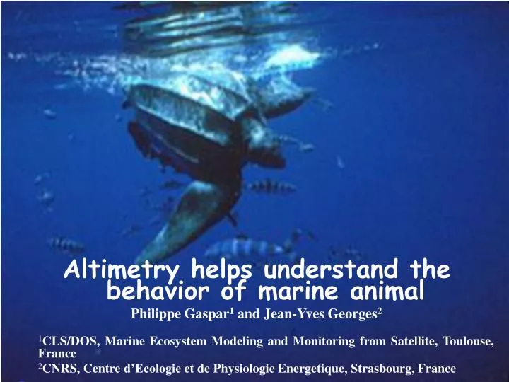
Altimetry helps understand the behavior of marine animal Philippe Gaspar 1 and Jean-Yves Georges 2 1 CLS/DOS, Marine Ecosystem Modeling and Monitoring from Satellite, Toulouse, France 2 CNRS, Centre d’Ecologie et de Physiologie Energetique, Strasbourg, France =.

E N D
Altimetry helps understand the behavior of marine animal Philippe Gaspar1 and Jean-Yves Georges2 1CLS/DOS, Marine Ecosystem Modeling and Monitoring from Satellite, Toulouse, France 2CNRS, Centre d’Ecologie et de Physiologie Energetique, Strasbourg, France =
THE FUTURE OF MARINE LIVING RESOURCES • Marine ecosystems are threathened by • Direct anthropogenic pressure (fisheries,…) • Climate change • Realistic population dynamics models are becoming indispensable to devise and analyze to impact of various rules (laws) established to • ensure sustainable exploitation of marine living resources • protect endangered species Such models cannot be developed without detailed observations of marine animals in the wild
BIOLOGGING : KEY OBSERVATIONS • Electronic tagging of individuals provides detailed observations of • the animal’s behaviour (movements,…..) • the environment in which he lives (depth, temperature…..) • The primary information provided by biologging is the animal’s trajectory (track) • Migration routes, habitats, energy budgets • Behaviour : migration/foraging • But tracks reflect • the actual motion of the animal (active swimming) • Passive drift due to currents
UNDERSTANDING THE IMPACT OF CURRENTS Effect of currents is generally neglected in track analyses. Is it really negligible ? • Study the impact of altimeter-derived currents on the trajectories of ARGOS-tracked leatherback turtles : • French Guiana and Suriname (1999-2002) : CNRS/CEPE (Ferraroli et al.,2004) • Grenada Island (2002-2003): U. Swansea (Hays et al., 2004) • 18 long post-nesting open ocean tracks. Focus here on the longest track • 295 days and 11 635 km in the North Atlantic
Tracking data Northern migration (N=11) Equatorial migration (N=7)
COMPUTING VELOCITIES (1/2) Take a time series of animal locations : X(to), X(t1), … X(tn) and derive the animal’s velocity on the ground (Vg): Vg = dX/dt ≈[X(ti) - X(ti-1)] / (ti - ti-1) For a marine animal : Velocity of the animal Velocity of the current Vg = Vs + Vc (1)
COMPUTING VELOCITIES (2/2) • Main issues : • Reduce location error • Resample at constant time intervals • Technical solution : • 1) Use all classes of Argos data with “mirror” positions fixed • 2) Eliminate fixes implying • Vg > 2.8 m/s (10 km/h) • 3) Smooth and resample the track at 3-hourly intervals using Local Linear Regression with a time window of 2 days.
SATELLITE-DERIVED CURRENT ESTIMATES • Vc varies in 3-D but ltb turtles mostly dive in the near-surface epipelagic zone (~ 80 % of the time above 100m), (near) surface current is a good approximation of Vc : Vgm : mean surface geostrophic current deduced from mean dynamic topography (Rio & Hernandez, 2004) Vga: anomaly of the surface geostrophic current directly derived from altimeter-derived SLA measurements Vek : near-surfacewind-driven ageostrophic component of the current deduced from scaterometer-derived wind speed measurements (Rio & Hernandez, 2003) OKexcept in the equatorial band ~ [3°N-3°S] and coastal areas Vc≈ Vgm + Vga + Vek
ZONAL VELOCITY Velocity on the ground Current velocity MERIDIONAL VELOCITY
Separating the current from the animal motion • Given an estimate of Vc, the velocity on the ground (Vg) is easily « corrected » for the current velocity to yield the true swimming velocity Vs(and hence the true speed and heading of the animal !) : • From there a current-corrected (cc) track can be computed • This cc-track is the trajectory the animal would have followed in a motionless ocean, swimming exactly the way he swam Vs = Vg - Vc
SWIMMING STRAIGHTER - SWIMMING LESS Straigther Less X [CD] : 2144 km [CD] : 1196 km • observed track • cc track
A STRONG COMPASS SENSE ! 1)Cc-tracks during migration legs tend to be straighter than observed tracks 2) Even in the presence of strong cross-currents turtles can maintain a steady swimming direction Strong compass sense ! …another example observed Current-corrected
TRAVELING OR FORAGING ? • Two main movement behaviors • Traveling~ long-ranged directed displacement • Foraging~ erratic motions • This movement characterization obviously concerns Vs not the combination Vs +Vg Movement analyses should be performed on cc-tracks ! • Does the currrent correction makes a significant difference ? • Analyse movement with a simple straigthness index S • S = (beeline distance between 2 points)/(actual length of the track between these 2 points) • S= 1 for straight motion ; S 0 for erratic motion
EFFECT OF CURRENTS ON STRAIGHTNESS INDEX Traveling Foraging -- S for actual track -- S for cc track S computed on 4-day long segments
Foraging areas based on observed or cc track Foraging areas deduced from cc-S values Foraging areas deduced from original S values
CONCLUSIONS • Ocean currents have a highly variable but rarely negligible impact on marine animals’ tracks ! • Correcting for their effect is now possible using new satellite-derived currents estimates • Current-correction : • Reveals unsuspected navigation skills (strong compass sense in strong currents , navigation strategies wrt currents) • Helps properly evaluate animal’s energy budgets • Helps properly position foraging areas/periods • Currents should be systematically taken into account (or at least properly evaluated) to warrant unbiased interpretation of pelagic animals’ tracks.
WHAT CAN WE LEARN FROM CC-TRACKS ? X • observed track • cc track