Download
1 / 25
250 likes | 361 Views
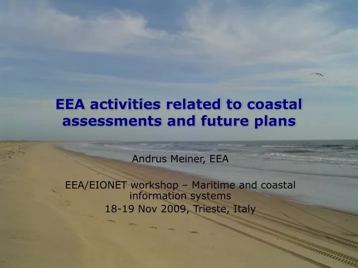
EEA activities related to coastal assessments and future plans. Andrus Meiner, EEA EEA/EIONET workshop – Maritime and coastal information systems 18-19 Nov 2009, Trieste, Italy. Aquaculture. Human dimension. Land based pollution. Tourism. Marine energy. Fisheries. Aggregate

E N D
EEA activities related to coastal assessments and future plans Andrus Meiner, EEA EEA/EIONET workshop – Maritime and coastal information systems 18-19 Nov 2009, Trieste, Italy
Aquaculture Human dimension Land based pollution Tourism Marine energy Fisheries Aggregate materials Maritime transport ICZM / Marine Spatial Planning Marine ecosystems Natura2000 at sea Marine Protected Areas Coastal Zone Catchments Off-shore area
Coastal system is part of a wider picture
Aggregation in meaningful way • Vision of marine and coastal ecosystems • towards ecosystem-based management approach • implementation of ICZM, including adaptation to climate change impacts • integrated monitoring and assessments • Vision of common maritime space • holistic management approach for all sea-related activities • information for maritime spatial planning
Integrated approach - assessment of coastal zones and maritime space • development and pollution pressures that impact coastal and marine areas; • services that are provided by ecosystems of the coastal and marine areas; • vulnerability to environmental change (incl. climate) and need for adaptation; • policy responses and maritime space management (e.g. ICZM and Maritime spatial planning).
development and pollution pressures that impact coastal and marine areas Changes in fishing fleet capacity - defined 1998-2007 (Source: EEA CSI034) Net land cover change within the 0-10 km coastal zone 2000-2006 (preliminary results based on 15 MS) Phosphate concentrations in European Seas, 2007 (Source: EEA CSI021)
services that are provided by ecosystems of the coastal and marine areas Source: EEA/ETC-BD, Habitats directive Art 17 data base
Location of seagrass in Europe Threats: • Eutrophication • Fishing • Turbid conditions • Coastal development
Awareness raising:Coastal services degraded as a result of development and resource use • Coastal ecosystems (land and sea) provide and sustain • Provisional services • fish, seabed resources, energy • Cultural and amenity services • tourism, recreation, heritage • Regulating and supporting services • shoreline stabilization, buffering from natural hazards, support water quality
Projected global average sea level rise (m) from 1990 to 2100 for the six SRES scenarios. Source: UNEP, 2007. vulnerability to environmental change (incl. climate) and need for adaptation + 1 m
Linking spatial data sets with spatially distributed modelling results PROJECTION: HadCM3 model; emissions scenario B2
policy responses and maritime space management (e.g. ICZM and Maritime spatial planning) • process-based indicators • i.e. indicators for monitoring the implementation of integrated policies and measures • outcome-based indicators • i.e. indicators for measuring the effectiveness of policy response actions
Analysis of policy effectiveness Request to EEA - provide information in conjunction with SoER reports focusing on: • What has been done? • Steps taken to implement responses e.g. ICZM progress indicators • Does it make a difference? • Evaluation of effectiveness of steps taken • Are we moving in the right direction? • Analysis on the progress to solve problems
IMP and MSFDMaritime policy and marine directive Marine Strategy Framework Directive: “The implementation of the MSFD is not a mere sectorial development unrelated to maritime economic activities. While it will help to define more accurately the boundaries of sustainability, this Directive has to be taken into account as really forming part of the Integrated Maritime Policy in the broad sense (and not a separate development which gives a "green" complement to ongoing efforts).” (Commission statement Rome, 18 May 2009)
MSFD requirements and linkages to Maritime Spatial Planning • Structured approach allows combining the process with MSP • Art. 5 and Art. 6 Duty of cooperation • Systematic process to elaborate 'marine strategies', culminating in the 'programme of measures'. • Programme of measures shall include spatial protection measures (Art. 13(4)) • Socio-economic considerations – in 'initial assessment', in 'programmes of measures', in 'exceptions' • Stakeholder consultation • 6-yearly review (& possible revision) of marine strategy elements
Integrated Maritime Policy Action plan 6th Environmental Action Plan Other EU policies (fisheries, energy transport, climate) Governance Marine Strategy Directive MSFD Maritime spatial planning Nature protection Marine Natura2000 Maritime / fisheries statistics Integrated assessment Water Framework Directive Maritime Research Strategy ICZM Recommendation Earth observation space/GMES Regional sea cooperation Territorial cohesion Research FP7 Context of policy areas relevant to coastal and marine environment
Boundary conditions for EEA assessment of coasts • Relevant to EU policies • European focus • Spatial assessment • Environment as entry point • Trend analysis • Contribution to conceptual development
Coastal regions of EU Sea basins Relative size of sea basin catchments Source: Eurostat, GISCO
Supporting formation of information systems • Support European MOnitoring and Data NETwork (EMODNET) formation and WISE-Marine • Interoperability of national coastal atlases • Spatial data infrastructure to support maritime spatial planning implementation • compliance with INSPIRE requirements • reference features, state of environment, operational monitoring and sea uses
Main objectives of work • Provide information of state of coastal environment, best management practices and policy responses (DPSIR) • Changes • What has been done • Provide follow up, using 2006 report as a baseline • Support State of the Environment and Outlook spin-off products • EU's ICZM strategy (2000/2010) and other relevant policies • Follow up 15 priority actions identified in the Executive summary of the 2006 report • Contribute to methodology for integrated spatial assessments (multi-scale nested approach for environmental accounting)
Towards a project planEEA multi-annual work programme for 2009-2013: integrated approach for coasts • EEA activities • AMP2010 work areas • Maritime (planning, concept, outline, coastal zone) • Marine (TCM waters, links to MSFD implementation) • others • ETC activities • IP2010 activities across four European Topic Centres • LUSI -> coastal land accounts, sustainable tourism, ICZM • Water -> transitional, coastal and marine waters, fisheries • Biodiversity -> coastal habitats, Natura2000 at coast & sea • Air and Climate Change -> coastal vulnerability, adaptation • EIONET activities • Support through relevant NRC networks (several)
Preliminary time table • 2010 Project plan and annotated outline, project data base established • 2011 Main implementation effort, incl analysis and drafting • 2012 Consultation (TBC), finalisation, editing, production, dissemination • Tentative publishing date Q4 2012 (±½ year)
Thank you! Contact: Andrus.Meiner@eea.europa.eu http://www.eea.europa.eu