Download
1 / 61
640 likes | 884 Views
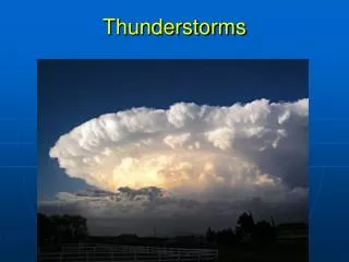
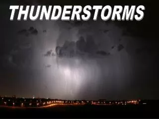
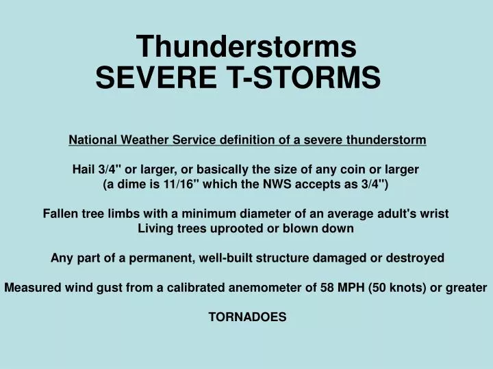
Thunderstorms. SEVERE T-STORMS. National Weather Service definition of a severe thunderstorm Hail 3/4" or larger, or basically the size of any coin or larger (a dime is 11/16" which the NWS accepts as 3/4") Fallen tree limbs with a minimum diameter of an average adult's wrist

E N D
Thunderstorms SEVERE T-STORMS National Weather Service definition of a severe thunderstorm Hail 3/4" or larger, or basically the size of any coin or larger (a dime is 11/16" which the NWS accepts as 3/4") Fallen tree limbs with a minimum diameter of an average adult's wrist Living trees uprooted or blown down Any part of a permanent, well-built structure damaged or destroyed Measured wind gust from a calibrated anemometer of 58 MPH (50 knots) or greater TORNADOES
SEVERE THUNDERSTORMS • TYPES: • SQUALL LINE THUNDERSTORMS • 2) MESOSCALE CONVECTIVE COMPLEX (MCC) • SUPERCELL THUNDERSTORMS • All three types last much longer than • ordinary thunderstorms. • All three types need warm air and other factors • in order to form.
SEVERE THUNDERSTORMS SQUALL LINE
SQUALL LINE THUNDERSTORMS *Develop ahead of cold fronts *Multi-cell storms *Often produce wind damage (DOWNBURSTS)
Squall Line Thunderstorms Cooler air Stratus clouds Snow, sleet, rain ahead of warm front L North, Northwest winds Cold air Clearing skies South, Southwest winds Warm air Clearing skies behind warm front Until cumulus clouds and thunderstorms ahead of the cold front
MCC *MCC must live more than 6 hrs *MCC high cloud cover must be larger than 18,000 square miles (size of CT, RI, MA) *MCC high cloud cover must be circular in shape Nebraska MCC moving Southeast, July 1997 – 7 hour difference between satellite images CIMMS, WISC U
MCC Rainfall due to Nebraska MCC moving Southeast, July 1997 CIMSS, WISC U
MCC Minnesota MCC moving Southeast, June 1994 NCDC
MCC The Great USA Flood of 1993 1993 Mississippi River, Grafton IL Flooding, USGS – the “500-year” flood
MCC The Great USA Flood of 1993 FLOOD OLD RECORD NEW RECORD (feet) DATE Quad Cities L/D15 22.5 650428 22.6 930709 Muscatine IA 24.8 650429 25.6 930709 Keithsburg IL 20.4 650427 24.2 930709 Burlington, IA 21.5 730425 25.1 930710 Keokuk L/D16 IA 23.4 730424 27.2 930710 Gregory Landing MO 24.6 730424 26.4 930707 Quincy IL 28.9 730423 32.2 930713 Hannibal MO 28.6 730425 31.8 930716 Louisiana MO 27.0 730424 28.4 930728 Clarksville MO L/D24 36.4 730424 37.7 930729 Winfield MO L/D25 36.8 730427 39.6 930801 Grafton IL 33.1 730428 38.2 930801 Melvin Price IL 36.7 730428 42.7 930801 St Louis MO 43.2 730428 49.6 930801 Chester IL 43.3 730430 49.7 930807 1993 Mississippi River Flooding, NOAA
SUPERCELL THUNDERSTORMS *Vertical Wind Shear *Two Downdrafts
SUPERCELL THUNDERSTORMS CRH NOAA
SUPERCELL THUNDERSTORMS overshooting tops over Brazil
SUPERCELL THUNDERSTORMS Chaseday.com
Tornados A rotating column of air
Tornado Facts Tornadoes occur in every state of the USA and in many countries around the world BUT TORNADO ALLEY IS THE PLACE IN THE WORLD TO SEE THEM NSSL
USA Tornado Tracks National Geographic Society
USA Tornados Miami Tornado – Salt Lake City Tornado CNN
The Fujita Scale http://www.spc.noaa.gov/faq/tornado/f-scale.html
Tornado Facts Tornadoproject.com
Tornado Facts NSSL
Tornado Damage NSSL
May 3, 1999 Oklahoma City Tornado Outbreak NWS Norman
May 3, 1999 Oklahoma City Tornado Outbreak Doppler Reflectivity & Velocity Loops: http://severewx.atmos.uiuc.edu/18/050399.reflectivity.html http://severewx.atmos.uiuc.edu/18/050399.velocity.html VIS & IR Satellite Loops: http://cimss.ssec.wisc.edu/goes/misc/990503.html