Download
1 / 60
630 likes | 872 Views
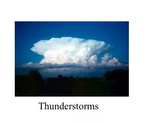
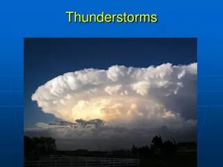
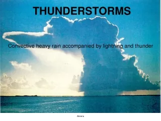
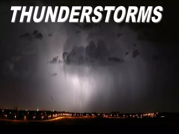
THUNDERSTORMS. Types of Thunderstorms Airmass or Ordinary Cell Thunderstorms Supercell / Severe Thunderstorms. Limited wind shear Often form along shallow boundaries of converging surface winds. Precipitation does not fall into the updraft Cluster of cells at various

E N D
Types of Thunderstorms • Airmass or Ordinary Cell Thunderstorms • Supercell / Severe Thunderstorms • Limited wind shear • Often form along shallow • boundaries of converging • surface winds • Precipitation does not fall • into the updraft • Cluster of cells at various • developmental stages due • to cold outflow undercutting • updraft
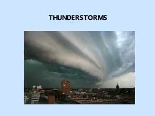
ORDINARY CELL THUNDERSTORMS • CUMULUS STAGE • Sun heats the land • Warm, humid air rises • Condensation point is • reached, producing a • cumulus cloud • Grows quickly (minutes) • because of the release of • latent heat • Updrafts suspend droplets • ‘Towering cumulus’ or • cumulus congestus
MATURE STAGE • Droplets large enough • to overcome resistance • of updrafts (rain/hail) • “Entrainment” • Drier air is drawn in • Air descends in • downdraft, due to • evaporative cooling • and falling rain/hail • Anvil head when stable • layer reached (cloud • follows horizontal wind) • Strongest stage, with • lightning and thunder
3. DISSIPATING STAGE • Updrafts weaken as gust front moves away from the storm • Downdrafts cut off the • storm’s “fuel supply” • Anvil head sometimes • remains afterward • Ordinary cell • thunderstorms may pass through all three stages in only 60 minutes
Review of Stages: Developing (cumulus), mature and dissipating
Thunderstorms • Typical conditions: • Conditional instability • Trigger Mechanism • (eg. front, sea-breeze front, mountains, • localized zones of excess surface heating, • shallow boundaries of converging surface • winds)
Thunderstorm Development • 1. Heating within boundary layer • Air trapped here due to stable layer aloft • increasing heat/moisture within boundary layer • (BL). • External trigger mechanism forces air parcels • to rise to the lifted condensation level (LCL) • Clouds form and temperature follows MALR • 3. Parcel may reach level of free convection • (LFC). Parcel accelerates under own buoyancy. • Warmer than surroundings - explosive updrafts • 4. Saturated parcel continues to rise until • stable layer is reached
CAPE Convective available potential energy (J/kg)
CAPE (J/kg) 0 Stable <1000 Marginally Unstable 1000-2500 Moderately Unstable 2500-3000 Very Unstable >3500 Extremely Unstable
The Severe Storm Environment • High surface dew point • Cold air aloft (increases conditional instability) • Shallow, statically-stable layer capping the • boundary layer • 4.Strong winds aloft (aids tornado development) • 5.Wind shear in low levels (allows for • long-lasting storms) • Dry air at mid-levels (increases downdraft • velocities)
Wind shear and vertical motions in a squall line thunderstorm
Supercell Thunderstorms • Defined by mid-level rotation (mesocyclone) • Highest vorticity near updraft core • Supercells form under the following conditions: • High CAPE, capping layer, cold air aloft, large • wind shear • Wind shear separates updraft from downdraft • so it can keep developing
Tornado Development • Pre-storm conditions: • Horizontal shaft of rotating air at altitude of • wind shift (generally S winds near surface • and W winds aloft) • 2. If capping is breached and violent • convection occurs, the rotating column is • tilted toward the vertical
Tornadogenesis • Mesocyclone 5-20 km wide develops • Vortex stretching: Lower portion of • mesocyclone narrows in strong updrafts • Wind speed increases here due to conservation • of angular momentum • Narrow funnel develops: visible due to adiabatic • cooling associated with pressure droppage
Tornado producing supercell [insert fig 11-29]
Multiple suction vortices greatly increase damage [insert fig 11-37]
Global tornado frequency [insert fig 11-32]
Waterspouts Similar to tornadoes Develop over warm waters Smaller and weaker than tornadoes
Distribution of lightning strikes [insert fig 11-23]
Lightning • Source of lightning: the cumulonimbus cloud • Collisions between ice crystals and graupel/hail surrounded • by supercooled water droplets cause clouds to become charged • Most of the base of the cumulonimbus cloud • becomes negatively charged – the rest becomes • positively charged (positive electric dipole) • Net transfer of positive ions from warmer object to • colder object (hailstone gets negatively charged & • fall toward bottom - ice crystals get + charge) • Result: positive charges well aloft, negative charges near the • cloud base
Development of cloud to ground Lightning (20% of cases) Charge separation Stepped leader approaches ground Positive charge surges upward from ground Spark surges up from ground