Download
1 / 58
850 likes | 1.39k Views
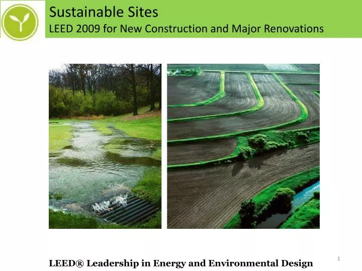
Sustainable Sites LEED 2009 for New Construction and Major Renovations. LEED® Leadership in Energy and Environmental Design. Sustainable Sites LEED 2009 for New Construction and Major Renovations. Overview : Selecting and Developing the Site Wisely

E N D
Sustainable Sites LEED 2009 for New Construction and Major Renovations LEED® Leadership in Energy and Environmental Design
Sustainable Sites LEED 2009 for New Construction and Major Renovations Overview: Selecting and Developing the Site Wisely Reducing Emissions Associated with Transportation Planting Sustainable Landscapes Protecting Surrounding Habitats Managing Stormwater Runoff Reducing the Heat Island Effect Eliminating Light Pollution
Sustainable Sites LEED 2009 for New Construction and Major Renovations
SS Prerequisite 1 Construction Activity Pollution Prevention NC: Required • Intent • To reduce pollution from construction activities by controlling soil erosion, waterway sedimentation and airborne dust generation. • Requirements • Create and implement an erosion and sedimentation control plan for all construction activities associated with the project. The plan must conform to the erosion and sedimentation requirements of the 2003 EPA Construction General Permit OR local standards and codes, whichever is more stringent. The plan must describe the measures implemented to accomplish the following objectives: • To prevent loss of soil during construction by stormwater runoff and/or wind erosion, including protecting topsoil by stockpiling for reuse. • To prevent sedimentation of storm sewers or receiving streams. • To prevent pollution of the air with dust and particulate matter. • The EPA’s construction general permit outlines the provisions necessary to comply with Phase I and Phase II of the National Pollutant Discharge Elimination System (NPDES) program. While the permit only applies to construction sites greater than 1 acre, the requirements are applied to all projects for the purposes of this prerequisite. Information on the EPA construction general permit is available at http://cfpub.epa.gov/npdes/stormwater/cgp.cfm.
SS Prerequisite 1 Construction Activity Pollution Prevention NC: Required Potential Technologies & Strategies Civil Engineer - Creates an ESC Plan during design phase Construction Manager – Implements the Plan BMPs – Best Management Practices Employ Strategies such as: StabilizationStructural Temporary Seeding Earth Dikes Permanent Seeding Silt Fencing Mulching Sediment Trap Sediment Basin
SS Credit 1 Site Selection NC: 1 point • Intent • To avoid the development of inappropriate sites and reduce the environmental impact from the location of a building on a site. • Requirements • Do not develop buildings, hardscape, roads or parking areas on portions of sites that meet any of the following criteria: • Prime farmland as defined by the U.S. Department of Agriculture in the United States Code of Federal Regulations, Title 7, Volume 6, Parts 400 to 699, Section 657.5 (citation 7CFR657.5). • Previously undeveloped land whose elevation is lower than 5 feet above the elevation of the 100-year flood as defined by the Federal Emergency Management Agency (FEMA). • Land specifically identified as habitat for any species on federal or state threatened or endangered lists • Land within 100 feet of any wetlands as defined by the U.S. Code of Federal Regulations 40 CFR, Parts 230-233 and Part 22, and isolated wetlands or areas of special concern identified by state or local rule, OR within setback distances from wetlands prescribed in state or local regulations, as defined by local or state rule or law, whichever is more stringent. • Previously undeveloped land that is within 50 feet of a water body, defined as seas, lakes, rivers, streams and tributaries that support or could support fish, recreation or industrial use, consistent with the terminology of the Clean Water Act. • Land that prior to acquisition for the project was public parkland, unless land of equal or greater value as parkland is accepted in trade by the public landowner (park authority projects are exempt).
SS Credit 1 Site Selection NC: 1 point Potential Technologies & Strategies During the site selection process, give preference to sites that do not include sensitive elements or restrictive land types. Select a suitable building location and design the building with a minimal footprint to minimize disruption of the environmentally sensitive areas identified above. Exempt Water Bodies: Small man-made ponds such as those used in stormwater retention, fire suppression, and recreation. Non-Exempt Water Bodies: Man-made wetlands and other water bodies created to restore natural habitats and ecological systems.
SS Credit 2 Development Density and Community Connectivity NC: 5 points Intent To channel development to urban areas with existing infrastructure, protect greenfields, and preserve habitat and natural resources. Requirements OPTION 1. Development Density Construct or renovate a building on a previously developed site AND in a community with a minimum density of 60,000 square feet per acre net. The density calculation is based on a typical two-story downtown development and must include the area of the project being built.
SS Credit 2 Development Density and Community Connectivity NC: 5 points • Requirements • OPTION 2. Community Connectivity • Construct or renovate a building on a site that meets the following criteria: • Is located on a previously developed site • Is within 1/2 mile of a residential area or neighborhood with an average density of 10 units per acre • Is within 1/2 mile of at least 10 basic services • Has pedestrian access between the building and the services • For mixed-use projects, no more than 1 service within the project boundary may be counted as 1 of the 10 basic services, provided it is open to the public. No more than 2 of the 10 services required may be anticipated (i.e., at least 8 must be existing and operational). In addition, the anticipated services must demonstrate that they will be operational in the locations indicated within 1 year of occupation of the applicant project.
SS Credit 2 Development Density and Community Connectivity NC: 5 points • Examples of basic services include the following: • Bank • Place of Worship • Convenience Grocery • Day Care Center • Cleaners • Fire Station • Beauty Salon • Hardware • Proximity is determined by drawing a 1/2-mile radius around a main building entrance on a site map and counting the services within that radius. • Potential Technologies & Strategies • During the site selection process, give preference to urban sites with pedestrian access to a variety of services. • Laundry • Library • Medical or Dental Office • Senior Care Facility • Park • Pharmacy • Post Office • Restaurant • School • Supermarket • Theater • Community Center • Fitness Center • Museum
SS Credit 3 Brownfield Redevelopment NC: 1 point Intent To rehabilitate damaged sites where development is complicated by environmental contamination and to reduce pressure on undeveloped land. Requirements OPTION 1 Develop on a site documented as contaminated (by means of an ASTM E1903-97 Phase II Environmental Site Assessment or a local voluntary cleanup program). OR OPTION 2 Develop on a site defined as a Brownfield by a local, state, or federal government agency. Potential Technologies & Strategies During the site selection process, give preference to Brownfield sites. Identify tax incentives and property cost savings. Coordinate site development plans with remediation activity, as appropriate.
SS Credit 3 Brownfield Redevelopment NC: 1 point A former landfill site is under consideration for a new low-cost housing development. For Sustainable Sites Credit, Brownfield Development, which remediation strategies are appropriate? (Choose three.) A. Solar detoxification B. Cap contaminants in place C. Treating contaminants on-site D. Hauling contaminated soil off-site E. Employing “Pump and Treat” method
SS Credit 3 Brownfield Redevelopment NC: 1 point A former landfill site is under consideration for a new low-cost housing development. For Sustainable Sites Credit, Brownfield Development, which remediation strategies are appropriate? (Choose three.) A. Solar detoxification B. Cap contaminants in place C. Treating contaminants on-site D. Hauling contaminated soil off-site E. Employing “Pump and Treat” method
SS Credit 4.1 Alternative Transportation – Public Transportation Access NC: 6 points Intent To reduce pollution and land development impacts from automobile use. Requirements OPTION 1. Rail Station, Bus Rapid Transit Station & Ferry Terminal Proximity Locate the project within 1/2-mile (800-meter) walking distance (measured from a main building entrance) of an existing or planned and funded commuter rail, light rail, subway station, bus rapid transit station or commuter ferry terminal. OR OPTION 2. Bus Stop Proximity Locate the project within 1/4-mile (400-meter) walking distance (measured from a main building entrance) of 1 or more stops for 2 or more public, campus, or private bus lines usable by building occupants. OR OPTION 3. Rideshare Proximity Projects outside the U.S. may locate the project within 1/4-mile (400-meter) walking distance (measured from a main building entrance) of 1 or more stops for 2 or more existing rideshare options that that meet the definition of public transportation and are authorized by the local transit authority if one exists.
SS Credit 4.1 Alternative Transportation – Public Transportation Access NC: 6 points Potential Technologies & Strategies Perform a transportation survey of future building occupants to identify transportation needs. Locate the building near mass transit. Bus rapid transit is an enhanced bus system that operates on exclusive bus lanes or other transit rights-of-way; it is designed to combine the flexibility of buses with the efficiency of rail. Rideshare is a transit service that involves sharing a single vehicle with multiple people, excluding large-scale vehicles such as buses and trains. The rideshare transit facility must include a signed stop and a clearly defined waiting area. Additionally, the rideshare must include an enclosed passenger seating area, fixed route service, fixed fare structure, continuous daily operation, and the ability to pick up and drop off multiple riders. Rideshare options must hold 4 or more passengers, except for human-powered conveyances which must hold 2 or more passengers. Public transportation consists of bus, rail, or other transit services for the general public that operate on a regular, continual basis. Exemplary Performance Option 1. Comprehensive Transportation Management Plan. The project team has instituted a comprehensive transportation management plan that demonstrates a quantifiable reduction in personal automobile use. Option 2. Double Transit Ridership. The project team has demonstrated quadruple the transit service requirements of the credit in order to achieve double transit ridership.
SS Credit 4.2 Alternative Transportation – Bicycle Storage and Changing Rooms NC: 1 point Intent To reduce pollution and land development impacts from automobile use. Requirements CASE 1. Commercial or Institutional Projects Provide secure bicycle racks and/or storage within 200 yards of a building entrance for 5% or more of all building users (measured at peak periods) Provide shower and changing facilities in the building, or within 200 yards of a building entrance, for 0.5% of fulltime equivalent (FTE) occupants. CASE 2. Residential Projects Provide covered storage facilities for securing bicycles for 15% or more of building occupants. Potential Technologies & Strategies Design the building with transportation amenities such as bicycle racks and shower/changing facilities.
SS Credit 4.3 Alternative Transportation – Low Emitting and Fuel Efficient Vehicles NC: 3 points Intent To reduce pollution and land development impacts from automobile use. Requirements OPTION 1 Provide preferred parking for low-emitting and fuel-efficient vehicles for 5% of the total vehicle parking capacity of the site. Providing a discounted parking rate is an acceptable substitute for preferred parking for low-emitting/fuel-efficient vehicles. To establish a meaningful incentive in all potential markets, the parking rate must be discounted at least 20%. The discounted rate must be available to all customers (i.e., not limited to the number of customers equal to 5% of the vehicle parking capacity), publicly posted at the entrance of the parking area and available for a minimum of 2 years. OR OPTION 2 Install alternative-fuel fueling stations for 3% of the total vehicle parking capacity of the site. Liquid or gaseous fueling facilities must be separately ventilated or located outdoors. OR OPTION 3 Provide low-emitting and fuel-efficient vehicles for 3% of full-time equivalent (FTE) occupants. Provide preferred parking for these vehicles. OR
SS Credit 4.3 Alternative Transportation – Low Emitting and Fuel Efficient Vehicles NC: 3 points • OPTION 4 • Provide building occupants access to a low-emitting or fuel-efficient vehicle-sharing program. The following requirements must be met: • One low-emitting or fuel-efficient vehicle must be provided per 3% of FTE occupants, assuming that 1 shared vehicle can carry 8 persons (i.e., 1 vehicle per 267 FTE occupants). For buildings with fewer than 267 FTE occupants, at least 1 low emitting or fuel-efficient vehicle must be provided. • A vehicle-sharing contract must be provided that has an agreement of at least 2 years. • The estimated number of customers served per vehicle must be supported by documentation. • A narrative explaining the vehicle-sharing program and its administration must be submitted. • Parking for low-emitting and fuel-efficient vehicles must be located in the nearest available spaces in the nearest available parking area. Provide a site plan or area map clearly highlighting the walking path from the parking area to the project site and noting the distance.
SS Credit 4.3 Alternative Transportation – Low Emitting and Fuel Efficient Vehicles NC: 3 points Potential Technologies & Strategies Provide transportation amenities such as alternative-fuel refueling stations. Consider sharing the costs and benefits of refueling stations with neighbors. For the purposes of this credit “preferred parking” refers to the parking spots that are closest to the main entrance of the project (exclusive of spaces designated for handicapped persons) or parking passes provided at a discounted price. To establish a meaningful incentive in all potential markets, the parking rate must be discounted at least 20%. The discounted rate must be available to all eligible customers (i.e. not limited to the number of customers equal to 5% of the vehicle parking capacity), publicly posted at the entrance of the parking area, and available for a minimum of 2 years. 2 For the purposes of this credit, low-emitting vehicles are defined as vehicles that are classified as Zero Emission Vehicles (ZEV) by the California Air Resources Board. Fuel-efficient vehicles are defined as vehicles that have achieved a minimum green score of 40 on the American Council for an Energy Efficient Economy (ACEEE) annual vehicle rating guide.
SS Credit 4.4 Alternative Transportation – Parking Capacity NC: 2 points Intent To reduce pollution and land development impacts from automobile use.
SS Credit 4.4 Alternative Transportation – Parking Capacity NC: 2 points Requirements CASE 1. Non-Residential Projects OPTION 1 Size parking capacity to meet but not exceed minimum local zoning requirements. Provide preferred parking for carpools or vanpools for 5% of the total parking spaces. OR OPTION 2 For projects that provide parking for less than 5% of full-time equivalent (FTE) building occupants: Provide preferred parking for carpools or vanpools, marked as such, for 5% of total parking spaces. OR OPTION 3 Provide no new parking. OR OPTION 4 For projects that have no minimum local zoning requirements, provide 25% fewer parking spaces than the applicable standard listed in the 2003 Institute of Transportation Engineers (ITE) “Parking Generation” study at http://www.ite.org.
SS Credit 4.4 Alternative Transportation – Parking Capacity NC: 2 points CASE 2. Residential Projects OPTION 1 Size parking capacity to meet but not exceed minimum local zoning requirements. Provide infrastructure and support programs to facilitate shared vehicle use such as carpool drop-off areas, designated parking for vanpools, car-share services, ride boards and shuttle services to mass transit. OR OPTION 2 Provide no new parking. CASE 3. Mixed Use (Residential with Commercial/Retail) Projects OPTION 1 Mixed-use buildings with less than 10% commercial area must be considered residential and adhere to the residential requirements in Case 2. For mixed-use buildings with more than 10% commercial area, the commercial space must adhere to non-residential requirements in Case 1 and the residential component must adhere to residential requirements in Case 2. OR OPTION 2 Provide no new parking.
SS Credit 4.4 Alternative Transportation – Parking Capacity NC: 2 points Potential Technologies & Strategies Minimize parking lot/garage size. Consider sharing parking facilities with adjacent buildings. Consider alternatives that will limit the use of single occupancy vehicles. 1 For the purposes of this credit “preferred parking” refers to the parking spots that are closest to the main entrance of the project (exclusive of spaces designated for handicapped persons) or parking passes provided at a discounted price. To establish a meaningful incentive in all potential markets, the parking rate must be discounted at least 20%. The discounted rate must be available to all eligible customers (i.e. not limited to the number of customers equal to 5% of the vehicle parking capacity), publicly posted at the entrance of the parking area, and available for a minimum of 2 years.
SS Credit 5.1 Site Development – Protect or Restore Habitat NC: 1 point • Intent • To conserve existing natural areas and restore damaged areas to provide habitat and promote biodiversity. • Requirements • CASE 1. Greenfield Sites • Limit all site disturbance to the following parameters: • 40 feet beyond the building perimeter; • 10 feet beyond surface walkways, patios, surface parking and utilities less than 12 inches in diameter; • 15 feet beyond primary roadway curbs and main utility branch trenches; • 25 feet beyond constructed areas with permeable surfaces (such as pervious paving areas, stormwater detention facilities and playing fields) that require additional staging areas to limit compaction in the constructed area. • CASE 2. Previously Developed Areas or Graded Sites • Restore or protect a minimum of 50% of the site (excluding the building footprint) or 20% of the total site area (including building footprint), whichever is greater, with native or adapted vegetation. Projects earning SS Credit 2: Development Density and Community Connectivity may include vegetated roof surface in this calculation if the plants are native or adapted, provide habitat, and promote biodiversity.
SS Credit 5.1 Site Development – Protect or Restore Habitat NC: 1 point Intent To conserve existing natural areas and restore damaged areas to provide habitat and promote biodiversity. Requirements CASE 2. Previously Developed Areas or Graded Sites Restore or protect a minimum of 50% of the site (excluding the building footprint) or 20% of the total site area (including building footprint), whichever is greater, with native or adapted vegetation. Projects earning SS Credit 2: Development Density and Community Connectivity may include vegetated roof surface in this calculation if the plants are native or adapted, provide habitat, and promote biodiversity. Projects with limited landscape opportunities may also donateoffsitelandinperpetuity, equal to 60% of the previously developed area (including the building footprint), to a land trust within the same EPA Level III Ecoregion identified for the project site. The land trust must adhere to the Land Trust Alliance ‘Land Trust Standards and Practices’ 2004 Revision.
SS Credit 5.1 Site Development – Protect or Restore Habitat NC: 1 point Potential Technologies & Strategies Survey greenfield sites to identify site elements and adopt a master plan for developing the project site. Carefully site the building to minimize disruption to existing ecosystems and design the building to minimize its footprint. Strategies include: Stacking the building program Tuck-under parking and sharing parking facilities with neighbors Establish clearly-marked construction boundaries to minimize disturbance of the existing site and restore previously degraded areas to their natural state. For previously developed sites, use local and regional governmental agencies, consultants, educational facilities and native plant societies as resources for the selection of appropriate native or adapted plants.
SS Credit 5.1 Site Development – Protect or Restore Habitat NC: 1 point Potential Technologies & Strategies Prohibit plants listed as invasive or noxious weed species. Once established, native/adapted plants require minimal or no irrigation; do not require active maintenance such as mowing or chemical inputs such as fertilizers, pesticides or herbicides; and provide habitat value and promote biodiversity through avoidance of monoculture plantings. Greenfield sites are those that are not previously developed or graded and remain in a natural state. For projects outside the U.S. only: For the compliance path described by Case 1, rural landscapes are considered the same as greenfield sites. A rural landscape is a natural area modified by agro-forestry-pastoral activities, with environmental, aesthetic, cultural and historical values resulting from the interrelationship between its physical and biological aspects and traditional human activities. Previously developed areas are those that previously contained buildings, roadways, parking lots or were graded or altered by direct human activities. 3 Native or adapted plants are plants indigenous to a locality or cultivars of native plants that are adapted to the local climate and are not considered invasive species or noxious weeds.
SS Credit 5.2 Site Development – Maximize Open Space NC: 1 point Intent To promote biodiversity by providing a high ratio of open space to development footprint. Requirements CASE 1. Sites with Local Zoning Open Space Requirements Reduce the development footprint and/or provide vegetated open space within the project boundary such that the amount of open space exceeds local zoning requirements by 25%. CASE 2. Sites with No Local Zoning Requirements (e.g. some university campuses, military bases) Provide a vegetated open space area adjacent to the building that is equal in area to the building footprint. CASE 3. Sites with Zoning Ordinances but No Open Space Requirements Provide vegetated open space equal to 20% of the project site area.
SS Credit 5.2 Site Development – Maximize Open Space NC: 1 point Requirements ALL CASES For projects in urban areas that earn SS Credit 2: Development Density and Community Connectivity, vegetated roof areas can contribute to credit compliance. For projects in urban areas that earn SS Credit 2: Development Density and Community Connectivity, pedestrian-oriented hardscape areas can contribute to credit compliance. For such projects, a minimum of 25% of the open space counted must be vegetated. Wetlands or naturally designed ponds may count as open space and the side slope gradients average 1:4 (vertical:horizontal) or less and are vegetated.
SS Credit 5.2 Site Development – Maximize Open Space NC: 1 point Potential Technologies & Strategies Perform a site survey to identify site elements and adopt a master plan for developing the project site. Select a suitable building location and design the building footprint to minimize site disruption. Strategies include stacking the building program, tuck-under parking and sharing parking facilities with neighbors to maximize the amount of open space on the site. 1 Development footprint is defined as the total area of the building footprint, hardscape, access roads and parking.
SS Credit 6.1 Stormwater Design – Quantity Control NC: 1 point Intent To limit disruption of natural hydrology by reducing impervious cover, increasing on-site infiltration, reducing or eliminating pollution from stormwater runoff and eliminating contaminants. Requirements OPTION 1. Design Storms CASE 1. Sites with Existing Imperviousness 50% or Less PATH 1 Implement a stormwater management plan that prevents the postdevelopment peak discharge rate and quantity from exceeding the predevelopment peak discharge rate and quantity for the 1- and 2-year 24-hour design storms. OR PATH 2 Implement a stormwater management plan that protects receiving stream channels from excessive erosion. The stormwatermanagement plan must include stream channel protection and quantity control strategies. CASE 2. Sites with Existing Imperviousness Greater Than 50% Implement a stormwater management plan that results in a 25% decrease in the volume of stormwaterrunoff from the 2-year 24-hour design storm. OR
SS Credit 6.1 Stormwater Design – Quantity Control NC: 1 point OPTION 2. Percentile Rainfall Events CASE 1. Non-Zero Lot Line Projects In a manner best replicating natural site hydrology processes, manage onsite the runoff from the developed site for the 95th percentile of regional or local rainfall events using Low Impact Development (LID) and green infrastructure. Use daily rainfall data and the methodology in the United States Environmental Protection Agency’s Technical Guidance on Implementing the Stormwater Runoff Requirements for Federal Projects under Section 438 of the Energy Independence and Security Act to determine the 95th percentile amount. OR CASE 2. Zero Lot Line Projects For zero lot line projects located in urban areas with a minimum density of 1.5 FAR (13,800 square meters per hectare net), in a manner best replicating natural site hydrology processes, manage onsite the runoff from the developed site for the 85th percentile of regional or local rainfall events using LID and green infrastructure. A zero lot line building is a freestanding building that abuts one side lot line of a zoning lot and does not abut any other building on an adjoining zoning lot.
SS Credit 6.1 Stormwater Design – Quantity Control NC: 1 point Potential Technologies & Strategies Design the project site to maintain natural stormwater flows by promoting infiltration. Specify vegetated roofs, pervious paving and other measures to minimize impervious surfaces. Reuse stormwater for non-potable uses such as: landscape irrigation, toilet and urinal flushing, and custodial uses.
SS Credit 6.1 Stormwater Design – Quantity Control NC: 1 point 1 Natural Site Hydrology is defined as the natural land cover function of water occurrence, distribution, movement, and balance. 2 Manage Onsite refers to capturing and retaining the specified volume of rainfall to mimic natural hydrologic function. This includes, but is not limited to, strategies that manage volume through evapotranspiration, infiltration, or capture and reuse. 3 Low Impact Development (LID) is defined as an approach to managing stormwater runoff that emphasizes on-site natural features to protect water quality by replicating the natural land cover hydrologic regime of watersheds and addressing runoff close to its source. Examples include better site design principles such as minimizing land disturbance, preserving vegetation, minimizing impervious cover, and design practices like rain gardens, vegetated swales and buffers, permeable pavement, rainwater harvesting, and soil amendments. These are engineered practices that may require specialized design assistance. 4 Green Infrastructure is a soil and vegetation-based approach to wet weather management that is cost-effective, sustainable, and environmentally friendly. Green infrastructure management approaches and technologies infiltrate, evapotranspire, capture and reuse stormwaterto maintain or restore natural hydrologies (US EPA).
SS Credit 6.2 Stormwater Design – Quality Control NC: 1 point • Intent • To limit disruption and pollution of natural water flows by managing stormwater runoff. • Requirements • Implement a stormwater management plan that reduces impervious cover, promotes infiltration and captures and treats the stormwater runoff from 90% of the average annual rainfall using acceptable best management practices (BMPs). • BMPs used to treat runoff must be capable of removing 80% of the average annual postdevelopment total suspended solids (TSS) load based on existing monitoring reports. BMPs are considered to meet these criteria if: • They are designed in accordance with standards and specifications from a state or local program that has adopted these performance standards, • OR • There exists infield performance monitoring data demonstrating compliance with the criteria. Data must conform to accepted protocol (e.g., Technology Acceptance Reciprocity Partnership [TARP], Washington State Department of Ecology) for BMP monitoring.
SS Credit 6.2 Stormwater Design – Quality Control NC: 1 point Potential Technologies & Strategies Use alternative surfaces (e.g., vegetated roofs, pervious pavement, grid pavers) and nonstructural techniques (e.g., rain gardens, vegetated swales, disconnection of imperviousness, rainwater recycling) to reduce imperviousness and promote infiltration and thereby reduce pollutant loadings. Use sustainable design strategies (e.g., low-impact development, environmentally sensitive design) to create integrated natural and mechanical treatment systems such as constructed wetlands, vegetated filters and open channels to treat stormwater runoff.
SS Credit 6.2 Stormwater Design – Quality Control NC: 1 point There are 3 distinct climates in the United States that influence the nature and amount of annual rainfall. Humid watersheds are defined as those that receive at least 40 inches (102 centimeters) of rainfall each year. Semiarid watersheds receive between 20 and 40 inches (51 and 102 centimeters) of rainfall per year, and arid watersheds receive less than 20 inches (51 centimeters) of rainfall per year. For this credit, 90% of the average annual rainfall is equivalent to treating the runoff from the following (based on climate): • Humid Watersheds — 1 inch (2.5 centimeters) of rainfall • Semiarid Watersheds — 0.75 inches (1.9 centimeters) of rainfall • Arid Watersheds — 0.5 inches (1.3 centimeters) of rainfall
SS Credit 7.1 Heat Island Effect - Nonroof NC: 1 point • Intent • To reduce heat islands to minimize impacts on microclimates and human and wildlife habitats. • Requirements • OPTION 1 • Use any combination of the following strategies for 50% of the site hardscape (including roads, sidewalks, courtyards and parking lots): • Provide shade from the existing tree canopy or within 5 years of landscape installation. Landscaping (trees) must be in place at the time of occupancy. • Provide shade from structures covered by solar panels that produce energy used to offset some nonrenewable resource use. • Provide shade from architectural devices or structures that have a solar reflectance index (SRI) of at least 29. • Use hardscape materials with an SRI of at least 29. • Use an open-grid pavement system (at least 50% pervious). • OR • OPTION 2 • Place a minimum of 50% of parking spaces under cover. Any roof used to shade or cover parking must have an SRI of at least 29, be a vegetated green roof or be covered by solar panels that produce energy used to offset some nonrenewable resource use.
SS Credit 7.1 Heat Island Effect - Nonroof NC: 1 point Potential Technologies & Strategies Employ strategies, materials and landscaping techniques that reduce the heat absorption of exterior materials. Use shade (calculated on June 21, noon solar time) from native or adapted trees and large shrubs, vegetated trellises or other exterior structures supporting vegetation. Consider using new coatings and integral colorants for asphalt to achieve light-colored surfaces instead of blacktop. Position photovoltaic cells to shade impervious surfaces. Consider replacing constructed surfaces (e.g., roof, roads, sidewalks, etc.) with vegetated surfaces such as vegetated roofs and open grid paving or specify high-albedo materials, such as concrete, to reduce heat absorption.
SS Credit 7.1 Heat Island Effect - Nonroof NC: 1 point Potential Technologies & Strategies 1 Heat islands are defined as thermal gradient differences between developed and undeveloped areas. 2 The solar reflectance index (SRI) is a measure of the constructed surface’s ability to reflect solar heat, as shown by a small temperature rise. It is defined so that a standard black surface (reflectance 0.05, emittance 0.90) is 0 and a standard white surface (reflectance 0.80, emittance0.90) is 100. To calculate the SRI for a given material, obtain the reflectance value and emittance value for the material. SRI is calculated according to ASTM E 1980. Reflectance is measured according to ASTM E 903, ASTM E 1918, or ASTM C 1549. Emittance is measured according to ASTM E 408 or ASTM C 1371. 3 For the purposes of this credit, under cover parking is defined as parking underground, under deck, under roof, or under a building.
SS Credit 7.2 Heat Island Effect - Roof NC: 1 point Intent To reduce heat islands to minimize impacts on microclimates and human and wildlife habitats. Requirements OPTION 1 Use roofing materials with a solar reflectance index (SRI) equal to or greater than the values in the table below for a minimum of 75% of the roof surface. Roofing materials having a lower SRI value than those listed below may be used if the weighted rooftop SRI average meets the following criteria:
SS Credit 7.2 Heat Island Effect - Roof NC: 1 point OR OPTION 2 Install a vegetated roof that covers at least 50% of the roof area. OR OPTION 3 Install high-albedo and vegetated roof surfaces that, in combination, meet the following criteria: Alternatively, a weighted average approach may be used to calculate compliance for multiple materials:
SS Credit 7.2 Heat Island Effect - Roof NC: 1 point Potential Technologies & Strategies Consider installing high-albedo and vegetated roofs to reduce heat absorption. Default values will be available in the LEED Reference Guide for Green Building Design and Construction, 2009 Edition. Product information is available from the Cool Roof Rating Council Web site at http://www.coolroofs.org/ and the ENERGY STAR® Web site at http://www.energystar.gov/. 1 Heat islands are defined as thermal gradient differences between developed and undeveloped areas. 2 The solar reflectance index (SRI) is a measure of the constructed surface’s ability to reflect solar heat, as shown by a small temperature rise. It is defined so that a standard black surface (reflectance 0.05, emittance 0.90) is 0 and a standard white surface (reflectance 0.80, emittance0.90) is 100. To calculate the SRI for a given material, obtain the reflectance value and emittance value for the material. SRI is calculated according to ASTM E 1980. Reflectance is measured according to ASTM E 903, ASTM E 1918 or ASTM C 1549. Emittance is measured according to ASTM E 408 or ASTM C 1371.
SS Credit 8 Light Pollution Reduction NC: 1 point Intent To minimize light trespass from the building and site, reduce sky-glow to increase night sky access, improve nighttime visibility through glare reduction and reduce development impact from lighting on nocturnal environments. Requirements Project teams must comply with 1 of the 2 options for interior lighting AND the requirement for exterior lighting. For Interior Lighting OPTION 1 Reduce the input power (by automatic device) of all nonemergency interior luminaires with a direct line of sight to any openings in the envelope (translucent or transparent) by at least 50% between 11 p.m. and 5 a.m. After-hours override may be provided by a manual or occupant-sensing device provided the override lasts no more than 30 minutes. OR OPTION 2 All openings in the envelope (translucent or transparent) with a direct line of sight to any nonemergency luminaires must have shielding (controlled/closed by automatic device for a resultant transmittance of less than 10% between 11 p.m. and 5 a.m.).
SS Credit 8 Light Pollution Reduction NC: 1 point For Exterior Lighting Light areas only as required for safety and comfort. Exterior lighting power densities shall not exceed those specified in ANSI/ASHRAE/IESNA Standard 90.1-2007 with Addenda 1 for the documented lighting zone. Justification shall be provided for the selected lighting zone. Lighting controls for all exterior lighting shall comply with section 9.4.1.3 of ANSI/ASHRAE/IESNA Standard 90.1- 2007, without amendments.
SS Credit 8 Light Pollution Reduction NC: 1 point Requirements Classify the project under 1 of the following zones, as defined in IESNA RP-33, and follow all the requirements for that zone: LZ1: Dark (developed areas within national parks, state parks, forest land and rural areas) Design exterior lighting so that all site and building-mounted luminaires produce a maximum initial illuminancevalue no greater than 0.01 horizontal and vertical footcandles (0.1 horizontal and vertical lux) at the LEED project boundary and beyond. Document that 0% of the total initial designed fixture lumens (sum total of all fixtures on site) are emitted at an angle of 90 degrees or higher from nadir (straight down). LZ2: Low (primarily residential zones, neighborhood business districts, light industrial areas with limited nighttime use and residential mixed-use areas) Design exterior lighting so that all site and building-mounted luminaires produce a maximum initial illuminancevalue no greater than 0.10 horizontal and vertical footcandles (1.0 horizontal and vertical lux) at the LEED project boundary and no greater than 0.01 horizontal footcandles (0.1 horizontal lux) 10 feet (3 meters) beyond the LEED project boundary. Document that no more than 2% of the total initial designed fixture lumens (sum total of all fixtures on site) are emitted at an angle of 90 degrees or higher from nadir (straight down). LZ3: Medium (all other areas not included in LZ1, LZ2 or LZ4, such as commercial/ industrial, and high-density residential) Design exterior lighting so that all site and building-mounted luminaires produce a maximum initial illuminancevalue no greater than 0.20 horizontal and vertical footcandles (2.0 horizontal and vertical lux) at the LEED project boundary and no greater than 0.01 horizontal footcandles (0.1 horizontal lux) 15 feet (4.5 meters) beyond the site. Document that no more than 5% of the total initial designed fixture lumens (sum total of all fixtures on site) are emitted at an angle of 90 degrees or higher from nadir (straight down). LZ4: High (high-activity commercial districts in major metropolitan areas) Design exterior lighting so that all site and building-mounted luminaires produce a maximum initial illuminancevalue no greater than 0.60 horizontal and vertical footcandles (6.5 horizontal and vertical lux) at the LEED project boundary and no greater than 0.01 horizontal footcandles (0.1 horizontal lux) 15 feet (4.5 meters) beyond the site. Document that no more than 10% of the total initial designed fixture lumens (sum total of all fixtures on site) are emitted at an angle of 90 degrees or higher from nadir (straight down).
SS Credit 8 Light Pollution Reduction NC: 1 point LZ2, LZ3 and LZ4 - For LEED project boundaries that abut public rights-of-way, light trespass requirements may be met relative to the curb line instead of the LEED project boundary. Potential Technologies & Strategies Adopt site lighting criteria to maintain safe light levels while avoiding off-site lighting and night sky pollution. Minimize site lighting where possible, and use computer software to model the site lighting. Technologies to reduce light pollution include full cutoff luminaires, low-reflectance surfaces and low-angle spotlights. The requirement to use ASHRAE Addenda I is unique to this credit and does not obligate Project teams to use ASHRAE approved addenda for other credits. To be LZ4, the area must be so designated by an organization with local jurisdiction, such as the local zoning authority.
Sustainable Sites LEED 2009 for Core & Shell Development
SS Credit 9 Tenant Design and Construction Guidelines CS: 1 point Intent To educate tenants about implementing sustainable design and construction features in their tenant improvement build-out. Tenant design and construction guidelines benefit the Core & Shell certified project in 2 important ways: First, the guidelines will help tenants design and build sustainable interiors and adopt green building practices; second, the guidelines will help in coordinating LEED 2009 for Commercial Interiors and LEED 2009 for Core and Shell Development certifications.
SS Credit 9 Tenant Design and Construction Guidelines CS: 1 point • Requirements • Publish an illustrated document that provides tenants with the following design and construction information: • A description of the sustainable design and construction features incorporated in the core & shell project and the project’s sustainability goals and objectives, including those for tenant spaces. • Informationon LEED for Commercial Interiors and how the core and shell building contributes to achieving these credits. • Information that enables a tenant to coordinate space design and construction with the core and shell’s building systems. Specific LEED 2009 for Commercial Interiors credits to be addressed when applicable include the following: • • Water use reduction. • • Optimize energy performance, lighting power. • • Optimize energy performance, lighting controls. • • Optimize energy performance, HVAC. • • Energy use and metering. • • Measurement and verification. • • Ventilation and outdoor air delivery. • Recommendations, including examples, for sustainable strategies, products, materials, and services. • Construction indoor air quality management. • Indoor chemical and pollutant source control. • Controllability of systems. • Thermal comfort. • Daylighting and views. • Commissioning. • Elimination or ctrl of ETS