Download
1 / 28
280 likes | 528 Views
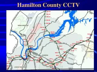
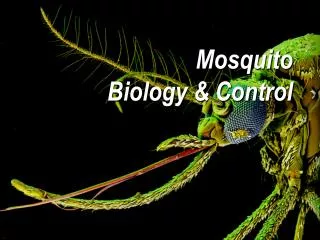
Mosquito Control and GIS – The Hamilton County Experience. Dan Walker, MPH March 8, 2006. Mosquito Control. Reason : Program initiated in response to West Nile Virus Purpose : To develop a program to prevent arbovirus disease transmission to the human population. Mosquito Life Cycle.

E N D
Mosquito Control and GIS – The Hamilton County Experience Dan Walker, MPH March 8, 2006
Mosquito Control • Reason: Program initiated in response to West Nile Virus • Purpose: To develop a program to prevent arbovirus disease transmission to the human population
Mosquito Life Cycle Adulticiding Larviciding
Locating Breeding Sites • Resident complaints • Aerial photography • Field work
No Stick Pins • GeoExplorer 3, GeoXT: collect data • GPS Pathfinder: process data • ArcView: analyze/manage data • POSSE: manage office/field workflow
Data Collection • Data related to the breeding site is entered into a workflow management software • Join is created in ArcMap to view details that were entered in software • Relate is created to view records from the breeding site
Adulticiding • Determine when to adulticide from monitoring and surveillance • Mosquitoes that test positive for WNV or SLE • Dead bird surveillance • Large trap collections of nuisance mosquitoes
Joe Seig – Hamilton County ISS Larry Stout – Hamilton County ISS Barry McNulty – H.C. Health Department Acknowledgements