Download
1 / 34
410 likes | 775 Views
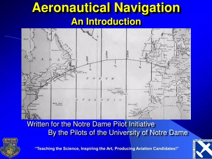
Aeronautical Navigation. An Introduction. Written for the Notre Dame Pilot Initiative By the Pilots of the University of Notre Dame. Quote. “For the execution of the voyage to the Indies, I did not make use of intelligence, mathematics or maps.” Christopher Columbus. Navigation .

E N D
Aeronautical Navigation An Introduction Written for the Notre Dame Pilot Initiative By the Pilots of the University of Notre Dame “Teaching the Science, Inspiring the Art, Producing Aviation Candidates!”
Quote “For the execution of the voyage to the Indies, I did not make use of intelligence, mathematics or maps.” Christopher Columbus
Navigation • Navis—ship • Agere—to direct
Roadmap • Terrestrial coordinates • Chart projections • Concepts of position • Piloting & dead reckoning • Radio navigation systems • Other electronic navigation systems • Celestial navigation
Terrestrial Coordinate System • Great Circles – The largest circle that can be drawn on the surface of the earth & all like it. • Equator • Meridians Equator Meridian Great Circle
Terrestrial Coordinate System • Small Circles-all other circles • Parallels
Longitude/Latitude • Parallels of latitude are small circles (with the exception of the equator) • Meridians of longitude are great circles
Desirable qualities of a chart projection: • Maintain true shape of physical features. • Maintain correct proportions of features relative to one another. • True scale, permitting accurate measurement of distance. • Rhumb lines plot as straight lines. • Great circles plot as straight lines. No chart has all of these!
Mercator vs. Gnomonic Mercator Projection Gnomonic Projection
Airways Follow Great Circles • V-12 from HAR to JST departs HAR westbound on a heading of 281, and departs JST eastbound on a heading of 096.
Navigational concepts • A circle has 360 degrees • A degree has 60 minutes • 1° of latitude is the same distance anywhere on the earth. • How many miles is one minute of latitude? • Ans. 1 min lat. = 1 nm = 2000 yds.
Where are we? • At the ROTC Building -point • On Juniper Road -LOP • ½ mile from Golden Dome -LOP(circle) • Near Meijer • Ambiguous(which one?) • Imprecise(how far?) • We will be there in 5 minutes • Answer to: when will we arrive there?
Line of Position (LOP) • A line that defines our position in 1-D • Not necessarily straight • Arc, circle, hyperbola, intersection of spheres • Need a second line to define a fix in 2-D • Need a third to be sure
Measurement Point Bearing Range 2 bearings 2 ranges Bearing & range Results Fix LOP LOP (arc) Fix Fix Fix Navigational Elements Aviation Example Over SBN GIJ 178°R GIJ 4.2 DME GSH 313°/GIJ 178° GSH 16.3/GIJ 4.2 GIJ 178°/4.2
How do we get there? • Plot a course • What’s a course? • path of intended motion • Steer a heading • What’s a heading? • the direction the aircraft is pointed • Make a good track • What’s a track? • the aircraft’s path over the ground
Course, Heading, & Track Big Bad Wind
Types of Navigation Systems • Pilotage • Dead Reckoning • Radio Navigation • ADF • VOR/DME/RNAV • Electronic Navigation • Loran • GPS • Inertial • Celestial
Basic VFR Navigation Techniques: • Pilotage • Sectional chart • Dead reckoning • (DEDuced reckoning) • Compass & watch
Nomenclature • True & magnetic courses are given in 3 digits, e.g. 090 • Relative bearings are given in degrees or clock position, e.g. 10º left of the nose, or 11 o’clock
N W E Big Bad Tower S Big Bad Mountain Dead Reckoning DEN 1300 DR 1200 DR 1100 DR 070 ° 1000 DR PHX 0900 DR 0800 Fix
Types of Navigation Systems • Pilotage • Dead Reckoning • Radio Navigation • ADF • VOR/DME/RNAV • Electronic Navigation • Loran • GPS • Inertial • Celestial
The Radio Compass • 1946 Stinson Voyager
The ADF, or Automatic Direction Finder, is the receiver in the aircraft The NDB, or Nondirectional Radio Beacon, is the transmitting antenna on the ground ADF/NDB • The ADF is the receiver of the NDB’s transmissions
NDB • The NDB is a ground-based radio transmitter that emits a signal in every direction • Benefits • Economic • Easy to maintain • Not line of sight • Errors • Susceptible to interference (T-Storms) • Bounces around coastlines
NDB • Operates on 190-535kHz • Range is 190-1750kHz • Types • HH – 2000+ watts; 75nm range • H – 50-1999 watts; 50nm range • MH – less than 50 watts; 25nm range • Compass Locator – less than 25 watts; 15 nm range
ADF • The ADF determines the bearing from the aircraft TO the station • Needle ALWAYS points to the station • Indicates relative bearing • Bearing, measured clockwise, from the nose of the aircraft TO the station • Card only indicates angle – has nothing to do with direction aircraft is pointed
ADF • Using relative bearing and magnetic heading, magnetic bearing can be found • Actual heading to fly to the station • MB = MH + RB
Homing the NDB • Homing • Flying the aircraft on any heading required to keep the needle pointed straight ahead (0° RB) • Works great without wind • Takes longer and not direct with wind
Tracking the NDB • Tracking – flying on a heading that maintains a constant, desired track to/from a station • Find heading/course that takes you to the station • Once off by 10°, double the deflection and turn towards station (head of the needle) • Once deflection equals correction, you are back on course • Turn 10° towards needle • Repeat as necessary and become more precise with correction
Intercepting the NDB • Parallel course • Note deflection • Double it • Turn towards needle • Once deflection equals correction, you are on course • Correct for wind (tracking) • NOTE: very similar to tracking
Types of ADFs • Fixed Card • Always shows 0° at the top • Moveable Card • Can show magnetic heading at top • Bad idea • RMI – Radio Magnetic Indicator • Slaved to move with aircraft • GREAT to have!
Types of ADFs Fixed Card Moveable Card RMI