Download
1 / 27
270 likes | 305 Views
This comprehensive manual covers data collection, computer-aided mapping, change over time analysis, GPS usage, Landsat imagery, and MultiSpec software. Learn mapping techniques, accuracy assessment protocols, and land cover sample site biometry.

E N D
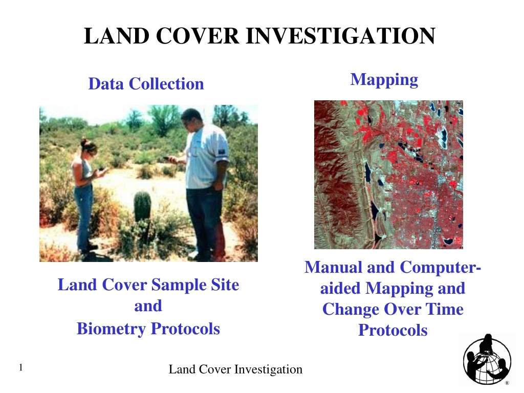
LAND COVER INVESTIGATION Mapping Data Collection Manual and Computer-aided Mapping and Change Over Time Protocols Land Cover Sample Site and Biometry Protocols
LAND COVER INVESTIGATION • Collect MANY Land Cover Sample Sites. • Map your GLOBE Study Site using the data and topographic maps, aerial photos, etc. with manual mapping or computer-aided mapping. • Carry out an accuracy assessment. • Analyze change in two images several years apart.
USING GPS IN A LAND COVER SAMPLE SITE We need to compare each Land Cover Sample Site on the ground to the corresponding area on the image. • If we take the average of 5 minutes of GPS readings, our position is accurate to about ± 5m. • It is impossible to determine the exact corner location of a single pixel on the ground. • By collecting GPS data in the center of the site, we know that within the positional accuracy of the imagery and ground, the center pixel is within the 90m x 90m Land Cover Sample.
LANDSAT IMAGE Using the Land Cover data entry pages, you can request your GLOBE Study Site image once you have reported 250 measurements and submitted the GPS coordinates of your school location.
MAPPING • Manual (Basic) • Computer-aided • satellite image (digital) • MultiSpec software • reference data, maps, aerial photos, etc.
MAP USES • studying the habitat of a certain animal or plant • looking at the succession of fields to forests • studying the rate of growth of a particular village, town or city • looking at the amount of undeveloped land • deciding how to protect water resources • deciding where to plant certain crops during the next growing season. • deciding new school boundaries • choosing where to connect recreational trails to create one continuous system • deciding how to efficiently run public transportation • studying another specific question
MULTISPEC • Free software for both Macintosh and PC computers. • Allows digital manipulation of LandSat images • zoom in/out • examine different band combinations • examine spectral properties of pixels/groups of pixels • perform “blue band correction” of images • Used to perform unsupervised clustering to create a computer-aided land cover type map
Site 1 1222 Site 6 Site 2 1121 Site 3 Site 8 92 1121 1121 Site 4 Site 5 92 Site 7 91 1222 ACCURACY ASSESSMENT After we collect many Land Cover Sample Sites throughout the GLOBE Study Site, perform an accuracy assessment on the land cover type map.
ACCURACY ASSESSMENT Using the Land Cover Sample Site data, complete the Accuracy Assessment Work Sheet.
ACCURACY ASSESSMENT Build an empty difference/error matrix. Label the matrix with the titles and MUC classes.
ACCURACY ASSESSMENT Tally each row of data.
ACCURACY ASSESSMENT • Calculate: • Row Totals • Column Totals • Total Data Samples
ACCURACY ASSESSMENT Overall Accuracy indicates how well the map identifies all land cover types on the ground.
ACCURACY ASSESSMENT Producer’s Accuracy indicates what percentage of the time a particular land cover type on the ground was identified as that land cover type on the map. It expresses how well the map producer identified a land cover type on the map from the satellite imagery data.
ACCURACY ASSESSMENT User’s Accuracy indicates what percentage of the time a particular land cover type on the map is really that land cover type on the ground. It expresses how well a person using the map will find that land cover type on the ground.
CHANGE OVER TIME • Comparing two images several years apart • two images , several years apart (digital) • these must be registered (images overlap exactly) to one another • if you do not have the capability (software) to do this, contact the Land Cover Team to find out how you can have this done for you • at least one completed land cover type map with accuracy assessment • MultiSpec • reference data, maps, aerial photos, etc.
CHANGE OVER TIME • Green may indicate an increase in urban type land covers • Magenta may indicate a decrease in urban type land covers