Download
1 / 2
20 likes | 211 Views
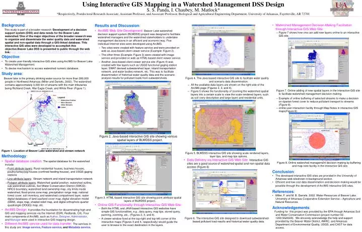
Active layer. Created buffer. Map Notes features. Selected feature. Save button. Using Interactive GIS Mapping in a Watershed Management DSS Design S. S. Panda, I. Chaubey, M. Matlock*

E N D
Active layer Created buffer Map Notes features Selectedfeature Save button Using Interactive GIS Mapping in a Watershed Management DSS Design S. S. Panda, I. Chaubey, M. Matlock* *Respectively, Postdoctoral Research Associate, Assistant Professor, and Associate Professor, Biological and Agricultural Engineering Department, University of Arkansas, Fayetteville, AR 72701