Download
1 / 76
820 likes | 1.44k Views
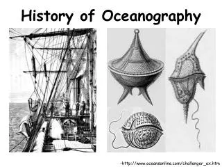
History of Oceanography. Why study historic oceanography? . Connected to the world’s overall history Commerce, warfare, resources, weather The oceans have shaped humanity’s past. Why study Oceanographic History?. Understand how and why people apply marine sciences today

E N D
Why study historic oceanography? • Connected to the world’s overall history • Commerce, warfare, resources, weather • The oceans have shaped humanity’s past
Why study Oceanographic History? • Understand how and why people apply marine sciences today • Oceanography’s history is about people, not just oceans and test tubes.
Branches of Oceanography • Physical Oceanography - study of the motions of seawater, particularly waves currents and tidal motion. • Chemical Oceanography - chemistry of seawater and reactions between the atmosphere and hydrosphere. More recently looks at how changes in seawater temperature (El Nino) and salinity affect global climate.
Branches of Oceanography • Biological Oceanography - study of life in the oceans, includes marine biology and ecology. • Geological Oceanography - study of the shape and geologic features of the ocean floor.
Ancient Uses and Explorations (5000 B.C. to 800 A.D.) • Not sure when ocean voyages actually began • Fish hooks and spears dated approximately 5000 B.C. • Paleolithic and Neolithic periods • Earliest humans: 1.6 million yr ago (mya) • Food gathering
Early Times: • Earliest recorded sea voyage – Egyptians about 3200 B.C. • Egyptians: • Offshore fishing • Exploration • Boat builders
Phoenician Explorations • Most important early Western seafarers • Motivated by trade, Phoenicians traveled incredible distances • Established first trade routes throughout the Mediterranean and as far north as Great Britain
Phoenician Navigation • Stayed within sight of land • Traveled at night – steered by observing constellations and the North Star (called the Phoenician Star in ancient world) • Had a Navy
Polynesian Exploration • Between 2000 and 500 B.C. • Often traveled thousands of kilometers across open ocean • Open canoes cut from tree trunks • Developed stick maps with ocean currents • Settled most of the islands in the Pacific Ocean hundreds of years before Europeans reached Pacific Ocean through observations of waves, cloud formations, stars
Polynesian Significance • Earliest known regular, long-distance, open-ocean seafaring beyond sight of land • Early celestial navigators (followed stars)
Greek Exploration • First who used mathematical principles and developed sophisticated maps for seafaring (used science & math) • Pytheas – Greek explorer, noted that he could predict tides in Atlantic based on phases of moon • He also measured angle between horizon and the North Star to determine position – improved navigation
Eratosthenes (264-194 B.C) • 2 major contributions that furthered Pytheas’ work: • Calculated Earth’s Circumference ~40,000 km • Invented first latitude/longitude system
Ptolemy (100-168 A.D.) • Created map of Earth that showed a portion of the Earth as a sphere on flat paper. • Produced first world atlas Improved longitude/latitude system • System still used today
Vikings (790 A.D. to 1100) • Vikings of Scandinavia were active explorers during The 9th century • Discovered Iceland and Greenland • Leif Eriksson – son of Eric The Red, set off in search of timber for Greenland Colony and discovered North America (Newfoundland, Canada)
Vikings: • Improvements in shipbuilding • Established trade and colonization through the North Atlantic
Arabs: • Description of currents associated with seasonal monsoons • Trade routes to China from the Persian Gulf • Preserved and improved Greek and Roman knowledge
China: • Development of the compass • Established trade routes to Persian Gulf
China: cont. • 7 epic voyages of Admiral Zheng He • Exploration of the western Pacific and Indian Oceans to east Africa • Short period of intense outreach to other cultures • Voyages ended and China turned inward
Chinese Exploration • The Chinese Ming Dynasty sent large convoys of ships out on missions in which seven voyages were made • There ships were more technologically advanced than anything in Europe, consisting of five masts and magnetic compasses and navigational charts • The Ming Dynasty reached as far as Africa
Prince Henry the navigator, (1420’s) • Founded the first school of navigation • Established a naval observatory • Trained other navigators and sailors
Christopher Columbus (1490’s) • Was attempting to find a west-ward route to India when he reached the Bahama Islands • Conducted 4 trans-Atlantic voyages to find a route to the east Indies
Ferdinand Magellan (1520) • Led the expedition that was the first successful circumnavigation of the Earth • Established the length of a degree of latitude and measured the circumference of Earth • Was killed in the Philippines (battled with the natives)
Sir Francis Drake (1570’s) • Followed Magellan and explored the western US coast as far north as the Canada border • Circumnavigated the globe
17th Century • The Beginning of Earth Science • Curiosity about Earth flourishes • Johannes Kepler • Described planetary motion • Galileo Galilei • Mass, weight, and acceleration • Isaac Newton • Principia and law of gravity
The Importance of Charts and Navigational Information • Enabled trade, travel, and exploration • Development of more accurate navigational charts and instruments • Relationship between time and longitude • John Harrison; first chronometer to keep accurate time at sea • First hydrographic offices to map the oceans established in France (1720) and Britain (1795)
The Importance of Charts and Navigational Information, continued • Voyages of James Cook • Used Harrison’s chronometer to update and correct navigational charts • Explored and charted the South Pacific, regions of Antarctic waters, east Australia and New Zealand, and sailed through the Bering Strait • European discoverer of Hawaii • Benjamin Franklin • Published a chart of Gulf Stream and helped establish a more rapid sailing route between the Europe and the US east coast • Compare Figures 1.10 and 1.11 • National and commercial interests • U.S. Survey of the Coast set up in 1807 by Thomas Jefferson (now known as the National Ocean Survey)
Cook’s Expedition(1768 – 1779) • Made 1st accurate maps of many regions in the ocean w/ new invention • Chronometer invented by John Harrison • Chronometer is a time piece capable of keeping accurate time aboard ship at sea
Ben Franklin and the Gulf Stream (1777) • Noted northerly routed ship from Europe took longer than ships that came by a longer more southerly route • Learned about gulf stream from nephew, who gave his uncle a chart • Franklin had the chart printed and distributed to the captains of mail ships. • They shortened their inbound voyages by avoiding the current and they shortened their outbound voyages by using the current.
18th Century • Previous exploration driven by military, trade, or conquest objectives • Royal Navy of Britain launched voyages with objectives of exploration, mapping and projecting British presence around the world
Ocean Science Begins • Botanists and naturalists go to sea • Collect, describe, and classify organisms • Investigations of microscopic drifting plants and animals (plankton) • Scientific interest based on practical reasons • Navigation, tide prediction, and safety • Importance of government support • Laying of transatlantic telegraph cables
Father of Oceanography… Matthew Maury • Matthew Maury, in charge of the Depot of Naval charts and instruments. • Organized first international meteorological conference to establish uniform methods • Published a summarized version of data in first Oceanographic textbook in 1855
Ocean Science Begins, continued • Charles Darwin serves as naturalist aboard the Beagle • Develops a theory of atoll formation • Charles Wyville Thompson publishes The Depths of the Sea (1873), now regarded as the first oceanography textbook • Thomas Henry Huxley investigates deep sea sediments for signs of primitive life to support Darwin’s theory of evolution
Darwin, Coral Reefs and Biological Evolution • From 1831 to 1836 a naturalist for the HMS Beagle circumnavigated the southern oceans and oceanic islands. • Darwin observed birds and other organisms on isolated islands, most of his research took place in the Galapagos Islands. • In 1859, his observations were published in the book “On the origin of Species”.
The Rosses, Edward Forbes, and life in the deep sea • John Ross took samples and animals in Baffin bay (Canada) Later James Ross took samples from Antarctic ocean bottom at 4.3 Miles • John Ross and James Ross found that there are some bottom dwelling creatures in Baffin Bay and Antarctic Ocean. They discovered that deep Atlantic is uniformly cold. • Forbes – Oceans divided into life-depth zones; concluded that ocean life decrease as depth increases. This contrasted with Rosses finings and created dispute for decades in Britain.
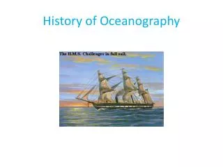
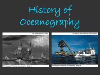
The Challenger Expedition • Comprehensive oceanographic expedition • Naval corvette refitted with laboratories, winches, and sounding scope • Circumnavigation • 361 sounding stations • Collected deep-sea water samples • Investigated deep-water motion • Temperature measurements at all depths • Thousands of biological and sea-bottom samples • Analysis and compilation of data continued for 20 years • Began oceanography as a modern science • Prestige stimulated expeditions by other nations
The Ocean as Laboratory : The Challenger Expedition (1872-1876) • The expedition covered 79,178 miles. • Directed by C. Wyville Thompson • 2 contributions: • Discovery and classification of 4,717 new marine species • Measurement of record water depth at the Mariana Trench of 26,847 feet.
Oceanography as Science • Transformation of oceanography • Descriptive science quantitative science • Hypothesis testing by gathering data • Theoretical models of ocean circulation • Fridtjof Nansen • Voyage of the Fram to reach the North Pole • Nansen bottle for deep water sampling • International scientific cooperation • Motivated by fluctuations in commercial fish • Advances in theoretical oceanography • Development of new instruments