Download

1 / 23
230 likes | 248 Views
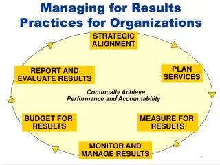
Explore scanning recommendations, georeferencing techniques, and mosaic dataset creation for efficient management and access to scanned maps and drawings. Learn to optimize and catalog imagery using geodatabase data models.

E N D
Best Practices for Managing Scanned Imagery Peter Becker
Objectives • Making Scanned Imagery Accessible • Topographic maps • Historic scanned maps • Navigation maps • Engineering drawings
Uses of Scanned Map Collections • An authoritative information source • Provides a record for land resource management • Forest plot perimeters • Wetlands • Agriculture • Glaciers • Land/water boundaries • Political boundaries • Historical analysis • Navigation • Adventure/exploration
Scanning - Recommendations • Scan resolution 400 – 600 dpi • 24bit rgb for color, 8bit for panchromatic • Non-rectified • Include Collars • No tinting • Use Unique Names Eg Name_Scale_Date_Version • Format • Should be Tiled. Eg Tiled TIF • Compression – Suggest LZW or JPEG (RGB) • Engineering drawings of as Grayscale or 1bit: LZW • Generate pyramids using Average/Bilinear sampling (JPEG compression OK) • Stats are optional
Georeferencing • Using ArcGIS for Desktop • Manually collect control points • More note below. (Use Update Georeferecing, Do Not Rectify) • Using Quad-G – From University of Wisconsin-Madison • Good for automated batch georeferencing • Use option to create AUX.XML and not rectify map Rectifying the map will reduce quality!
Define the Correct Projection and Datum • Check Coordinate system in which the map was printed • Not the projection of the Neatline (SheetCut) • Georeference in Map coordinate system • Maps are not printed in Geographic coordinates! • Lines of longitude and latitude are not straight! e.g. ` ` Sheet created in . The neatline is in geographic, but same NAD 1927 datum
Manual Georeferencing Notes: • Set Files to Read Only! (Else ArcMap will update) • Use “Update Georeferencing” • Will create file.AUX.XML • Defines: • Image and ground coordinates • Transformation type • Projection information • Can always improve later • Do Not use Rectify! • Optimization (faster but may not be so accurate) • Use Sheet Cut (in map projection) as control • Check residuals using 1st Order (affine) • Set to Projective Transformation
Metadata Table • Need Table with Metadata Fields • Can be CSV (but check field defintion when using Import Table) • Following Fields • Raster – Path and name of raster (tif) • MapScale – Eg 24000 for 1:24,000 • Map_Date – best of have some ‘date/time’ field • NameOnMap, Citation, …….. as required • If Geographic: Include map extent coords • N_Lat, S_Lat, W_Long, E_Long
Mosaic Dataset Optimum method to manage and serve collections of imagery • Geodatabase data model used to catalog, process, visualize and share your collections of imagery (rasters and lidar) data • References source • Defines metadata • Defines processing (including projection, clipping enhancement) • Provides dynamic mosaicking and on-the-fly processing • Used as a catalog and an image • Direct use in ArcGIS Desktop • Served as an image service
Creating Mosaic Dataset – Using Table Raster Type • Create Mosaic Dataset • Define Projection (of MosaicDataset not maps) • Add Rasters • Use Table Raster Type • Set Properties • Review and control Max_PixelSize
Defining the Order and Display Of Imagery • Display controlled by Scale and Mosaic Method (eg by Attribute, date) • Many methods to order imagery • Also controlled by MinPS and MaxPS • Image displayed if screen/request pixel size is between these values • Can set MinPS,MaxPS to any suitable value (do run Calculate Item Visibility if changed) • Mosaic Method is overridden by ZOrder. Lower ZOrder, higher priority • Eg set ZOrder = (Map_Scale *10000) – Start_Time results in larger scale and latest maps having higher priority
Neatline (SheetCut) What you want see
Neatline (SheetCut) What you want hidden (Normally)
Creating Neatline (SheetCut) • Manually • If Geographic: • Set Dataframe to Geographic with correct datum • Generate sheet cut (eg using Fishnet, table, …) using straight lines • Will get reprojected to Map coordinate system • If Projected • Set correct projection/datum • Automated • Use CreateEnvelopes (Download)
Defining Footprints • Image spatial search use footprints • Images get clipped to footprints • Use Import Mosaic Dataset Geometry • From neatline geometries • Now image will be clipped • Footprints can be edited Imagery will always be clipped to footprint Except if mosaic method is seamline, or clip to footprint is off
Using Seamlines to Clip Imagery • Imagery Clipped to Seamlines if exist and Mosaic Method is Seamline • Order of imagery then defined by SOrder • To Build Seamlines • Computation Method - Copy Footprint • Set SOrder = ZOrder • Set Default Mosaic Method to Seamline
Removing Footprint Clip • Change ‘Always Clip Raster to its Footprint’ to Off • Now will search by footprint, but not clip
Mosaic Dataset Properties • Footprints May Contain NoData – No • You don’t want transparent pixels • Default Compression – LZW • Mosaic Method - <Seamline>, Allow Lock Raster • Use Time – Yes • Set Start and End field • Check Geographic Coordinate System Transform Ensure required datums are defined
Publishing and Using Image Services • Standard Method to Publish Image Service • Use Image Services • ArcGIS Desktop • WebMaps • WebApps
Additional Tools and Resources • Image management workflows http://resources.arcgis.com/en/home/ Imagery Image management workflow • Automation - Mosaic Dataset Configuration Scripts • Learn.arcgis.com • Tool to generate Envelops will be put here
Thank you… • Please fill out the session survey in your mobile app • Select [Best Practices for Managing Scanned Imagery] in the Mobile App • Use the Search Feature to quickly find this title • Click “Technical Workshop Survey” • Answer a few short questions and enter any comments