Download
1 / 34
340 likes | 494 Views
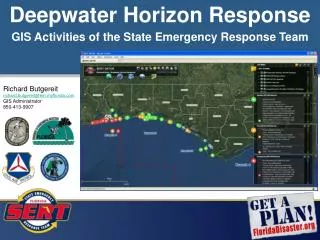
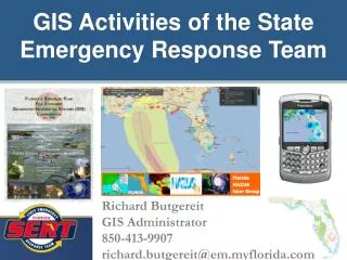
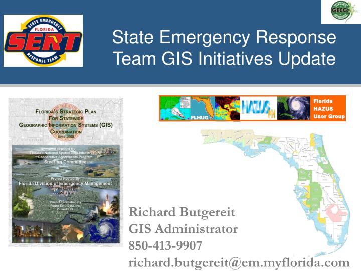
State Emergency Response Team GIS Initiatives Update. Richard Butgereit GIS Administrator 850-413-9907 richard.butgereit@em.myflorida.com. Some activities…. FDOT Unified Basemap Repository Coastal LiDAR/SLOSH Project HAZUS Data Web Portal USNG Map Books Statewide GIS Coordination E-Plan

E N D
State Emergency Response Team GIS Initiatives Update Richard Butgereit GIS Administrator 850-413-9907 richard.butgereit@em.myflorida.com
Some activities… • FDOT Unified Basemap Repository • Coastal LiDAR/SLOSH Project • HAZUS Data Web Portal • USNG Map Books • Statewide GIS Coordination • E-Plan • H1N1 Mapping • Post-event imagery
FDOt Unified Basemap Repository • FDOT has funded a statewide, enterprise license for government agencies • NAVTEQ roads now available for all levels of Florida government https://www3.dot.state.fl.us/unifiedbasemaprepository
LiDAR Status • FDEM – dark green • SWFWMD – light green • Counties - orange
What is HAZUS-MH? Tool that can identify hazard related risks, calculate potential losses to life and property, and help define effective ways to reduce losses Available from FEMA free of charge http://www.fema.gov/plan/prevent/hazus
Supported Hazards Hurricane Winds Riverine and Coastal Floods Earthquakes
Florida HAZUS Users Group • Promotes the use of HAZUS across the state • Builds on Florida’s regional approach to risk assessment and planning. • Effectively uses a committee structure to identify, develop and implement projects. • Florida HUG will continue to play a pivotal role in HAZUS training and data management in the state of Florida.
What is CDMS? • CDMS is a tool developed by FEMA to support integration of locally developed inventory data into the HAZUS-MH loss estimation process. • Primary functions • Support transfer of data into and out of the major master statewide databases • Provide validation of new data into the system • Allow users to query and print information within the system
What is CDMS? HAZUS-MHStatewide Databases Field mappingValidation Shapefiles ExcelWorksheetsMS Access DatabaseDelimitedTextGeodatabases Bndrygbs.mdb EF.mdb flAG.mdb CDMSRepository flVeh.mdb Hplf.mdb Msh.mdb Trn.mdb Util.mdb
Florida HAZUS User Group • flhug.hazus.org • www.usehazus.com/flhug • floridadisaster.org/gis • flhazusdata.com
The Strategic Plan • Grant funded project • October 2007 – April 2008 • 3 regional user conferences 520+ stakeholders engaged • 3 regional workshops 150+ participants • Stakeholder interviews from local, county, regional, state, federal, university, private • 158 stakeholder online survey
Programmatic Goals • Establish a formal framework for successful GIS coordination • Create Geospatial Programs Office headed by a GIS Coordinator • Create a Geographic Information Council • Empower Technical Advisory Committees
Partnerships “Building collaborative relationships and governance…ensures that the state plan effectively becomes a statewide plan that is relevant to the needs and incentives of local government as well as state government. Through this approach, state government will derive greater value from its geospatial knowledge base…” Source: NASCIO 2008, page 16
Broadband Mapping under the ARRA • American Recovery and Reinvestment Act • Broadband internet access mapping/needs assessment/adoption • Heavily reliant upon GIS and mapping • Grant opportunity for mapping/needs assessment/prioritization • Strategic Planning component available for states
USNG Map Books • County-wide map books • Soon to make available county-specific MXD’s with pre-fabricated map books
Hazardous Material Facilities For first responders User names/password provided through Local Emergency Planning Committee https://erplan.net E-Plan
Florida Department of Health Weekly county activity maps Survey H1N1 Mapping
FDEM publishing post-event imagery via ArcGIS server – ArcGIS services and KML http://map.floridadisaster.org/ArcGIS/rest/services/Events Post-event Imagery
USGS publishing post-event imagery via WMS services and distributing through the Hazards Data Distribution System -- http://hdds.usgs.gov/hdds Post-event Imagery
floridadisaster.org/gis map.floridadisaster.org Richard Butgereit, GIS Administrator richard.butgereit@em.myflorida.com 850-413-9907 Erika Pittman, GIS Analyst erika.pittman@em.myflorida.com 850-413-9906 EOC-GIS@em.myflorida.com Florida Division of Emergency Management