Download
1 / 10
110 likes | 272 Views
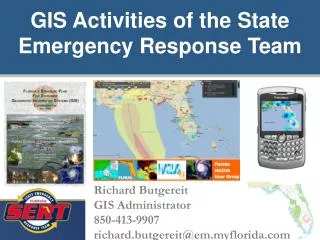
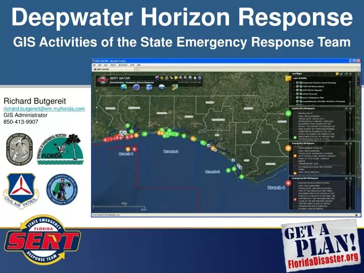
Deepwater Horizon Response. GIS Activities of the State Emergency Response Team. Richard Butgereit r ichard.butgereit@em.myflorida.com GIS Administrator 850-413-9907. Viewing data from ESI and GRP maps in GATOR.

E N D
Deepwater Horizon Response GIS Activities of the State Emergency Response Team Richard Butgereit richard.butgereit@em.myflorida.com GIS Administrator 850-413-9907
Viewing data from ESI and GRP maps in GATOR • In the screen capture below, ESI Shoreline Characterization may be seen, as well as several “3 diamond” locations near Pensacola Pass. • Note that Booming Operations are also available via GATOR, indicating proposed and completed booming. This data will be updated as information is provided. • A map grid for ESI and GRP maps is also visible.
GATOR and the Deepwater Horizon Response
RECON reports in GATOR Total number of Recon Reports submitted: 8349
GATOR and the Deepwater Horizon Response