Download
1 / 33
330 likes | 457 Views
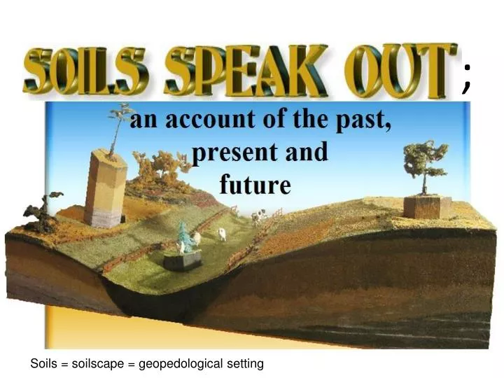
;. Soils = soilscape = geopedological setting. OUTLINE. INTRODUCTION THEORETICAL BACKGROUND AND ILLUSTRATIVE EXAMPLES CONCLUSION. INTRODUCTION: Soil definition.

E N D
; Soils = soilscape = geopedological setting
OUTLINE • INTRODUCTION • THEORETICAL BACKGROUND AND ILLUSTRATIVE EXAMPLES • CONCLUSION
INTRODUCTION: Soil definition • “A natural body consisting of layers (or horizons) of mineral (and/or organic constituents) of variable thickness, which differ from the parent material in their morphological, physical, chemical, and mineralogical properties and their biological characteristics” S = f (Cl, O, R, P, T,……M)
Definition :A soil = “pedon” is the smallest volume with a surface extent which varies from about 1 to 10 m²” Soil sample Pedons/ polypedons in ‘soilscape’
Definition:Pedon / polypedon • For mapping purposes, similar pedons are pooled together, forming a polypedon, obviously associated with variability, depending on scale
Functions:What does soil do? 1- Soil provides the required setting for water, nutrient, air, and heat exchange for living organisms.2- Soil controls the water distribution;affects the movement of soluble materials. 3- Soil regulates biological activity and molecular exchanges among solid, liquid, and gaseous phases. 4- Soil acts as a filter to protect the quality of water, air, and other resources.
What does soil do? 5- Soil provides mechanical support for living organisms and their structures. People and wildlifedependonthisfunction. 6- Soils act:- as an archive (=history book of the landscape), - as a guide, and - as a ‘predictor’
THEORETICAL BACKGROUND AND ILLUSTRATIVE EXAMPLES Soils speak out; an account of the past, present, and future
An account of the past, present, and future Past Paleoecology Present Soil Management Future Soil Degradation/ Conservation
Past: Paleoecology
History book of the landscape (archive) • Examples of features revealing paleoecology: • Pedogenic (horizons): * Anthropic, * Plaggen, etc • * Argillic, *Agric, etc • 2. Geomorphic (features):* Glacis formation:Tunisia, Morocco * Travertine (karstic): Iran
2. Geomorphic; glacis formation2.1 Tunisian example: Pedimentation/ planation : in practice, erosional glacis – adjacent to the mountain front— is followed by an accumulation glacis. A fan distinguishes itself from the glacis by being associated with a distributary (dichotomic) drainage pattern .
2. Geomorphic; glacis formation 2.2 Moroccan example Erosional glacis terraces Accumulation glacis
2. Geomorphic; glacis formation2.3 Iranian example Stereogram depicting glacis Pedostratigraphy (approving)
2. Geomorphic featuresKarstic springs; Travertine Karst spring (dried out) Travertine in scattered patches
Iran: • A wetter climate, karstic springs where travertine is spread out; • Once upon a time (27000 yr BP-13000 yr BP) the study area was subject to cycles of erosion and sedimention, also approved by the occurrence of Argillic and Petrocalcic horizon ; • Aridification has never been as degrading as it is today • Morocco: • Occurrence of Ultisols and Plinthite implies a wetter and hotter climatic condition • Different vegetation cover
Present: Soil- management
Present: Soil Management Guiding features: *Soil properties (Physico-chemical): particle size class, depth, pH,…… *Position in landscape (Site)
When well managed Traditional wooden device for plowing; pulled by oxen
Future:Prediction”A soil survey describes the characteristics of the soils in a given area, classifies the soils according to a standard system of classification, plots the boundaries of the soils on a map, and makes predictions about the behavior of soils.”(SSM, 1993)
Future: Predictionregarding (possible) land degradation • Guiding features: • Pedon (individual soil body) • Diagnostic soil characteristics- Abrupt textural change • - COLE (coefficient of Linear Extensibility)- (Para-) Lithic contact,……..
Change of erosion base-level: gully formation and landslide Bushes hold soils together Landslide Landslide Gully running perpendicular It is clearly seen that the gully in the bottom of the vale (fig c) is triggering; landslide has occurred once the slope has been de-bushed (cleared) The gully Fig. c
Gullies formed Bush land Cereals Boundary between 2 soil series Gully Gully Ploughed for Vine tree plantation
Incision (gully) occurs in a joint, the weakest line between two pedons
CONCLUSION: If you want to conserve the environment Listen to what soils say Prevention is better than cure
Is check-dam solving the problem?! Water goes like this; neglecting the dam Check-dam does not help Slump Second trial The first check dam
Buol, S.W., Hole, F.D., and R.J. McCracken. 1973. Soil Genesis and Classification. The Iowa State University Press, Ames. Farshad, A. 2006. Introduction to Applied Geomorphology for Soil Scientists (Geopedologists). Lecture-notes, Department of Earth System Analysis (ESA), ITC, Enschede, The Netherlands. Rferences Rosa M.Poch (editor- in- Chief) and Kovda, Irnia and Curtis Monger (Guest editors). 2013.1st volume of the proceedings of the 14th IWMSM. Departament de Medi Ambient i Ciències del Sòl Universitat de Lleida Av. Rovira Roure 191, 25198 Lleida (Catalonia) USDA, 1975. Soil Taxonomy, A Basic System of Soil Classification for Making Interpreting Soil Surveys. Soil Survey Staff. Agricultural Handbook No. 436. Zinck, G.A. 1988/89. Physiography and soils; soil survey courses (Lecture-notes) , ITC, Enschede, The Netherlands.