Download
1 / 65
700 likes | 1.07k Views
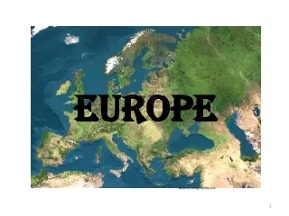
INDUSTRIAL REVOLUTION. AGE OF EXPLORATION. Europe. RENAISSANCE. ROMANS AND GREEKS. Birthplace of religions. Largest continent. asia. population. Harappan and mesopotamian. Few quick flicks about Europe. Europe is the second smallest continent. Total area is 10 million sq.km .

E N D
INDUSTRIAL REVOLUTION AGE OF EXPLORATION Europe RENAISSANCE ROMANS AND GREEKS Vikas Patil 2010-11
Birthplace of religions Largest continent asia population Harappan and mesopotamian Vikas Patil 2010-11
Few quick flicks about Europe • Europe is the second smallest continent. • Total area is 10 million sq.km. • Thrice the size of India (approx) • Total no of countries is 45 • Largest country is Russia • Smallest country is Vatican City • Highest peak is Mt. Elbrus (5,642 m) • Lowest point is Caspian Sea (28 m below sea) • Longest river is River Volga (3,531 km) Vikas Patil 2010-11
Few quick flicks about ASIA • Asia is the LARGEST continent. • Total area is 44 Million sq.km. • Total population is approx 3680 million which is about 3/5 of world’s population. • Total no of countries is 48 • Largest country is Russia (17 mill sq km) • Smallest country is Singapore (660 sq km) • Highest peak is Mt. Everest (8,848 m) • Lowest point is Dead Sea (400 m below sea) • Highest plateau is Plateau of Tibet Vikas Patil 2010-11
Few quick flicks about ASIA • Deepest sea is South China Sea • Deepest lake is lake Baikal (1637 m) • Longest strait is Strait of Malacca • Coldest place is Verkhoyansk, Russia (-70˚C) • Hottest place is Sind, Pakistan (52 ˚C) • Wettest place is Mausinram, India (11,43 cm) Vikas Patil 2010-11
The location of Europe • Latitudinal • 35° N to 73° N Greenwich Londen • Longitudinal • 25° W to 65° E Prime Meridian Vikas Patil 2010-11
The location and extent of ASIA 8,690 Km 9,700 Km • Longitudinal • 25° E to 170° W • Latitudinal • 10° S to 80° N Vikas Patil 2010-11
The Shape of Europe • Collection of peninsulas • Europe itself is a peninsula of Eurasia Vikas Patil 2010-11
The Shape of Europe • Scandinavian peninsula has narrow inlets called fiords Vikas Patil 2010-11
WATER BODIES OF Europe Rivers Seas Rhine, Danube, Guadalquivir, Elbe, Seine, Thames North Sea, Baltic Sea, Mediterranean Sea, Adriatic Sea, Black Sea, Sea of Azov, Aegean Sea Gulfs and Bays Oceans Straits Bosporus, Gibraltar, English Channel (G)Bothnia, Finland (B)Biscay Arctic Ocean, Atlantic Ocean Europe’s Major Bodies of Water Vikas Patil 2010-11
WATER BODIES OFasia Rivers Seas Euphrates, Tigris, Indus, Ganga, Yamuna, Brahmaputra, Irrawaddy, Salween, Mekong, Si Kiang, Chang Jiang, Hwang He, Amur, Lena, Yenisei, Irtysh, Syr Darya, Amu Darya, Red Sea, Arabian Sea, Andaman Sea, Java Sea, Arafura sea, South China Sea, Timor Sea, Celebes Sea, Yellow Sea, Sea of Japan, Sea of Okhotsk, Bering Sea Vikas Patil 2010-11
WATER BODIES OFasia Gulfs Bays Straits Bab el Mandeb, Palk Strait, Strait of Malacca, Bering Strait, Soya Strait, Korea Strait, Taiwan Strait, Gulf of Suez, Gulf of Aden, Persian Gulf, Gulf of Oman, Gulf of Thailand, Gulf of Tonkin, Gulf of Bo Hai, Gulf of Tartary Bay of Bengal Vikas Patil 2010-11
Main Countries of Europe Vikas Patil 2010-11
Main Countries of Europe How many names Do u remember????? Vikas Patil 2010-11
Now write down as many names as you can….. Vikas Patil 2010-11
Main Countries of Europe Vikas Patil 2010-11
HISTORY OF EARTH Vikas Patil 2010-11
TECTONIC PLATES Vikas Patil 2010-11
SAN ANDREAS FAULT PACIFIC PLATE NORTH AMERICAN PLATE VikasPatil 2010-11
Political Divisions of Europe SCANDINAVIA • Norway, Sweden, Finland Denmark and Iceland • Norway and Sweden form the Scandinavian Peninsula. • Norway, Sweden and Denmark are also known as Nordic Countries. Vikas Patil 2010-11
Political Divisions of Europe LOWLANDS • Belgium, Netherlands and Luxembourg • This part is below sea level. • They are also called BENELUX Vikas Patil 2010-11
Political Divisions of Europe UNITED KINGDOM • UK is made up of Great Britain and Northern Ireland • Great Britain is made up of Scotland, England and Wales. • The British Isles is made up of Great Britain and Republic of Ireland Vikas Patil 2010-11
Political Divisions of Europe BALKAN STATES • Hungary, Romania, Bulgaria and Greece • They all lie in the Balkan mountain range Vikas Patil 2010-11
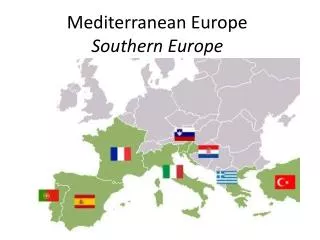
Political Divisions of Europe IBERIAN PENINSULA • Spain and Portugal Vikas Patil 2010-11
TIME TO LOOK BACK Answers!!!! 1-f, 2-d, 3-a, 4-e, 5-b and 6-c Vikas Patil 2010-11
Main POLITICAL DIVISIONS of Asia NORTH ASIA CENTRAL ASIA EAST ASIA SOUTH WEST ASIA SOUTH EAST ASIA SOUTH ASIA Vikas Patil 2010-11
Main POLITICAL DIVISIONS of Asia EAST ASIA Vikas Patil 2010-11
Main POLITICAL DIVISIONS of Asia SOUTH EAST ASIA MYANMAR MALAYSIA THAILAND SINGAPORE COMBODIA VIETNAM LAOS INDONESIA PHILIPPINES Vikas Patil 2010-11
Main POLITICAL DIVISIONS of Asia SOUTH ASIA INDIA PAKISTAN BANGLADESH SRI LANKA NEPAL BHUTAN AFGANISTAN Vikas Patil 2010-11
Main POLITICAL DIVISIONS of Asia SOUTH WEST AISA SOUDI ARABIA YEMEN OMAN IRAQ BEHRAIN IRAN UAE JORDAN KUWAIT SYRIA ISRAEL LEBANON TURKEY Vikas Patil 2010-11
Main POLITICAL DIVISIONS of Asia CENTRAL ASIA AZERBAIJAN ARMENIA GEORGIA KASAKHSTAN TURKMENISTAN UZBEKISTAN KYRGYSTAN TAJIKISTAN Vikas Patil 2010-11
Main POLITICAL DIVISIONS of Asia NORTH ASIA ASIAN RUSSIA Vikas Patil 2010-11
TIME TO LOOK BACK Answers!!!! 1-e, 2-f, 3-b, 4-a, 5-c and 6-d Vikas Patil 2010-11
Physical Features of Europe Vikas Patil 2010-11
Physical Features of Europe • THE NORTH WESTERN HIGHLANDS • CENTRAL EUROPEAN PLAINS • SOUTHERN PLATEAU AND HIGHLAND • THE ALPINE MOUNTAIN SYSTEM Vikas Patil 2010-11
THE NORTH WESTERN HIGHLANDS • Mountains and plateaus of Norway and Sweden • Among the oldest mountains of Europe • Made up of old, hard crystalline rocks • On the coast fiords are formed due to glacial erosion for millions of years • There are deep inlets of water with steep sides • It makes the coastline irregular Vikas Patil 2010-11
CENTRAL EUROPEAN PLAINS • It stretches from Atlantic ocean in the west to Ural Mt in the east. • White sea in the north and southern mountain in the south. • It is partly made up of glacial deposits and partly by alluvium deposits by big rivers like Don, Dneiper, Volga and the Ural. • They are very fertile and good for agriculture. Vikas Patil 2010-11
SOUTHERN PLATEAU AND HIGHLAND • These are not very high. Max height is 1800 mt. • It includes • Plateau of Spain, • The Central Massif and the Vosges of France, • The Black Forest of Germany • The Plateau of Bohemia. • The Ural Mt in Russia Vikas Patil 2010-11
THE ALPINE MOUNTAIN SYSTEM • Young fold mountains • Stretches from Pyrenees in Spain to The Pamir Knot in Central Asia. • It includes • Alps in the center (Mt Blanc in the highest peak with 4807 Mt height) • Pyrenees in the West and further as Canterbrian Mts. • The Appenines in the South • The Dinaric Alps, Carpthian Mt, The Transylvanian Alps and Balkan Mt in the South • Caucasus Mt in the East. (Mt Elbrus is the highest peak of Europe with 5642 Mt height) Vikas Patil 2010-11
Physical Features of ASIA Vikas Patil 2010-11
Physical Features of Asia • THE NORTHERN LOWLANDS • THE CENTRAL FOLD MOUNTAINS AND INTER-MOUNTAIN PLATEAUX • THE SOUTHERN PLATEAUX • THE GREAT RIVER VALLEYS • THE ISLAND CHAINS Vikas Patil 2010-11
THE NORTHERN LOWLANDS • THE SIBERIAN PLAIN: • Wide in west and becomes narrow towards east. • Drained by 3 rivers- Ob, Yenisei and Lena • THE TURAN PLAIN: • Lowlands around the Aral Sea • Drained by 2 rivers- Amu Darya and Syr Darya (Inland drainage). Vikas Patil 2010-11
THE CENTRAL MOUNTAINS AND PLATEAUS • Fold mountains and intermontane plateaus. • PAMIR KNOT: • WEST: • SulaimanMts, Zagros, Taurus Mts. • Hindu Kush, Elburz Mts, Pontic Mts. • EAST: • The Himalayas • The Karakoram Mts. • Kunlun Mountain • AltynMts • Tien Shan Mts. • INTERMONTANE PLATEAUS: • Anatolia, Iran, Tibet, Mongolia Vikas Patil 2010-11
THE SOUTHERN PLATEAUS • OLD, HARD, CRYSTALLINE ROCKS • PLATEAU OF ARABIA: Steep along SW and gentle along NE • PLATEAU OF PENINSULAR INDIA: Steep along West and gentle along East • PLATEAU OF SHAN AND YUNNAN: Steep along the West and gentle along East Vikas Patil 2010-11
THE GREAT RIVER VALLEYS Vikas Patil 2010-11
THE ISLAND GROUPS MALAY ARCHIPELAGO Vikas Patil 2010-11
Important Rivers of Asia Vikas Patil 2010-11