Download
1 / 55
550 likes | 678 Views
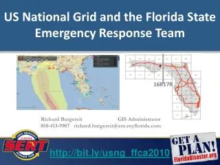
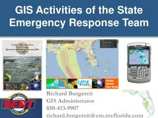
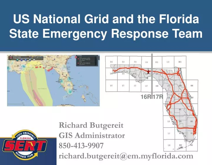
US National Grid and the Florida State Emergency Response Team. 16R. 17R. Richard Butgereit GIS Administrator 850-413-9907 richard.butgereit@em.myflorida.com. US National Grid. Introduction to the US National Grid Why do we need to use the US National Grid?

E N D
US National Grid and the Florida State Emergency Response Team 16R 17R Richard Butgereit GIS Administrator 850-413-9907 richard.butgereit@em.myflorida.com
US National Grid • Introduction to the US National Grid • Why do we need to use the US National Grid? • How is it similar/differ from other systems? • How to read USNG coordinates • Tools for Responders • Tools for GIS Support Staff
Introduction to the USNG • Why do we need to use the US National Grid? • How is it similar/differ from other systems? • How to read USNG coordinates
US National Grid • Lessons learned have taught us that standardized grids are needed for positional reporting. • As far back as Hurricane Andrew, problems were recognized for emergency managers...
Florida Adopts the USNG • USNG was adopted by the FFCA • FDEM adopted the USNG in the States CEMP • Florida Fire College, Florida Fire Chiefs Association, FL National Guard developed curriculum and instructor manuals • Modules incorporated into Firefighter II curriculum
FEMA Adopts the USNG • Near term priority approved by Administrator Fugate • Establish a standard for FEMA operational maps using the National Grid
Introduction to the USNG • Why do we need to use the US National Grid? • How is it similar/differ from other systems? • How to read USNG coordinates
What’s wrong with current systems? We already have… • Latitude/Longitude • Township/Range/Section • Street Address and Zip • “Bingo” Grids
Latitude/Longitude Multiple formats are confusing DD -85.990151, 30.272240 DM -85 59.409089, 30.16.334386 DMS 85 59’24.545”W, 30 16’20.063”N All the same location!!!
How far is a second anyway? What is the distance from…. 85 59’24.545”W, 30 16’20.063”N To here…. 85 59’26.292”W, 30 16’14.546”N
Township/Range/Section Township/Range/Section grid from the Public Lands Survey System is an important and good system… • basis of land ownership records • been in use for over 180 years
Township/Range/Section • But a perfect section really doesn’t exist • irregular in coastal areas • too large to meet needs of ground crews
Street Address and Zip • Problematic due to… • rural routes • post office boxes • House numbers missing or obscured
Introduction to the USNG • Why do we need to use the US National Grid? • How is it similar/differ from other systems? • How to read USNG coordinates
Universal Transverse Mercator • Developed by the United States Army Corps of Engineers in the 1940s • A position on the Earth is referenced in the UTM system by the UTM zone, and the easting and northing coordinate pair. Abbreviated as “UTM” 16R 766000 3364820
Military Grid Reference System • is the geocoordinate standard used by North Atlantic Treaty Organization (NATO) for locating points on the earth. • is derived from the UTM grid system, but uses a different labeling convention. Abbreviated as “MGRS” 16R GU 66000 64820
United States National Grid • Practically identical to MGRS. • Difference is the datum – MGRS uses WGS84, which USNG uses NAD 83 • Coordinates reported identical. Abbreviated as “USNG” 16R GU 66000 64820
USNG • it has the advantage of being easily plotted on USGS topographic maps by using a simple "right and then up" method instead of having to plot from right to left when using latitude and longitude in the Western Hemisphere. The coordinates are also easily translated to distance since they are in meters. Thus the distance between two coordinates can quickly be determined in the field.
Introduction to the USNG • Why do we need to use the US National Grid? • How is it similar/differ from other systems? • How to read USNG coordinates
How to read USNG 16R GU 66000 64820 Grid Zone Designation – for a world-wide unique address, identifies the longitude zone number and the latitude band letter 100,000 Meter Grid – identification for regional areas Grid Coordinates – Easting and Northing position
Truncate for locality 16R 17R 16R GU 66000 64820 • just like you don’t have to dial an area code to make a local call… • all Florida locations will be 16R or 17R
Truncate for locality 16R 17R 16R GU 66000 64820 • 100,000 meter zone designation may be dropped when working locally
Truncate for less precision… 16R GU 66000 64820 Locates within 1 meter 66000 64820 Locates within 10 meters 6600 6482 660 648 Locates within 100 meters 66 64 Locates within 1000 meters
USNG • Easily scaleable • Pin-point and cell based locational reporting • “Grid within a Grid”
Tools for Responders • GPS • GeoPDF • Mapping applications and websites
Support for USNG • http://www.floridadisaster.org/gis/usng • tools and instructions for GIS staff • FDEM’s GATOR • new mapping website with USNG tools • FDEP’s Incident Mapper • simple Google Maps mashup with USNG tools • GeoPDF’s • new PDF formats have GIS capabilities, including USNG support
Global Positioning Systems • I have GPS……..why do I need to care about any of this? • USNG can be used with GPS • GPS supplements USNG • USNG will work when your GPS won’t
USNG and GPS • Most GPS units explicitly support USNG as an option for units • If you choose USNG, you must also choose NAD 83 as your datum (or technically, you haven’t chosen USNG) • You may also choose MGRS with NAD 83 to be the functional equivalent of USNG
http://map.floridadisaster.org/GATOR Geospatial Assessment Tool for Operations and Response web mapping application real-time data like weather radar, watches, storm reports base map and post-event data GATOR
KML for Google Earth • http://map.floridadisaster.org/ArcGIS/KML • Critical Facilities – including USNG coordinates for facilities • USNG layers – statewide 100,000m, 10,000m, and 1,000m
Hazardous Material Facilities For first responders User names/password provided through Local Emergency Planning Committee https://erplan.net E-Plan
http://www.floridadisaster.org/gis/kml/viewer.htm simple Google Maps mashup with USNG tools real-time data like weather radar, watches, storm reports will be transitioning to GATOR Incident Mapper
Tools for GIS Support Staff • USNG and ArcGIS • GeoPDF
USNG in ArcGIS 9.1 • USNG National Grid Tools Repackaging of… • Military Analyst • Product line tool set (PLTS) • USNG Locational Toolbar Available from ArcScripts • Less complicated, easier to use
USNG in ArcGIS 9.2/9.3 • Integrated… • Go to X,Y Tool • Identify • Graticules
Military Analyst in ArcGIS 9.2/9.3 USNG coordinates may easily be added to a feature class. NAR-C is proper NAD 83 choice - “North American Reference CONUS”