Download
1 / 17
170 likes | 325 Views
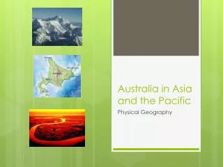
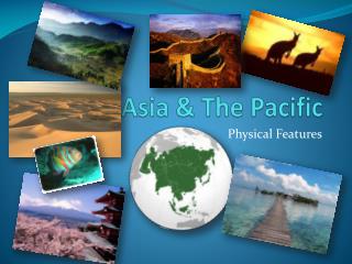
Asia and the Pacific . Physical Geography Chapters 1-3. Chapter 1: East Asia Section 1: Land and Water. Himalayas. Mt. Everest. Huang. Chang. Mountains. Rivers. Mount Fuji. Plateaus. East Asia’s Landforms. Narrow Plains. Highlands. Plateau of Tibet. Wide Plains. Desert.

E N D
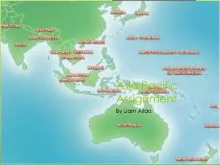
Asia and the Pacific Physical GeographyChapters 1-3
Chapter 1: East AsiaSection 1: Land and Water • Himalayas • Mt. Everest • Huang • Chang • Mountains • Rivers • Mount Fuji • Plateaus • East Asia’s Landforms • Narrow Plains • Highlands • Plateau of Tibet • Wide Plains • Desert • North China Plains • Gobi
Section 3: Natural Resources and Land Use • What are East Asia’s natural resources? • How is the land used to produce food? • Coal and iron are plentiful in North Korea. • South Korea has some tungsten and graphite. • China has copper, tin and iron. • China’s coal deposits are its most important mineral resource. • China has oil deposits • Flowing water is used to produce electricity. • Ocean and inland waters are an important source of food. • Every bit of available land is farmed to feed its large population. • Terraces are cut into steep hillsides to grow crops. • Even the sides of roads and railways are used for planting. • Farmers in China often plant one crop between the rows of another crop. • Farmers use double cropping to grow two or three crops on the same land during a year.
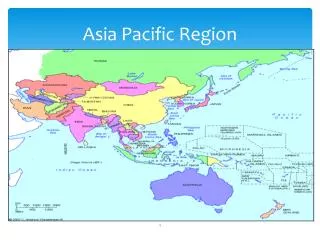
Chapter 2 South, Southwest, and Central Asia: Physical Geography
Section 3: Central Asia • Physical Geography of Central Asia • Land • Climate • Natural Resources • Physical features include highlands, deserts, and steppes • Tien Shan and Pamir mountain ranges are in southeastern area of Central Asia • Tien Shan range extends into China • Pamir range extends into Afghanistan to meet the Hindu Kush mountains • Kara Kum desert covers much of Turkmenistan and Uzbekistan • The Kirghiz Steppe is located in Kazakhstan • Most of Central Asia has a dry climate • A band of semiarid land surrounds the arid climate that covers much of the interior • The arid areas of Central Asia receive less precipitation than the semiarid areas. • Petroleum and natural gas are major natural resources • Kazahstan, Uzbekistan, Turkmenistan all have large oil and gas reserves • Kazahstan is a large exporter of coal • Kyrgyzstan, Tajikistan, and Uzbekistan are important gold producers • Copper, iron ore, lead, and uranium are found in the region. • Caspian Sea is a salt lake the largest lake in the world, and has large oil reserves • Much of the land in Central Asia is used for agriculture, especially raising livestock and commercial farming
Chapter 3 Southeast Asia and the Pacific Region: Physical Geography
Section 1: Southeast Asia • Monsoons and typhoons • Many people depend on subsistence or commercial farming • Rice is a major cash crop and a food crop • Tropical rain forests once covered nearly all of Southeast Asia • Need to balance economic growth and preserve rain forests • Bamboo serves as an important resource for building and other uses. • Rich in minerals, oil, and natural gas • Mainland Southeast Asia • Much of the area is covered by forested mountains • Most people live in the narrow river valleys between mountain ranges • Has several different climates — tropical wet, tropical wet and dry, humid subtropical • Island Southeast Asia • Part of Ring of Fire — region of volcanoes and earthquakes surrounding the Pacific Ocean • Mostly tropical wet climate
Section 3: Pacific Islands • Most people • “black islands” • Located north of Equator • “small islands” • Melanesia • Micronesia • High islands • low islands • Pacific Islands • Polynesia • High and low islands • “many islands” • Includes Hawaii • largest island group
Chapter 1 Topics to Know • Key Terms: plateau, fertile, archipelago, population density, monsoon, typhoon, deciduous, developing country, developed country, terrace, double-cropping • What country takes up most of the territory of East Asia? • How is the climate described in most of East Asia? • Rivers – The Chang and Huang • The North China Plain • What is a strong influence on the climates of East Asia? • Main foods (Northern China & Southern China) • Natural Resources
Chapter 2 Topics to Know • Key Terms: (subcontinent, alluvial, cash crop, oasis, petroleum, nonrenewable resource, standard of living, steppe) • Himalayas – formation, weather, etc • Largest country in Central Asia • Tigris and Euphrates Rivers • Most important factor in determining the climate of South Asia • Largest oil producing region • Physical features of Central Asia • South Asian cash crops • Bodies of water that border Southwest Asia • Major crop of Uzbekistan, Turkmenistan, and Tajikistan
Chapter 3 Topics to Know • Key Terms (subsistence farming, commercial farming, paddy, geyser, fiord, marsupial, tectonic plate, high island, low island, atoll, coral) • Number of islands and 3 main groups • High and low islands • Cash crops • Ring of Fire • Rain forests • Mainland Southeast Asian countries • Southeast Asia climate • Plant & animal life in Australia and New Zealand • Canterbury Plain • Most important resource in the Pacific island
Possible Essay/Short Answer Questions • Chapter 1: If North and South Korea could get along and were willing to share, how do you think both countries would benefit? • Chapter 2: What is one problem that can be caused when a country’s economy depends too much on a single cash crop? • Chapter 3: How has the fact that most of Melanesia’s large islands are high islands affected the size of its population?
Other Study Tips! • Be sure to study your packets from chapters 2 and 3. • Don’t forget about the graphic organizers in chapter 1. Good Luck