Download
1 / 33
330 likes | 456 Views

E N D
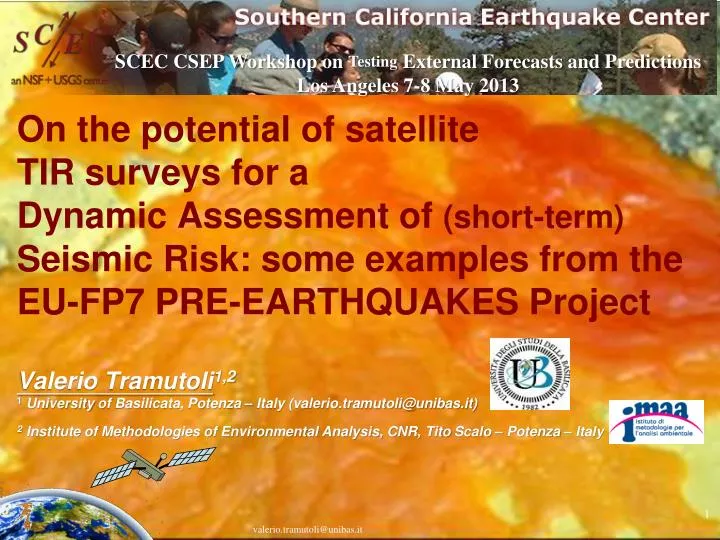
On the potential of satellite TIR surveys for a Dynamic Assessment of (short-term) Seismic Risk: some examples from the EU-FP7 PRE-EARTHQUAKES Project Valerio Tramutoli1,21Universityof Basilicata, Potenza – Italy (valerio.tramutoli@unibas.it)2 Institute of Methodologies of Environmental Analysis, CNR, Tito Scalo – Potenza – Italy SCEC CSEP Workshop on Testing External Forecasts and Predictions Los Angeles 7-8 May 2013 valerio.tramutoli@unibas.it
NOAA-16 July, 22, 2001 01GMT AVHRR Channel 4 atmosphere total atmospheric transmittance and profile which depends on physical (mainly T(h) temperature profile) and chemical (mainly H2O, CO2, NH4) properties of the atmosphere surface TS: surface temperature eDl: spectralemissivity TIR SIGNAL valerio.tramutoli@unibas.it
Data Analysis:the noise ! (natural/observational) Atmospheric transmittance Time of day Atmospheric temperature profile Season Observational Satellite TIR signal Atmospheric humidity profile Natural Satellite view angle atmospere Surface temperature surface Satellite spatial resolution Spectral emissivity orography TIR signal is strongly variable depending on the observation timet and place r. valerio.tramutoli@unibas.it
TIRAnomaly Monitoring by RST (Robust Satellite Technique): the RETIRA (Robust Estimator of TIR Anomalies) index(Tramutoli et al., RSE, 2005) y x 5 ∆T(x,y,τ) 12 t 17 • reducing siteeffects Signal time-average µΔT(x,y) and standard deviation ΔT(x,y) are computed at the pixel level in similar observational conditions (same month of the year, same time slot,etc.) V(x,y,τ) = T(x,y,τ);T(x,y,τ) = T(x,y,τ) - < T(τ)> RST derives from RAT (Robust AVHRR Approach) (Tramutoli , 1998) • reducing year-to-year variability and seasonal-drift effects The local signal excess T(x,y,τ)= T(x,y,τ) - <T(τ)> (compared with the spatial average on the scene) is the considered signal instead of its absolute local value T(x,y,τ) • space-time persistence required • known spurious effects discarded (Filizzola et al., 2004, Aliano et al., 2008, Genzano et al., 2009) • Validation/confutation approach always applied
A posteriori Validation/Confutation Analyses(5.7 – 9.0) MAGNITUDE EQs
The method has been independently evaluated by two projects funded by two National Space Agencies (NASA and DLR) Greece-Turkey 1998-2004 AVHRR 6 YEARS California 2000-2006 MODIS 7 YEARS
Genzano et al; NHESS; 2009 Lisi et al; NHESS; 2010 Pergola et al; NHESS; 2010 Vp/Vs anomalies Lucente et al, (Geology, 2010) CO2 fluxes Martinelli, 2009 Number of EQ January 1 up to April 6, 2009 TEC anomalies Akhoondzadeh et al., 2010 G. Papadopoulos et al., 2010 De Santis et al., 2010 TIR anomalies MODIS-AVHRR-SEVIRI Uranium groundwater Plastino et al 2010 VLF radio anomalies Rozhnoi et al 2009 VLF radio anomalies Moving to multiparametric observations (Abruzzo-L’Aquila April 6th 2009 EQ) 30/3/09 30/3/09 30/3/09 V.Tramutoli__ EMSEV 2010 ___Chapman University, Orange, CA, USA ___(valerio.tramutoli@unibas.it)
Partners (increasing through Networking Membership) WD IZMIRAN FIAG RSS Laboratoire the Physique et de Chimie de l’Environment and de l’Espace - CNRS DLR LPC2/CNRS National Observatory of Athens UNIBAS GSI NOA TUBITAK MAM CHAP Chapman University
independent observations Strategy and tools 1. Learning Off-line integration on past events over 3 main testing areas/events 2. Apply in Real Time: PRIME (Pre-earthquakes Real-time Integration and Monitoring Exercise) Real time integration over 2 selected wide areas Jul– Nov 2012 Integration tool: Pre-Earthquakes Geoportal (PEG)
From “a posteriori” to real time validation/confutation • PRIME • The Pre-earthquakes Real-time Integration and Monitoring Experiment • (July-November 2012)
18-JUL-2012 DECISION: To locally look to the data, Blue (Only Local) Alert Level
19-JUL-2012 DECISION:, REQUEST OF ATTENTION BY PARTNERS ! Yellow Alert Level
20-JUL-2012 DECISION:, MOVE TO RED ALERT
20-JUL-2012 22 July 201209:26:02 UTC M=5 ANDIRIN – KHARANMANMARA event occurred (4 days after the first anomaly observed on July 18)
PRIME results • Example 2 • K.Maras-Pazarcik event (16/10/2012 M 4.6) The game of responsibility a real time experiment Presented at the EMSEV 2012 Conference Gotemba Japan 3 October 10:45 LT
28-SEPTEMBER-2012 non persistent anomalies DECISION: To Locally look to the data, Blue (Only Local) Alert Level
29-SEPTEMBER-2012 2 persistences close to faults DECISION:, REQUEST OF ATTENTION BY PARTNERS ! Yellow Alert Level
30-SEPTEMBER-2012 1 persistent high intensity close to the fault DECISION:, MOVE TO RED ALERT
01-OCTOBER-2012 no anomalies (but the alert status should be mantained for the next 6-7 days)
OCTOBER 1, 2012 (18:17 Rome time) Why ? DECISION:, MOVE TO RED ALERT
WHY ? Same shape, same place than in the previously predicted event (22 July 2012, M=5) 20 July 2012 (2 days before the M5 EQ) 29 September 2012 30 September 2012 22 July 201209:26:02 UTC M=5
WHY ? Anomalies (again) following the main fault systems 29 September 2012 30 September 2012
OCTOBER 1, 2012 (19:43 Moscow time) PRE-EARTHQUAKES collaboration (FIAG, Sergey Pulinets) PRE-EARTHQUAKES final review meeting - Brussels - 15 March 2013
OTHER AVAILABLE INFOMedium term forecast (e.g. M8+, Kossobokov)
28 09 2012 16:25:00 UT 28 09 2012 17:05:00 UT OCTOBER 2, 2012 (13:29 Berlin time) PRE-EARTHQUAKES collaboration (DLR, Norbert Jakowski) 28 09 2012 14:25:00 UT More than 10 hours/day of anomaly on Sept 28-29 (see Tiger Lee speach) continuing 30 sept and Oct 1 but with geomagnetic storms 29 09 2012 14:05:00 UT 29 09 2012 16:45:00 UT VIOLET ALERT
Participants to the EMSEV 2012 Conference Gotemba (Japan) 3 October 2012
2 weeks later EMSEV presentation 16 October 2012 2012-10-16 10:25:05 UTC ML 4,5 Depth 39.4 Km 2012-10-16 01:16:02 UTC ML 4,6 Depth 9.2 Km
Conclusions (? only 4 months of test ) • During PRIME experiment significantly persistent TIR anomalies were observed only in few cases (very often in apparent relation with earthquakes occurred within 2 weeks later). • Integration with ancillary information and/or observations allowed to increase the number of pre-alerted events • Very few earthquakes with M>4 (not necessarily the most important) have been pre-alerted compared with their total number (>60, clouds coverage playing the major preventing role). • The repetition of pre-seismic TIR anomalies with similar characteristic in the same place strongly increases reliability of the alerts (shared with the EMSEV community 2 weeks before)
The italian (DPC-INGV-S3) project on short-term earthquakes prediction(Coord. Prof. Dario Albarello)
Forecast Summary Questions TIR anomalies by RST approach and RETIRA index (Tramutoli et al., 2005) • Describe a typical forecast: Space-time persistent TIR anomalies (not associated to known and verifiable spurious effects) can contribute to increase the alert level in the framework of a DASR System. In association with other information quality of the forecast strongly increase (no apparent relations with magnitude). • What area do they cover? variable from 106 up to 106 km2 • What is the magnitude range? >4 (possible relationships among affected area and M still under study) • How long is the time period? from 30 to few days before the EQ, co-seismic and after-seismic (until few days after the EQ) observed (and expected) • Do you include a probability of an event during the forecast? only Low, High, Very High alert levels are given always in conjunction with other independent observations. Relative intensity of RETIRA index can offer (if time series are sufficiently long to justify a Gaussian-like distribution) an indication on the rarity of the anomalies. Space-time persistence, shapes, spatial relations with other static (e.g. fault system) or dynamic (e.g. seismicity) factors are also considered. • Do you include a confidence level in the forecast? see before • Describe the process for making a forecast: • Is it automatic or manual? Automatic for TIR anomalies generation. Partly automatic for the analysis of spurious effect and space-time persistence. • What data are used? Thermal Infrared Radiances (10-12 micron) from different satellite sensors onboard geostationary platforms (like MSG, GOES, MTSAT, etc.) is today preferred. Passive MWs sensors (not yet available) on geostationary satellite should significantly improve negative effects due to cloud presence and distribution (spurious effects) • Do you have a preference for which earthquake data should be used to test your forecasts? No • Do you have a preferred testing method? Real-time release of (different level of) alerts in the framework of a PRE-EARTHQUAKES like collaboration. • What physical hypotheses about earthquake predictability have motivated your research? Like all physical processes earthquakes (and their preparation phases) can be studied, modeled and then predicted (as it is already done at least on the long terms). No scientific proofs exists demonstrating an intrinsic EQ unpredictability. Main problem is, presently the accuracy of predictions and the poorness of the observation systems. .
RAT/RST people Thanks