Download
1 / 22
220 likes | 357 Views
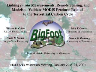
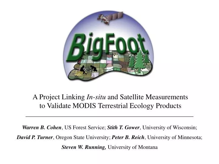
A Project Linking In-situ and Satellite Measurements to Validate MODIS Terrestrial Ecology Products. Warren B. Cohen , US Forest Service; Stith T. Gower , University of Wisconsin; David P. Turner , Oregon State University; Peter B. Reich , University of Minnesota;

E N D
A Project Linking In-situ and Satellite Measurements to Validate MODIS Terrestrial Ecology Products Warren B. Cohen, US Forest Service; Stith T. Gower, University of Wisconsin; David P. Turner, Oregon State University; Peter B. Reich, University of Minnesota; Steven W. Running, University of Montana
Objectives Technical • Provide high quality site-specific data layers • at four sites that can be compared to MODIS • and other sensor products Scientific • Develop better understanding of the climatic • and ecological controls on total net primary • production and carbon allocation within and • among biomes • Learn how flux tower-measured NEE and • field-measured NPP co-vary in time & how to • translate between them using ecological models • Explore errors and information losses that • accrue when extrapolating field data to coarse- • grained (1 km) surfaces
Sites BOREAS Northern Old Black Spruce (NOBS) Muskeg (open black spruce), “Closed” black spruce, Aspen, Wetlands, Jack pine Harvard Forest (HARV) LTER Mixed hardwoods, Eastern hemlock, Red pine, Old-field meadow Konza Prairie Biological Station (KONZ) LTER Tallgrass, Shortgrass, Shrub, Gallery forest; grazing and burning regimes Bondville Agricultural Farmland (AGRO) Corn, Soybeans, Fallow
Field-Based Sampling Design 100 25m2 plots 80 in a nested spatial series 20 plots broadly distributed Plot measurements Vegetation cover LAI, fPAR Aboveground biomass Aboveground productivity Belowground productivity
27 July 99 AGRO (29 July 99) 98 % accurate (cross validation) LAI P vs. O r^2 = 0.72
2 r = 0.42 ETM+ band 4 NOBS 57 % accurate (cross validation) ETM+ band 4 ETM+ band 3 7 ETM+ band 5 ETM+ band 5 0 ETM+ band 3
Vegetation Cover Component Characterization System (3CS): • Quantitative measurements of cover proportions • Basic building blocks for variety of classification systems • Improved LAI mapping?
sphagnum feathermoss n=48
n=48 Correlations n=192
Meeting Our Land Cover Mapping Needs • AGRO • corn (class--label fields in-situ) • soybean (class--label fields in-situ) • other (classes--label clusters in-situ & HD imagery) • NOBS • conifer/hardwood/standing dead (relative proportions--from camera observations, HD imagery) • “ground” cover (relative proportions--from camera observations, moss classes from ocular estimate) • other (classes--label clusters in-situ, camera observations, & HD imagery) • HARV • hardwood/conifer (relative proportions--from HD imagery) • other (classes--label clusters in-situ & HD imagery) • KONZ • grass (short/tall combined class--labels from plots & HD imagery) • forest (one class--labels from plots & HD imagery) • shrub (percent--from HD imagery calibrated with camera observations, plots) • other (classes--label clusters in-situ & HD imagery) “ground” cover classes: moss, lichen, herbaceous, shrub, fine litter, tree regeneration, coarse wood debris, water HD (high definition) imagery: ADAR, IKONOS, AVIRIS mission photos, MQUALS
HARV Capturing seasonality With ETM+ is important to both land cover and LAI mapping HARV Leaf-off Leaf-on KONZ April July September
27-Jul-99 Preliminary calculations 27-Jul-99 Preliminary calculations
Regression Kriging Kriged residuals
IGPB: Cropland UMD: Cropland Biome: Broadleaf Crops Percent Tree Cover: 0
MODLand/BigFoot Comparisons • Land cover (e.g.,…) • aspatial: compare frequency distribution of translated site-specific classes with same • from MODLand • spatially explicit: summaries of site-specific cover proportions within MODLand- • labeled cells • LAI/fPAR (e.g.,…) • mean 1 km cell values vs. MODLand values • distributions of fine-grained values within MODLand cells • NPP (e.g.,…) • integrated 1 km cell values vs. MODLand values • distributions of fine-grained values within MODLand cells • spatially degrade land cover and LAI, repeat modeling, redo above NPP comparisons • informationally degrade land cover, repeat modeling at fine grain, redo comparisons