Download
1 / 8
80 likes | 158 Views
Explore the comprehensive geologic and base-category symbols, map unit colors, and more for precise map representation. Learn about the detailed standards development process and implementation of the digital cartographic standard. Act now to discuss and endorse this exemplary standard for geologic mapping.

E N D
Digital Cartographic Standard for Geologic Map Symbolization Presented by Julie Maitra Chair, FGDC Standards Working Group and Dave Soller Chair, FGDC Geologic Data Subcommittee
STAGE STEP CUSTODIAN PROPOSAL 1- Develop Proposal FGDC Standards Working Group (SWG) 2 - Review Proposal SWG PROJECT 3 - Set Up Project FGDC Subcommittee or Working Group (SC/WG) DRAFT 4 - Produce Working Draft Standards Development Group 5 - Review Working Draft SC/WG REVIEW 6 - Review and Evaluate Committee Draft SWG 7 - Approve Standard for Public Review FGDC Coordination Group (CG) 8 - Coordinate Public Review FGDC Secretariat 9 - Respond to Public Comments Standards Development Group 10 - Evaluate Responsiveness to Public Comments SWG 11 - Approve Standard for Endorsement CG FINAL 12 – Endorsement FGDC Steering Committee FGDC Standards Process From FGDC Standards Reference Model, http://www.fgdc.gov/standards/process/FGDC-standards-reference-model
About the FGDC Digital Cartographic Standard for Geologic Map Symbolization Geologic Data Subcommittee Chair – Dave Soller, USGS
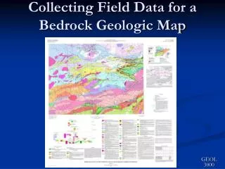
Content of the standard • Comprehensive set of geologic and base-category symbols • Map unit colors and patterns • Geologic age font • Terminology for scientific and locational certainty of geologic map features
Standards development • 1996-1998 – review of existing standards; USGS preparation of FGDC draft • 1999-2000 – FGDC review (GDS and SWG) • 2000-2001 – Public Review of standard; evaluation of comments • 2002-2004 – revision of standard, with assistance from newly-formed Standing Committee • 2005-2006 – preparation and review of final version.
Implementation and maintenance • Publish in PDF and in full-color, loose-leaf paper format • Publish implementations (in Postscript, ArcGIS format) • Maintain the standard: • Encourage public comments that lead to periodic revision of the standard • The National Geologic Map Database project will initiate the revisions, with guidance provided by the Standing Committee and the FGDC GDS • Revisions will be published in PDF format, and all interested parties will be notified by email.
Action • Discussion • Vote to approve the Digital Cartographic Standard for Geologic Map Symbolization for FGDC endorsement
Observations • State participation enabled through close collaboration between FGDC Geologic Data Subcommittee and American Association of State Geologists • Reminder sent to reviewers one month before end of public review stimulated submission of comments.