Download
1 / 16
190 likes | 532 Views
An examination of commercial network RTK GPS services in Great Britain. Newcastle University The Survey Association Ordnance Survey Leica Geosystems Trimble Royal Institution of Chartered Surveyors Reviewed by: Robert Odolinski & Johan Sunna.

E N D
An examination of commercial network RTK GPS services in Great Britain Newcastle University The Survey Association Ordnance Survey Leica Geosystems Trimble Royal Institution of Chartered Surveyors Reviewed by: Robert Odolinski & Johan Sunna 2009-04-24, Reviewed by Robert Odolinski & Johan Sunna
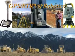
Background • Ordnance Survey provide and maintain the national network of continuously operating GPS active stations, with a few stations of GLONASS capability. • There are two available commercial networks that provide corrections based on data from Ordnance Survey, Leica ‘SmartNet’ and Trimble ‘VRS NOW’. • SmartNet network RTK solution is based on the so-called Master-Auxiliary Concept (MAC) and VRS NOW is based on Virtual Reference Station (VRS). • Both systems capabilities are examined to obtain an impartial and objective indicator of the achievable accuracy (no ranking between the two network RTK systems). • This study provides a basis for an extended and updated document that cover best practice guidelines for network RTK users in Great Britain.
Objectives • Determine the accuries attainable from both system at a range of representative locations that users may experience. • Determine coordinate repeatabilities attainable from the two systems (SmartNet and VRS NOW). • Performance of the system at the geographical extents of the active station network (e.g. coastal zone). • System performance when significant height differences exist between the OS Net reference stations and the rover. • Examine the potential of network RTK solutions by integration of additional satellite constellations e.g. GLONASS.
OS Net reference stations and test sites • Blue points : number of active OS Net reference stations: more than 100, target of 110 stations. • Red triangles: seven test sites with some different criteria e.g.: • - sites at the extent of the network (coastal zone) • - different site elevations to OS stations (high and low differences) - different distances from site to OS stations etc.
Instruments/settings and collection of data/coordinates • Centre antenna orientated to North and connected to dual frequency receiver recording static data. • ‘True’ coordinates recorded for central antenna, and baselines of 250 mm distances to provide SmartNet and VRS NOW receiver with ‘true’ coordinates. • These short baselines (250 mm) made it possible to cancel tropospheric and ionospheric biases. • ‘True’ coordinates were later compared with the network RTK solutions for the VRS NOW and SmartNet systems to assess overall system accuracies in each coordinate component.
Data analysis • All network RTK fixed solutions with worse than the following instrument-reported qualities were filtered: • 1st filter: • Horizontal Coordinate Quality > 50 mm • Coordinate Quality in height > 100 mm • 2nd filter: • DOP 3 • Statistics were generated for 1, 5, 180 and 300 second samples using only a single moving window average. Then for a double-window average the average of two such windows was used, separated by 20 or 45 minutes.
Results/analysisNetwork RTK accuracies • In overall the DOP filter did not imply to affect the overall rms statistics for all areas. • However for high multipath areas, e.g. GRAG (table), the purple equipment accuracy improved greatly. • This would suggest that DOP limit of 3 does not affect network RTK in open environment, but in challenging areas it can radically improve system reliability.
Results/analysisNetwork RTK accuracies • The ratio plots (CQ+DOP filter) has been generated by the obtained rms divided by the reported CQ values from the network RTK equipment. • In challenging environments (e.g. GRAG) with high multipath, the pink network RTK equipment can give over-optimistic CQ values. • Environments with high multipath, large distances or height differences to OS Net stations can give CQ values that are over-optimistic by a factor 3-5.
Site STRE (open environment) with a mean height difference of -255 m to nearest OS Net reference stations and 22-72km to nearest 4 OS stations. • The plot reveals excursion of about 50 mm for the purple equipment. In problematic environments short term repeatability (seconds to minutes) can give a misleading impression of accuracy. • Site TRET (the extent of the network) and has OS Net stations only to the east. • After applying CQ filter the rms errors are: 10,7 and 19 mm (N,E,U) purple equipment and 13, 7 and 18 mm (N,E,U) pink equipment • Despite these rms errors the plot reveals epoch-to-epoch excursions up to 30 mm. Results/analysisRepeatabilities
Results/analysisHeight effects Coordinate Quality + DOP filter • Site TUSH and GWYN with mean height difference of 16 m respectively 254 m to nearest OS Net active stations were investigated. • The table shows that the rms values for GWYN are in overall slightly worse, despite the height differences to nearby OS Net active stations. • At places where the height differences increase even more, the mitigation of residual tropospheric effects cannot be guaranteed, at such circumstances windowing techniques should be considered.
Results/analysisOcean Tide Load • Complicated coast line in Great Britain and shallow seas results in large variability of OTL displacement. • Network RTK reduces OTL error to current system noise levels throughout most of the mainland of Great Britain; but where the OTL still remains it can be almost completely removed by taking two sets of coordinates with 6-6.5 hours of separation. • Instantaneous differences in displacement of Ocean Tide Load between the rover and base station can cause errors in the measured coordinates. Note: The periodic redistribution of water due to ocean tides loads the Earth’s surface resulting in time-varying OTL displacement.
Recommendations for best practice 1(4) Network RTK accuracy: • Generally commercial network RTK solutions in Great Britain provide results that achieve horizontal accuracy of around 10-20 mm and height accuracy of 15-30 mm (one sigma). Equipment configuration: • Rover firmware should be configured according to manufacturer guidelines. Significant variations from recommendations may lead to unacceptable coordinate determination. • DOP limit of 3 will in problematic areas improve the robustness of the determined coordinates.
Recommendations for best practice 2(4) Quality indicators: • In most situations (open areas, etc.) the coordinate quality indicators reflect well the performance of the system. • In more challenging areas, though, the CQ indicators may be over-optimistic by a factor of 3-5 (especially in height component). Improving solution robustness: • 180 sec (3min) single averaging window yielded a small improvement compared to one epoch (1 sec), however no further significant improvement were shown for a 5 minute single averaging window. For precise work, e.g. control station establishment: • A two window (3 min single window) with 20 minute separation yielded a 10-20% improvement in coordinate accuracy and a 45 minute separation a 15-30% improvement, all compared to a single epoch solution.
Recommendations for best practice 3(4) Additional satellite constellation: • It can be concluded that additional satellite constellation signals improve network RTK system availability, however further testing is recommended. • Where the satellite visibility is limited (e.g. under a tree) the surveyor should consider to adopt standard terrestrial survey techniques instead of network RTK. Surveying at the limits of the network: • The figure shows the mean distance to the four nearest OS active stations and it can aid the planning of network RTK surveying. • When working at the extent of the network, or with large mean distance, it is recommended that the user should consider windowing techniques.
Recommendations for best practice 4(4) Height effects: • At places where the height differences increase the mitigation of residual tropospheric effects cannot be guaranteed, at such circumstances windowing techniques should be considered. Ocean Tide Loading: • Network RTK reduces OTL error to current system noise levels throughout most of the mainland of Great Britain. However, where the OTL still is a problem in network RTK system it can be completely removed by taking two sets of coordinates with 6-6.5 hours of separation.
The End! Thanks for listening Questions?