Download
1 / 114
1.14k likes | 1.25k Views
Welcome back to the …. Highway Data Workshop February, 2010. Highway Data Services Bureau New York State Department of Transportation 50 Wolf Road, 3-2 Albany, New York 12232 (518) 457-1965. THIS MORNING. Functional Class Map Viewer Newest Data on the Web

E N D
Welcome back to the… Highway Data WorkshopFebruary, 2010 Highway Data Services Bureau New York State Department of Transportation 50 Wolf Road, 3-2 Albany, New York 12232 (518) 457-1965
THIS MORNING • Functional Class Map Viewer • Newest Data on the Web • Traffic Data Analysis/Forecasting • Project Level Forecasts • Traffic Assignment Modeling • Vehicle Miles of Travel
Functional Class Maps -A proposed approach for the next update • Old approach • Static pdf images • Difficult to produce • Do not reflect subsequent approved changes • Proposed approach • Functional Class Viewer • Based on an approved FC system • Approved changes applied immediately • Updated GIS files readily available
Functional Class Viewer • Internet-based viewer • Based on approved system as encoded in a GIS-based file • Link to original approval document • Revisions noted by link to approval memos • Revised GIS data regularly distributed http://wvmoap22/fc/
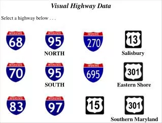
Data on the Web • Highway Data • Detailed Inventory Listings • Functional Class Maps • Highway Mileage Report • Traffic Data • Traffic Data Report • Hourly Traffic Volume Files • Reference and Factor Files
Highway Data Services Bureau • www.nysdot.gov • A to Z Site Index • Select “H” • Select “Highway Data Services Bureau”
Other NYSDOT Links • https://www.nysdot.gov/divisions/ policy-and-strategy/darb/dai-unit/ttss • FHWA/FTA approved Urban Areas • Census-based Urban Areas • Metropolitan Planning Areas • Statewide Annual VMT since 1920
Other NYSDOT Links • https://www.nysdot.gov/divisions/ policy-and-strategy/darb/dai-unit/ttss • Traffic Change in New York State • Change in Traffic on NYS Bridges, Thruway and Roads, January 2010 • Contains transit and other data as well as traffic data
Other NYSDOT Links • https://www.nysdot.gov/divisions/ operating/oom/transportation-systems/manuals • Qualifying and Access Highways (trucks) • Touring Route Book • https://www.nysdot.gov/divisions/ engineering/design/dqab/rmm • Reference Marker Manual
Other NYSDOT Links • https://www.nysdot.gov/main/bridgedata • Bridge information (BIN, condition, location) • http://gisweb2/strviewer/ • Viewer showing location of all bridges and culverts with condition ratings and postings • Only available internally (Intradot)
Potential RIS Viewer • Currently in development • Hope to eventually offer via the Internet • Links RIS data to GIS, orthoimagery, Photolog • Links from within RIS or directly through viewer interface
THIS MORNING • Functional Class Map Viewer • Newest Data on the Web • Traffic Data Analysis/Forecasting • Project Level Forecasts • Traffic Assignment Modeling • Vehicle Miles of Travel
HDSB Forecasting • Current year estimates • Matrix process • Traffic Data Forecaster • HPMS • Current year estimates • VMT estimates • All based on linear regression
Traffic Count DataWhat is collected • Volume • Vehicle Classification • Speed • Weigh-in-Motion
Traffic Count StationsWhere it is collected COMPREHENSIVE COVERAGE State Highways/State System National Highway System All Other Federal Aid Eligible Roads SEGMENT SPECIFIC Highway Performance Monitoring System NHS Intermodal Connectors Bridges, Railroad Crossings Sampling of non-Federal Aid highways County counting partnership, MPOs
Traffic Count CoverageWhen it is collected • State Highways/State System – 3 yrs • HPMS Samples – 3 yrs • National Highway System – 3 yrs • Including Intermodal Connectors • Federal Aid eligible roads – 6 yrs • Bridges, Railroad Crossings – 5 yrs • Sampling of non-Federal Aid roads – 6 yrs • Special needs – on demand
Traffic Count DataHow it is collected • Continuous versus short counts • Continuous • About 175 sites • Daily and other temporal patterns • Design hour volume factors • Short (coverage) counts • Large quantity at low cost • Stations covering about 30,000 miles
Some of the Data UsersWhy it is collected Internal Users of Traffic Data • Planners – MPOs, Policy & Planning Div. • AADT, hourly, quarter hour • CNAM, BNAM, PNAM, traffic assignment models • Designers – scope and scale • AADT, DHV/DDHV, % trucks, turn moves • Traffic Engineers – safety analyses • Maintenance/Construction - MPOT
Some of the Data UsersWhy it is collected External Users • Air quality planners/researchers • Transportation researchers - professors & students, public & non-profit agencies • Realtors/developers • Lawyers • Health researchers • New York State Police
Available Data • AADT – Inventories, TDR, TDV, Matrix • Hourly – Interval data on Internet • Class, Speed – reports on TDV, data files on request • Adjustment factors – axle, “seasonal” • DHV, DDHV, K factor/d factor • Vehicle Miles of Travel • HPMS estimates by FC by Urban Area
Vehicle ClassificationsBased on axle spacing via speed with which tubes are crossed • 1 Motorcycles • 2 Passenger Cars • 3 Two axle, four tire trucks • 4 Buses • 5 Two axle, six tire • 6-10 Single trailer, varying no. of axles • 11-13 Double trailer, varying axles
“Seasonal” adjustments - Monthly Variations • Use continuous counter data • Calculate 12 monthly averages of the daily traffic (MADT) • Average 12 MADTs to get an Annual Average of the Daily Traffic (AADT) • Ratio of each MADT to AADT gives monthly factor
“Seasonal” adjustments - Daily Variations • Calculate using only weekdays (Mon to Fri noon) • Calculate using only weekend traffic • Yields three sets of adjustment factors • Full week or seven day, weekday, weekend • Daily variations are “lost” in monthly calculations • Weekday factors most commonly used • Seven day factors show true “seasonality”
Factor Groups • Stations stratified into FG based on 1980’s analyses • Minimal seasonality (commuter dominated) • Some seasonality • Highly seasonal • Even winter resorts show summer peaks • Region 7 reassessment in late 1990’s • “Flattening” of curves • NY metro area is “average” (FG = 30)
Design Hour Volumesand Directional Design Hour Volumes • 30th highest hour • Used for scaling capital projects • Continuous counters used to calculate DHV and DDHV factors (K and d) • Good for system analyses but questionable for project level • Site specific three-day high-hour versus ADT may give better project results
Design Hour Volumesand Directional Design Hour Volumes • 30th highest hour is used as a result of NCHRP study • Example: count station 26 0120 in Utica • Highest Hour= 3991 • 30th Hour= 3780 • 100th Hour= 3640 • 200th Hour= 3523
Vehicle Miles of Travel HPMS Statewide Estimates