Download
1 / 16
160 likes | 260 Views
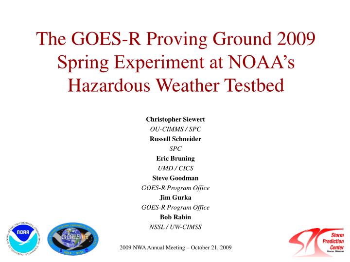
The GOES-R Proving Ground 2009 Spring Experiment at NOAA’s Hazardous Weather Testbed. Christopher Siewert OU-CIMMS / SPC Russell Schneider SPC Eric Bruning UMD / CICS Steve Goodman GOES-R Program Office Jim Gurka GOES-R Program Office Bob Rabin NSSL / UW-CIMSS.

E N D
The GOES-R Proving Ground 2009 Spring Experiment at NOAA’s Hazardous Weather Testbed Christopher Siewert OU-CIMMS / SPC Russell Schneider SPC Eric Bruning UMD / CICS Steve Goodman GOES-R Program Office Jim Gurka GOES-R Program Office Bob Rabin NSSL / UW-CIMSS 2009 NWA Annual Meeting – October 21, 2009
Forecaster Needs • Incorporating new products into a forecaster’s routine difficult • Must provide information already not available to forecaster through other means • Must replace something currently used that they already have confidence in • Must have knowledge on product limitations • Must use regularly to gain comfort
GOES-R Proving Ground at the SPC • Integrate GOES-R products into real-time operational testing prior to launch • Day-1 readiness • Goals • Provide product developers with useful feedback on product usefulness/performance through detailed interactions with forecasters and real-time testing • Provide forecasters with product education and quality display • Aid successful AWIPS-II integration • Bring a satellite perspective to the heart of radar country
NOAA Hazardous Weather Testbed EFP EWP Experimental Warning Program Experimental Forecast Program GOES-R PG Detection and prediction of hazardous weather events up to several hours in advance Prediction of hazardous weather events from a few hours to a week in advance
2009 Spring Experiment Activities • In concert with EWP, EFP and VORTEX-II during April-June 2009 severe weather season • 2-3 visitors per day (13 total this year) • Interact with EWP/EFP/VORTEX-II forecasters on a constant basis • Provide local expertise on satellite products/techniques • Expose non-satellite community to satellite capabilities • Hourly convective forecast activities during convectively active periods • Constant interaction with products in real-time forecast environment • Daily morning post-mortem analysis of product performance
Initial Products & Examples • Four GOES-R Proving Ground products available at the SPC for 2009 Spring Experiment • 15-minute Cloud-top Cooling (CTC) Rate (UW-CIMSS) • Monitors cloud-top IR brightness temperature based on an operational cloud mask using a box-averaging method • Convective Initiation (CI) Nowcast (UW-CIMSS) • Based on CTC product with more stringent requirements for cloud-top microphysical properties • 10-km Total Lighting Source Density (SPoRT/NSSL) • Re-sampled from three LMA networks (Huntsville, AL, Washington DC and Norman, OK) • 0-1 Hour Probability of Severe Hail (CIRA)* • Based on RUC objective analysis fields and cloud-top temperature**
MESOSCALE DISCUSSION 0872 NWS STORM PREDICTION CENTER NORMAN OK 0348 PM CDT TUE MAY 26 2009 AREAS AFFECTED...PORTIONS OF N-CNTRL TX TO THE BIG COUNTRY CONCERNING...SEVERE POTENTIAL...WATCH POSSIBLE VALID 262048Z - 262215Z UNCERTAINTY REMAINS HIGH OVER TIMING AND LOCATION OF TSTM INITIATION INTO LATE AFTERNOON...ESPECIALLY WHERE BUOYANCY APPEARS MAXIMIZED. BUT...AT LEAST ISOLATED TSTMS SHOULD DEVELOP BY 22Z ALONG VARIOUS SURFACE TROUGH/OUTFLOW BOUNDARIES ACROSS W-CNTRL TX INTO THE BIG COUNTRY. DESPITE MODEST DEEP-LAYER FLOW...STEEP LOW/MID-LEVEL LAPSE RATES SHOULD SUPPORT POTENTIAL FOR SEVERE HAIL/WINDS. A WW DOES NOT APPEAR IMMINENT...BUT THE AREA WILL CONTINUE TO BE MONITORED FOR A POSSIBLE WW. 20Z SUBJECTIVE SURFACE ANALYSIS PLACED A MESOLOW AROUND 20 N MWL WITH SEVERAL RATHER DIFFUSE TROUGHS/BOUNDARIES REMAINING EVIDENT IN THE WAKE OF CONVECTION NOW OVER ERN TX. RECENT VISIBLE SATELLITE IMAGERY DEPICTED CU/TCU INCREASING FROM THE PERMIAN BASIN INTO THE BIG COUNTRY. MODIFIED 12Z MAF RAOB SUGGESTS THIS AREA IS UNCAPPED TO MIXED-LAYER PARCELS. GIVEN TEMPERATURE/DEW POINT SPREADS AOA 40 DEG F...DRY MICROBURSTS AND HAIL MAY OCCUR. FARTHER EAST...MIDDLE 60S TO LOWER 70S SURFACE DEW POINTS PERSIST ACROSS NERN TX...ALTHOUGH SHRINKING IN AREAL EXTENT AS DRIER AIR CONTINUES TO MIX NWD. CONVECTIVE INITIATION IN THE NEAR-TERM MAY REMAIN SUPPRESSED BY LARGER-SCALE DESCENT IN THE AFTERMATH OF MCS ALONG THE SABINE RIVER VALLEY. OPERATIONAL AND HI-RES MODEL GUIDANCE VARY SUBSTANTIALLY WHETHER OR NOT CONVECTIVE INITIATION WILL OCCUR INTO EARLY EVENING ACROSS N-CNTRL TX. IF IT DOES OCCUR...THE VERY UNSTABLE AIR MASS WOULD SUPPORT RAPID TSTM DEVELOPMENT WITH LARGE HAIL AND DAMAGING WINDS AS THE PRIMARY THREATS.
2145 2202 2232 2215
Expanding Cloud Edges Thin Cirrus
Opportunities to Grow • Provide select products for real-time testing within SPC operations • Expanded product suite possibilities • Leverage use of current GOES sounder TPW/LI/CAPE products • Improved CI/CTC • ‘Nearcast’ product • 8-km flash initiation and extent densities; pixel-level and cell trends • Ingest data from additional LMA networks • Synthetic satellite from NWP and MODIS imagery • Overshooting top/Enhanced-V detection • Additional Experiments • Fire weather/heavy rain experiment (August/September) • Winter weather experiment (December/January) • Expand integration with HWT forecast/warning programs • Increased interaction with operational community towards common goals (ie – aviation wx, warn-on-forecast)