Download
1 / 23
280 likes | 473 Views
Why is scientific work in geohazard important - where does Geohazard fit in to oil business ?. Presented by James M. Strout. Assessment - Prevention - Mitigation. GEOHAZARDS, WHAT ARE THEY?

E N D
Why is scientific work in geohazard important - where does Geohazard fit in to oil business? Presented by James M. Strout Assessment - Prevention - Mitigation
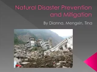
GEOHAZARDS, WHAT ARE THEY? “Events caused by geological conditions or processes, which represent serious threats for human lives, property or the natural environment” Onshore Volcanism Earthquakes Slides/debris flows Floods Avalanches Offshore Slope instability Earthquakes Tsunamis Shallow gas/hydrates Diapirism
INTERNATIONAL CENTRE FOR GEOHAZARDSAssessment, prevention, mitigation and management ICG vision: Develop knowledge that can help save lives and reduce material and environmental damage. To be, within 5 to 8 years, the world authority and the premier research group on geo-related natural hazards, with special emphasis on slide hazards, both on land and offshore.
PARTNERS IN CENTRE OF EXCELLENCE • HOST ORGANISATION • Norwegian Geotechnical Institute (NGI) • PARTNERS • University of Oslo (UiO) • NTNU • Geological Survey of Norway (NGU) • NORSAR
Wave generation Tsunami Tsunami Retrogressive sliding Mud volcano Debris flow Gas hydrates or free gas Gas chimney Earth-quake Underground blowout Diapirism Doming Overpressure Offshore geohazards
Focus on underwater slope stability • Field development on the continental slopes • Enormous historic and paleo slides observed • Large runout distances, retrogressive sliding upslope/laterally and tsunami generation may threaten 3rd parties in large areas The Ormen lange field illustrates the importance of a geohazard study
The Storegga Slide (8200 ybp) Ormen Lange Field development was contingent on the results of the geohazards study. It was necessary to: - understand the Storegga slide - survey, sample, test and monitor to characterise site - develop failure mechanisms and models - evaluate the present day stability conditions These studies resulted in the conclusion that the present day slopes were stable, and the site was safe for development. Headwall 300 km Run-out 800 km Volume 5.600 km3 Area 34.000 km2
Geohazards study – elements • Site investigation (geophysical, geological & geotechnical) • Assess in situ conditions and material properties • Define relevant and critical geo-processes • Assess interaction of processes • Identify failure mechanisms • Identify trigger mechanisms
Geohazards study – Assessment • Overall geological understanding of site • Assessment of probability of occurence • Calculate/predict consequences • Uncertainties: • Limited site investigations, measurement and test data • Modelling of processes and mechanisms
Monitoring and measuring • Key parameters needed • Seismic survey and metaocean data • Geological structures, history, sedimentation rates • Pore pressure and mechanical behaviour of the soil • Inclination/movement/settlement/subsidence • Gas releases or seepages • Vibrations/earthquakes • + + + • Time dependent variable? • ’Snapshot’ measurement w/o time history • Monitoring w/ time history, e.g. to capture natural variations, or effects caused by construction/production activity • Timing: before, during and after field development
Closing comments • Consequences of geohazard events can be very large, in terms of both project risk and 3rd party risk • Thorough understanding of natural and human induced effects is needed in order to identify the failure scenarios relevant for field development • Geohazard assessment require multi-discipline geoscience cooperation and understanding
Purpose of geohazards research • improve ourunderstanding of why geohazards happen. • assess the risks posed by geohazards. • prevent the risks when possible. • mitigate and manage the risks when it is not possible to prevent them.
In situ conditions and material propertiesCorrelation of geological, geotechnical, and geophysical parameters
h(t) z Sealevel change time Dt s’ Du p u s T Stress/pressure: p, s, u, s’ Defining critical geo-processes1D Basin model for Pressure-Temperature time history during geological time Deposition rate T=temperature p=hydr. water pressure u=pore pressure s=vertical soil stress s’=eff. soil stress
BGHSZ at LGM sea level at -130m m Potential zone of GH melting BGHZ after intrusion of warm atlantic surface water BGHSZ after sea level rise Contributing processes/interactionGas hydrate melting caused by climate change after deglaciation Geothermal gradient 50C/km
Failure mechanismRetrogressive Sliding • Development of material and mechanical models required for explanation of failure on low slope angles • High excess pore pressure and/or strain softening (brittleness) required • Local downslope failure (slumping) need to be triggered for initation of large slide
0.05g 0.10g 0.20g 0.30g Depth belom mudline, m Depth belom mudline, m Max. pore pressure ratio after event, % Max. displacement, cm Triggering mechanisms Earthquake analysis • 1D site response analysis of infinite slope • Material model for cyclic loading includes pore pressure generation, cyclic shear strain, accumulated shear strain • Pore pressure redistribution and dissipation after earthquake
Overall geological understandingOrmen lange: the entire “geo-conditions” leading to instability
Evaluating probabilities • Variability/incompleteness of data • Modelling errors • Recurrence of triggering mechanisms • Presence of necessary conditions • + + +