Download
1 / 16
170 likes | 472 Views
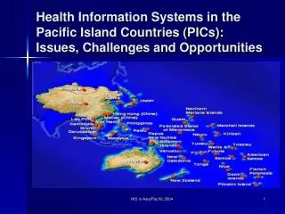
The Pacific GIS/RS User Conference Suva, Fiji Island, 27-30 November 2012 Sharon R. Boe , SPC/GIZ-SOPAC (sharon@sopac.org ). 2012. SPC/GIZ Regional REDD+ Project: Forest Carbon Inventory In Vanuatu. Proposed Forest Mapping In Vanuatu. ABBREVIATIONS.

E N D
The Pacific GIS/RS User Conference Suva, Fiji Island, 27-30 November 2012 Sharon R. Boe, SPC/GIZ-SOPAC (sharon@sopac.org) 2012 SPC/GIZ Regional REDD+ Project: Forest Carbon Inventory In Vanuatu Proposed Forest Mapping In Vanuatu
ABBREVIATIONS • SPC – Secretariat of the Pacific Community • GIZ – Deutsche Gesellschaft fur InternationaleZusammenarbeit • REDD – Reducing Emissions from Deforestation and forest Degradation • FCPF – Forest Carbon Partnership Facility • MRV – Measuring, Reporting and Verifying • REL – Reference Emission Level • GHG – Green House Gas • VANRIS – Vanuatu Resource Information System
PROJECT OVERVIEW • SPC/GIZ Climate Protection through Forest Conservation in Pacific Island CountriesProject >> Aim: mitigate greenhouse gas emissions from forestry and receive compensation payments. • Vanuatu: REDD readiness process mainly supported by: >> SPC/GIZ – development of system for MRV carbon level and REL >> FCPF of World Bank – policy process • Ongoing Project until 2015
PILOT ISLANDS • The islands of Vanuatu are located approx. 2,200km east of Australia and comprises of 82 islands. • The program is focusing on 4 pilot islands: • Santo • Malekula • Efate • Erromango
MAPPING ACTIVITIES • Delineation of coconut stands on Santo 2010 • Deforestation processing Santo 2007-2010 • Cloud correction Santo 1990-2000 • Deforestation processing Santo 2000-2007-2010 • Accuracy assessment Santo 2010
WORLD VIEW 2 DATA • 8 band bundle data (Santo) • Multispectral: 2m • Panchromatic: 0.5m • Projection: UTM/WGS84, zone 58S • Pre-processed (atmospheric correction, pan-sharpened (NC & FC), image enhancement, backdrop) • Digital Terrain Model (DTM): 25m
ALOS PALSAR DATA • ALOS (Advanced Land Observation Satellite) PALSAR (The Phased Array type L-band Synthetic Aperture Radar) • 25m Mosaic dual polarization • Data was ordered at Level 1.5 format • Dual temporal change detection and forest cover • Adv: Cloud-free, Day & Night and All weather land observation • Training: 16-19 October 2012 • SAR Image Preprocessing, Enhancement, Classification (Erdas 9.1) • Support from Jaxa
ALOS PALSAR RGB COMPOSITE + • HH Polarization • Very low backscatter of water • High backscatter in Urban Areas • High backscatter over vegetation and non-vegetation • HV Polarization • High backscatter over vegetation areas • Low backscatter over non-vegetation areas + = • RGB • R: HH • G: HV • B:HH/HV • HH/HV Ratio • Forest/Dense Vegetation (bright) • Non-Vegetation Areas (dark)
CHALLENGES WITH CURRENT RADAR DATA Layover Effects Visible on most of Western Part of Santo: high altitude areas
PROHIBITS IMAGE ANALYSIS Spatial Modeler, Erdas 9.1 • HH/HV Ratio Calculations • Classification • Conversion of amplitude data (DN) to radar cross-section (dB) • Above Ground Biomas (AGB) Calculations
Semi-Automatic Forest Classification • Move into the use of semi-automatic classification for forest mapping: • Vanuatu Study (2007) conducted by Martin Heroldand his team • Supervised Classification • Maximum Likelihood Algorithm • Challenges • Trial Image Segmentation • E.g. Imagine Objective ext. for Erdas
DELIVERABLES The project envisions the following results for Vanuatu: • Forest cover based on an approved national forest definition • Carbon density map for 5 generic forest strata (medium height forest [open/closed], low forest [open/closed], mangroves) • Validated forest cover map using very high resolution imageries